
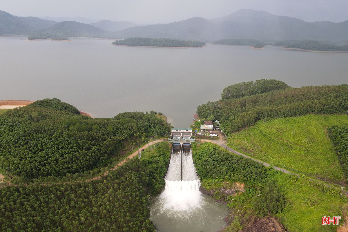
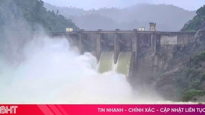
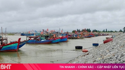
At this time, Ke Go Lake (Cam Due Commune, Ha Tinh Province) is regulating water through 2 Doc Mieu spillways with a flow rate of 5 m 3 / second. The spillway of Ke Go Lake is being carried out by Nam Ha Tinh Irrigation Company Limited when Ha Tinh Hydrometeorological Station forecasts a widespread heavy rain with a flow rate of 150 - 300 mm, in some places over 400 mm.
Before the spill, the water level of Ke Go Lake was at 29.3/32.5 m, equivalent to a capacity of 256/345 million m3 of water. According to the management unit's calculations, proactive spill will lower the lake's water level, reducing millions of m3 of water.
Although the spillway discharge is at a fairly low flow rate, in case of heavy rain, based on the weather and water flow into the lake, Nam Ha Tinh Irrigation Company Limited will increase the spillway discharge rate.

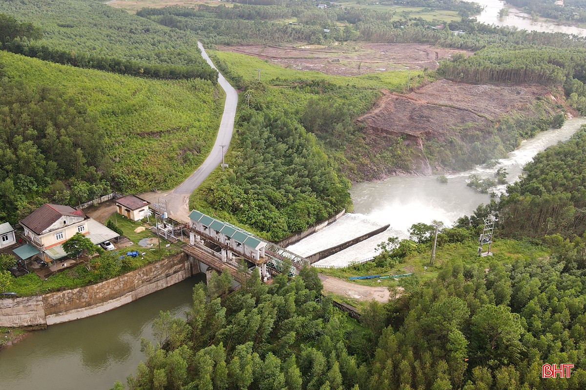
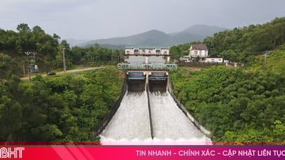
Besides Ke Go lake, to proactively respond to the forecast of heavy rain caused by storm No. 12, Nam Ha Tinh Irrigation Company Limited has simultaneously operated the spillway of large reservoirs in the area, including: Boc Nguyen with a flow of 5 m 3 / sec, Kim Son 10 m 3 / sec, Thuong Song Tri 11 m 3 / sec.
Director of Nam Ha Tinh Irrigation Company, Tran Manh Cuong, assessed: The reservoirs operate spillway discharge with not too large flow, the water level of rivers and streams is quite low, so the regulation of the reservoir water does not greatly affect the lives and activities of people in the downstream areas.
However, the lake management unit has also notified the local authorities of the affected downstream communes and wards to inform and guide the people to take safety measures.

Nam Ha Tinh Irrigation Company Limited is managing and operating 38 large and small dams in the whole province. Recently, the province has continuously experienced large-scale heavy rains, while the water levels of large reservoirs in the province have basically exceeded the spillway threshold, and small-capacity reservoirs have reached the spillway threshold and overflowed every time there is heavy rain.
Faced with this reality, every time there is a forecast of prolonged heavy rain, the reservoir management unit has deployed many spillway operations to regulate water at reservoirs such as: Ke Go, Thuong Song Tri, Kim Son, Da Han, Tau Voi, Song Rac, Boc Nguyen...
"Each time the spillway is released, the unit always calculates and builds a specific plan, based on the actual water level in the lake and the operation and water regulation process approved by the People's Committee of Ha Tinh province to proactively receive floods, ensuring the safety of the project and the downstream area," said Tran Manh Cuong, Director of Nam Ha Tinh Irrigation Company Limited.

Along with irrigation reservoirs, reasonable and scientific water regulation during complicated flood and rain events is also proactively implemented by hydropower plants.
Mr. Nguyen Ba Tuan - Deputy Director of Ho Ho Hydropower Plant said: Before the forecast of Ha Tinh having another large-scale heavy rain, in parallel with generating electricity through the generator, the unit has regulated water through the spillway with a flow rate from 9:00 a.m. on October 21 with a flow rate of 50 m3 /second to lower the lake water level and increase flood prevention capacity.
According to Mr. Tuan, in the coming days, the unit will closely monitor weather developments and coordinate closely with departments and localities in regulating reservoir water, ensuring safety of works and downstream areas.

Head of the Irrigation Sub-Department Tran Duc Thinh assessed: Dam operation during complicated flood situations is always a matter of concern for the Provincial Party Committee, the People's Committee of Ha Tinh province and other departments and branches whenever the flood situation becomes complicated.
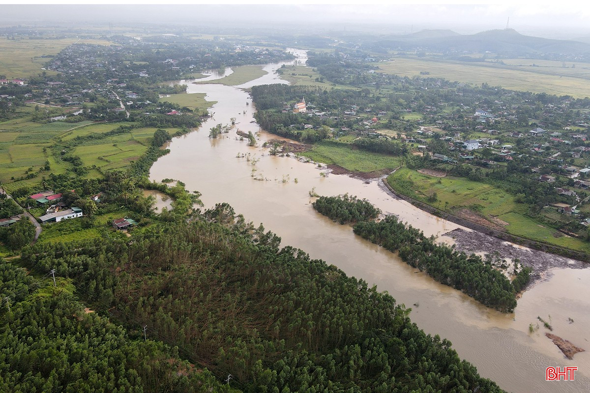
The timing of spillway discharge and the amount of discharge must be closely coordinated between the reservoir management and operation unit with the forecasting agency, functional units and local authorities to make reasonable and scientific calculations to both protect the safety of the project and contribute to flood control for the downstream area. Especially avoid releasing large volumes of floodwaters at times when the flood situation is complicated and the water level in the downstream area is rising.
As of 9:00 p.m. on October 21, the water level of Ngan Truoi Lake (Vu Quang Commune) was at 43.65/52m, equivalent to a capacity of 465.13/775.7 million m3 . The water level of the lake has only reached nearly 60% of its design capacity and can still hold about 300 million m3 , so the amount of rain this time will ensure flood control for the downstream and supplement water to serve agricultural irrigation, environmental water supply, daily life for people and combined with power generation through hydropower plants.
Source: https://baohatinh.vn/ho-dap-cat-lu-hieu-qua-qua-cac-dot-mua-lon-o-ha-tinh-post297858.html


![[Photo] Da Nang residents "hunt for photos" of big waves at the mouth of the Han River](https://vphoto.vietnam.vn/thumb/1200x675/vietnam/resource/IMAGE/2025/10/21/1761043632309_ndo_br_11-jpg.webp)


Comment (0)