
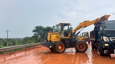
(Fatherland) - On October 31, Lang Biang Tourist Area (Lam Dong province) announced that it had temporarily suspended the walking route to the top of Lang Biang mountain to ensure the safety of tourists.
Heavy rains that have lasted for many days have caused landslides on the hiking trail to the top of Lang Biang Mountain, with the risk of trees falling, threatening the safety of tourists. The rainy season also causes the sky to darken quickly, and the mountains and forests are foggy, making it difficult for tourists to determine direction and easily get lost.
Accordingly, the Lac Duong district authorities and the tourist area have put up warning signs, prohibition signs and barriers at the trails leading to the forest to prevent tourists from going up the mountain on their own. At the same time, they have organized patrols to detect cases of spontaneous mountain climbing to ensure safety. The reopening of the route will be considered when the weather is favorable.

Temporarily suspending the hiking route to the top of Lang Biang Mountain. Photo: Son Lam
Lang Biang is a mountain range with 3 peaks: Radar Hill, Ong Mountain and the highest is Ba Mountain (2,167m high), located in Lac Duong district, 12km north of Da Lat center. In recent years, many domestic and foreign tourists have come to conquer this mountain peak, immersing themselves in the wild and majestic nature.
Although not too high and difficult to climb, Lang Biang is mainly a forest road with steep terrain, stretching 10-12km. From July 2024 to now, more than 10 tourists have gotten lost in Lang Biang forest, forcing authorities to search.
Most recently, on September 29, two tourists from Ho Chi Minh City got lost while visiting the forest on top of Lang Biang, and were "rescued" by authorities after 3 hours of searching./.
Source: https://toquoc.vn/lam-dong-tam-dung-tuyen-di-bo-len-dinh-nui-lang-biang-20241031155653294.htm

![[Photo] Students of Binh Minh Primary School enjoy the full moon festival, receiving the joys of childhood](https://vphoto.vietnam.vn/thumb/1200x675/vietnam/resource/IMAGE/2025/10/3/8cf8abef22fe4471be400a818912cb85)
![[Photo] Prime Minister Pham Minh Chinh chairs meeting to deploy overcoming consequences of storm No. 10](https://vphoto.vietnam.vn/thumb/1200x675/vietnam/resource/IMAGE/2025/10/3/544f420dcc844463898fcbef46247d16)


Comment (0)