
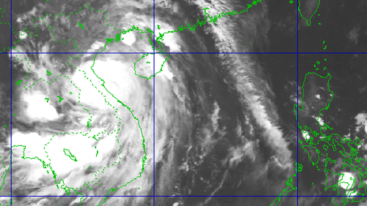
On the morning of September 21, according to international meteorological agencies, storm Ragasa (called Nando in the Philippines) is very active in the sea east of Luzon Island (Philippines).
Early on September 21, the Vietnam National Center for Hydro-Meteorological Forecasting said the storm's center was at about 17.7 degrees North latitude and 127.8 degrees East longitude, only about 600km east of Luzon Island (Philippines).

According to international meteorological agencies, after 7:00 a.m. on September 21, the strongest wind near the storm's center reached level 16 on the Beaufort scale (equivalent to 185-200 km/h), gusting above level 17 (over 220 km/h).
Most models from the United States, Europe and Japan currently predict that in the next 12 to 24 hours, Ragasa will likely strengthen and reach super typhoon level (equivalent to level 17 on the Vietnam typhoon scale). The storm will move mainly in a West-Northwest direction, traveling about 15km per hour.

On September 22 and 23, the storm is likely to pass through the northern part of Luzon Island and then enter the East Sea. After passing the Philippines, the storm's intensity may remain at a very strong level for 2-3 days, then gradually weaken when interacting with mainland China or may be affected by other air circulation (cold high pressure).
However, some Vietnamese meteorological experts believe that the storm's trajectory is not directly affected by low-level cold air masses, but is mainly guided by wind currents in higher atmospheric layers (from 700hPa and above).

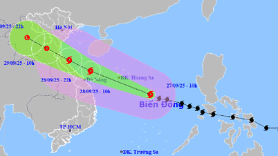
It is noteworthy that since the night of September 20 (Vietnam time), reputable international forecasting models have changed or updated the storm's trajectory compared to 2-3 days ago. Currently, most scenarios suggest that Ragasa will shift west, pass through the Leizhou Peninsula (China) and head straight into the Gulf of Tonkin around September 25. Some models are giving a high probability that the storm will make landfall in Vietnam.
Some forecasting models, including JMA (Japan) and ECMWF (Europe), believe that the storm may approach our mainland (North) with a level 11-12 intensity, gusting to level 14. If the storm moves north, the wind and rain levels may decrease. If it moves south, the risk of affecting the North Central region will be more obvious.

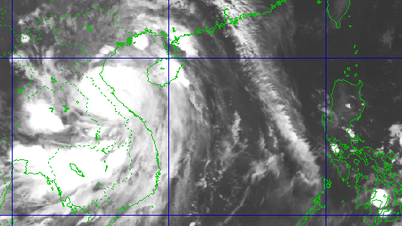
Global forecast models such as GFS (NOAA, USA), ICON (Germany), ECMWF (Europe), as well as warnings from JTWC (Joint Typhoon Warning Center, USA) and JMA (Japan Meteorological Agency) all give similar results on the track and ability to maintain the intensity of typhoon Ragasa.
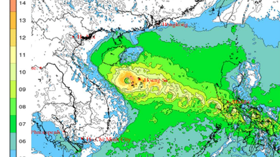
Scenarios show that in the next few days, the circulation of storm Ragasa may cause extremely strong winds and heavy rains in the northern Philippines, then impact the East Sea, affecting the weather in the coastal provinces of the North and North Central of Vietnam.
According to meteorological experts, this is a super storm whose direction of movement is difficult to predict, and has many uncertain factors at play. People need to continuously monitor it in case the storm makes landfall in our country.
Source: https://www.sggp.org.vn/sieu-bao-ragasa-co-the-vao-viet-nam-post813981.html
![[Photo] Joy on the new Phong Chau bridge](https://vphoto.vietnam.vn/thumb/1200x675/vietnam/resource/IMAGE/2025/9/28/b00322b29c8043fbb8b6844fdd6c78ea)


![[Photo] The 4th meeting of the Inter-Parliamentary Cooperation Committee between the National Assembly of Vietnam and the State Duma of Russia](https://vphoto.vietnam.vn/thumb/1200x675/vietnam/resource/IMAGE/2025/9/28/9f9e84a38675449aa9c08b391e153183)
![[Photo] High-ranking delegation of the Russian State Duma visits President Ho Chi Minh's Mausoleum](https://vphoto.vietnam.vn/thumb/1200x675/vietnam/resource/IMAGE/2025/9/28/c6dfd505d79b460a93752e48882e8f7e)


Comment (0)