

During the 2025 dry season, U Minh Thuong National Park has identified a key area at high risk of fire of 4,730 hectares, of which 85 hectares of forest are at high risk of fire, the rest are warned of level I and level II fires.
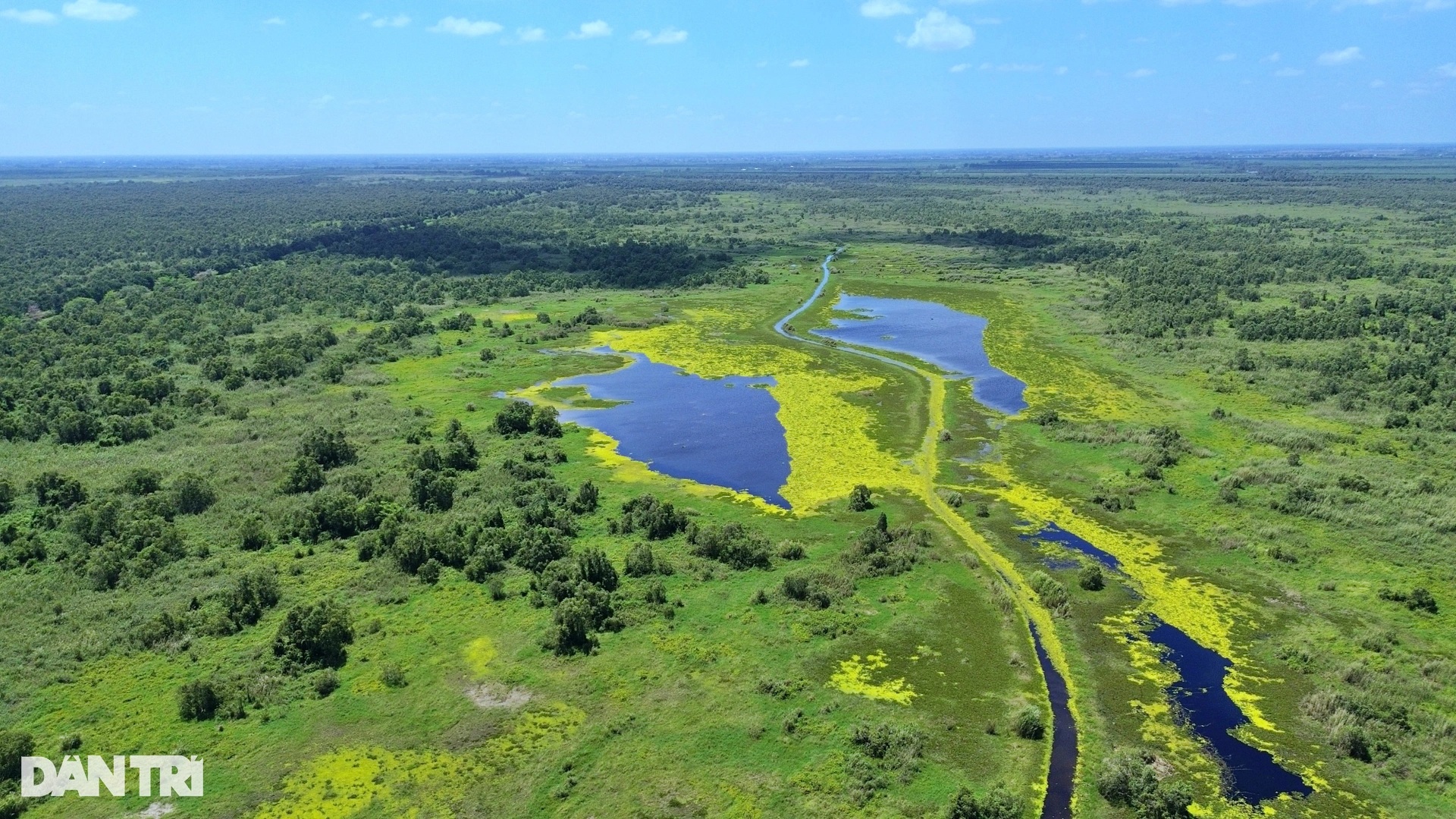
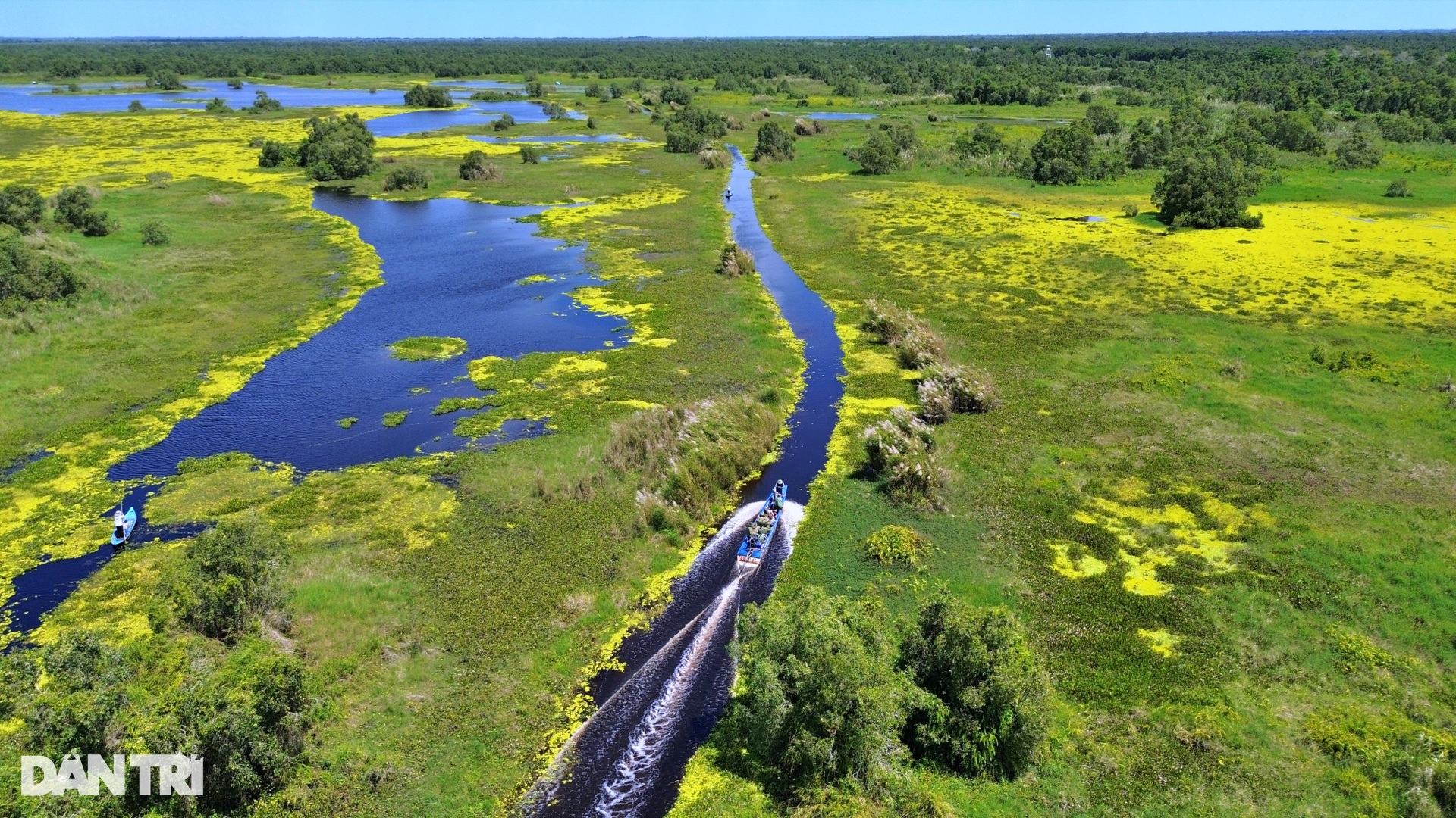
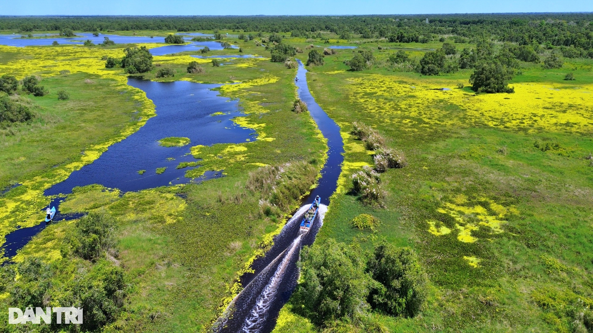
At this time, the vegetation here is entering a distinct transformation phase, each layer of water fern turns yellow due to the impact of hot climate and high temperature.

Officers of the Mobile Forest Ranger and Forest Fire Prevention and Fighting Team at U Minh Thuong National Park have entered the highest duty cycle of the year, ready to respond quickly to preserve the world 's biodiversity "treasure" to overcome the great drought.
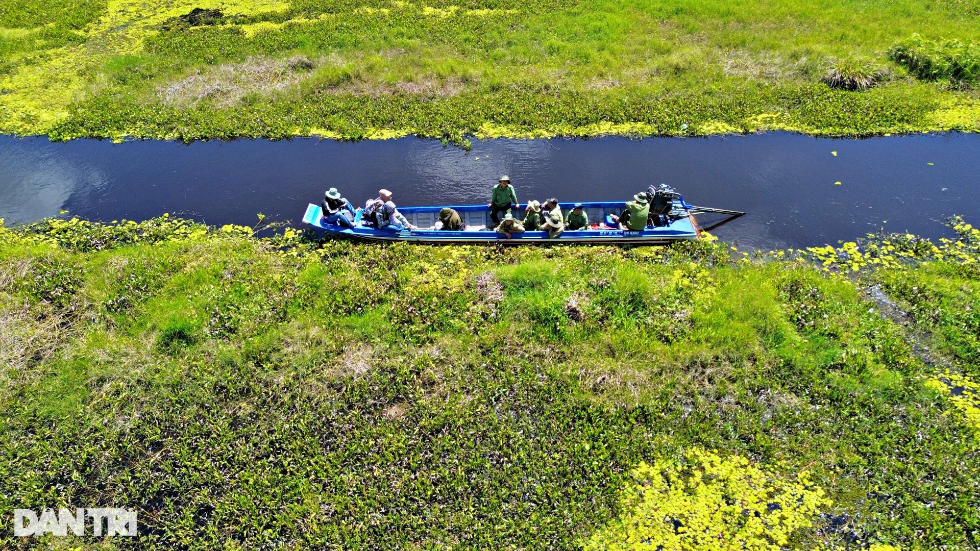
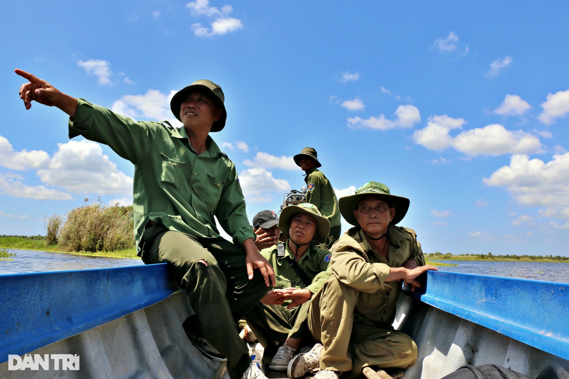
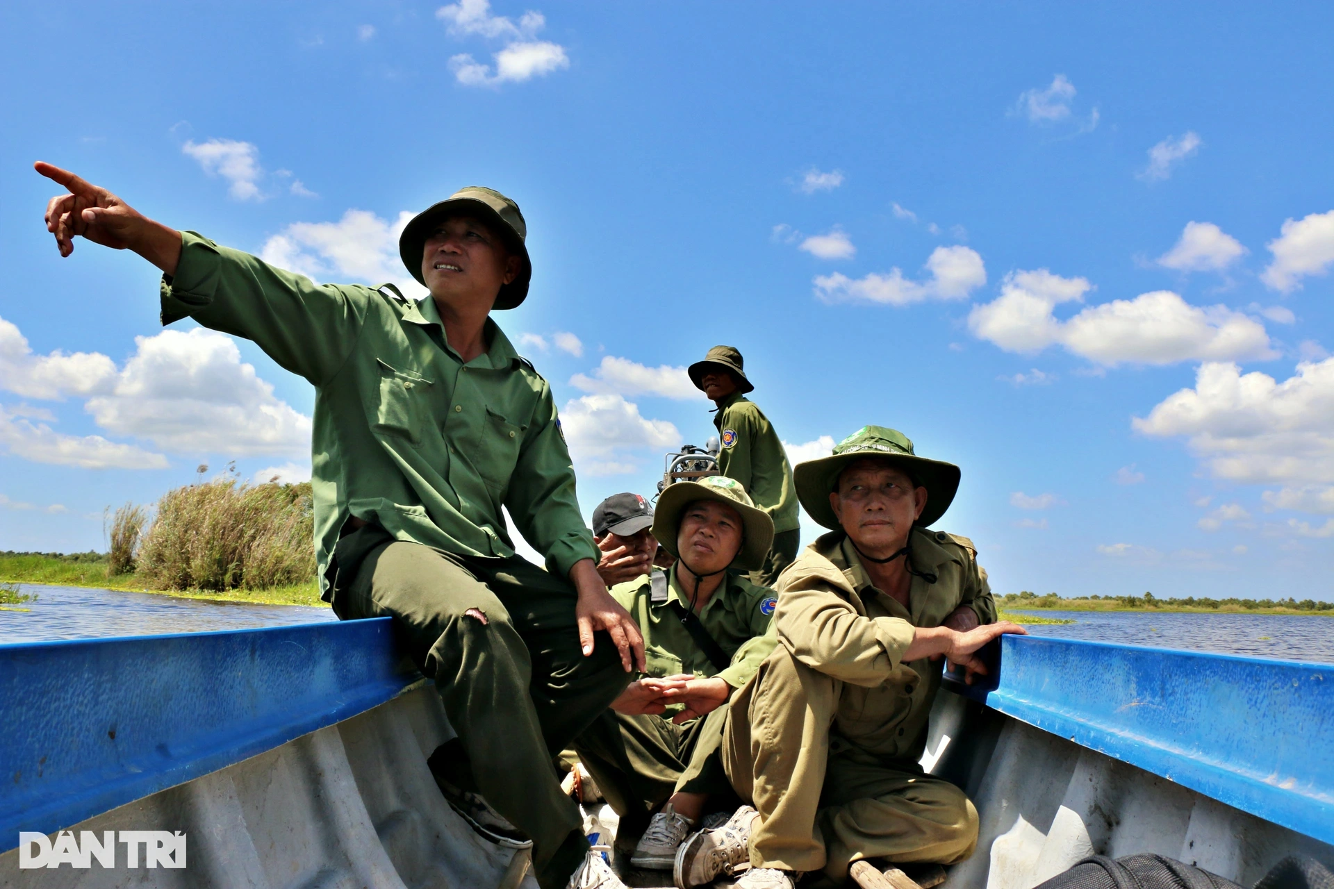
According to the report, U Minh Thuong National Park has completed and arranged 5 Mobile Ranger and Forest Fire Prevention and Fighting Teams with more than 60 people stationed in the areas: Channel 6, Channel 14, Channel 19, Cotton Tree, Administrative Area and Wildlife Rescue Area. All operate according to the 4-on-site method.
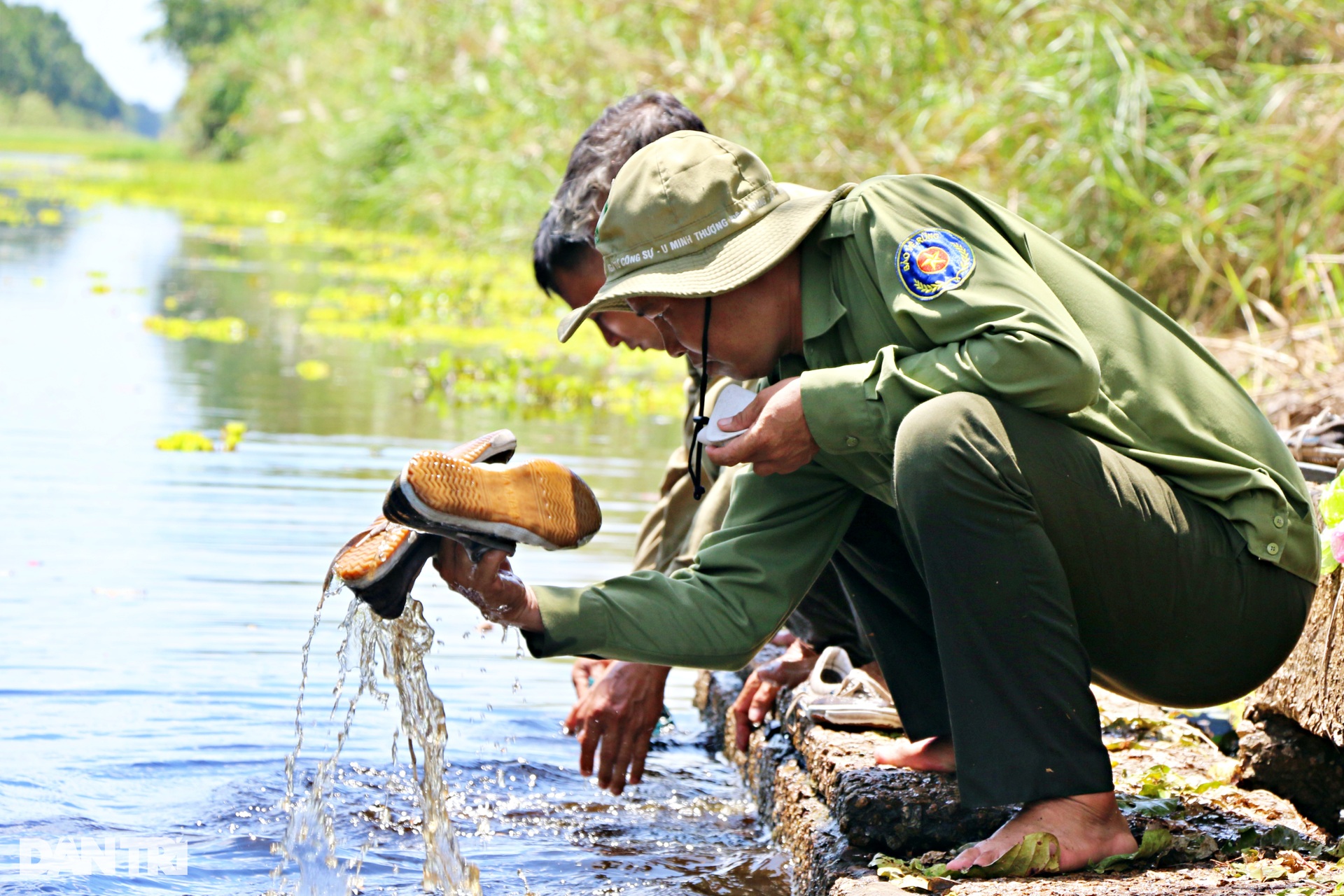
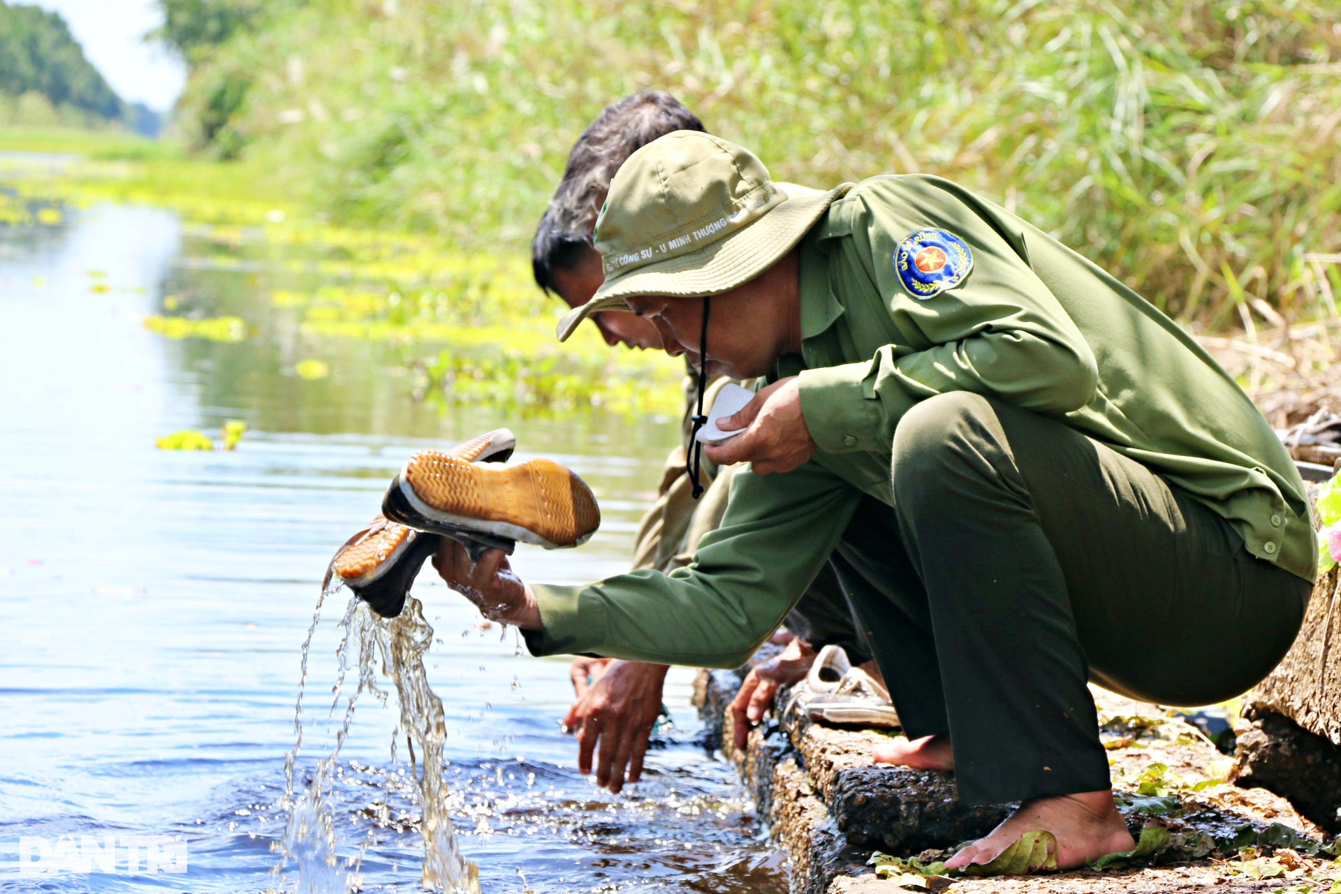
Before entering the shift, the teams proactively met and divided into small groups. By road, they skillfully infiltrated the central area; by water, they took a boat across the grasslands at the edge of the forest; from above, they surveyed the forests with binoculars.
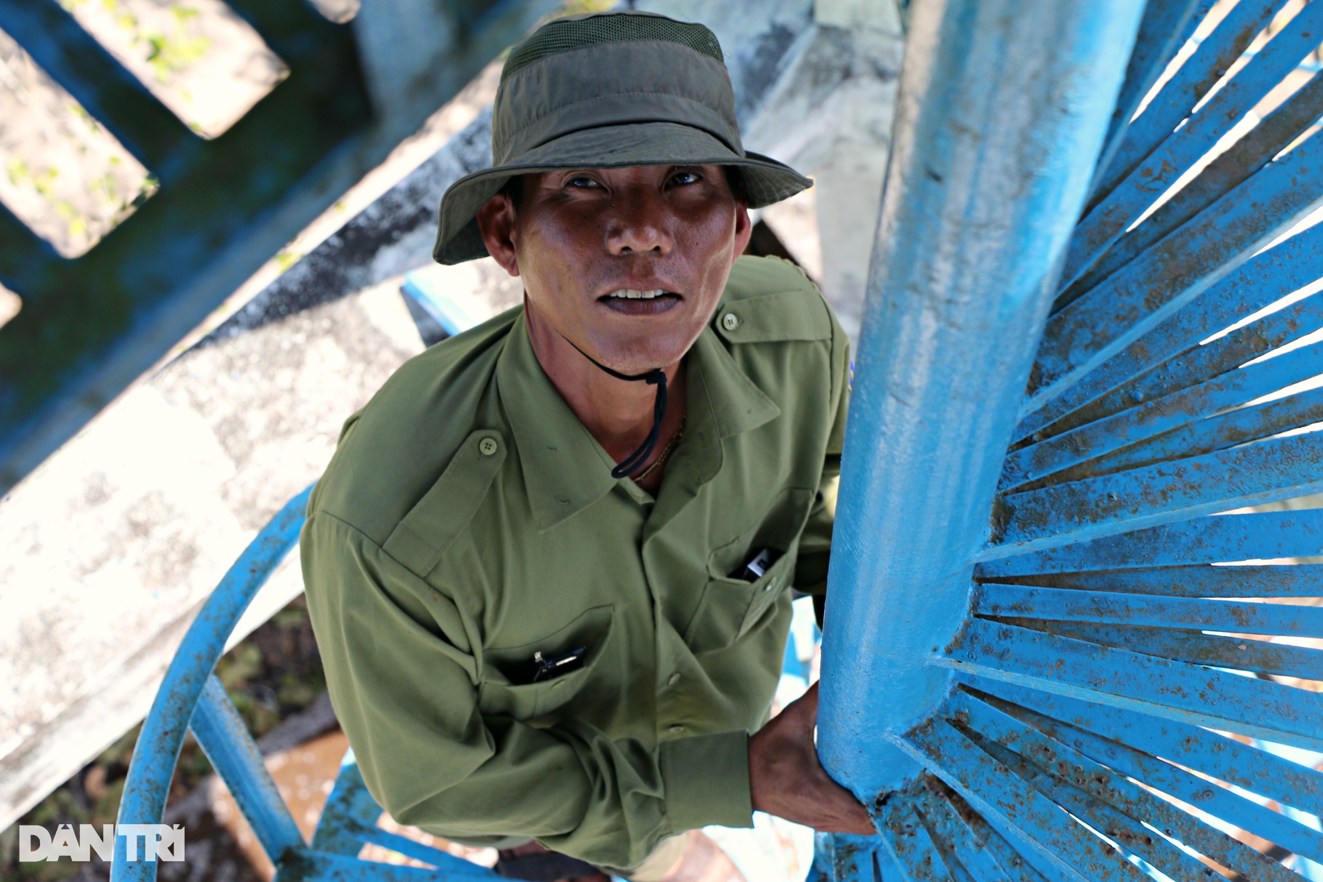

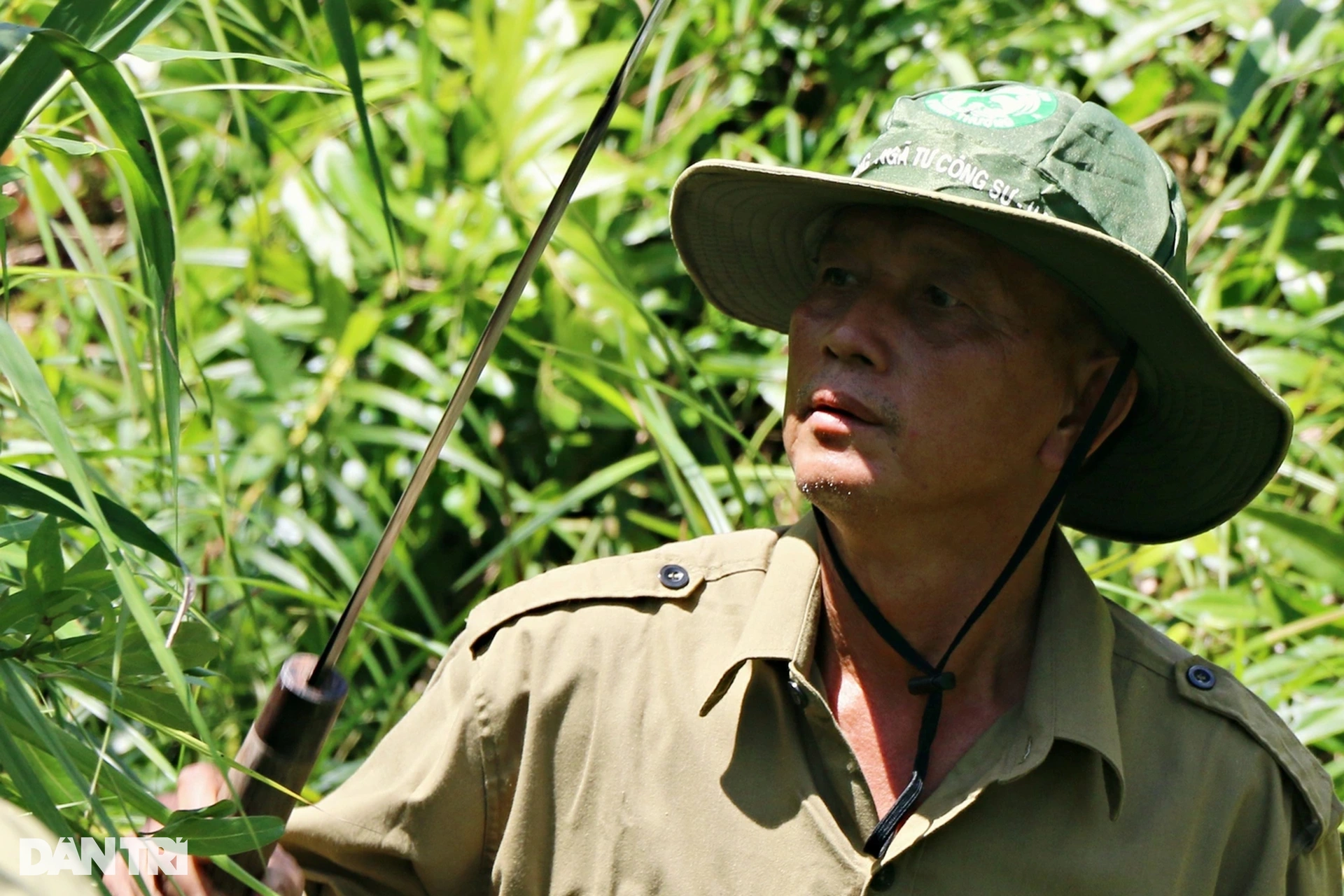
Mr. Cao Thanh Dien, an officer of the Mobile Ranger and Forest Fire Prevention and Fighting Team of U Minh Thuong National Park, climbed up the observation tower, which is more than 30 meters above the ground. The view from the tower combined with binoculars can cover the entire core area of the national park. When detecting smoke or unusual signs, Mr. Dien will immediately contact the command center.
Mr. Dien is also one of the officers who has been on duty for many years to guard against "fires" in the core zone of the national park. And many times, he has witnessed the sea of fire burning down rows of fresh cajuput trees.
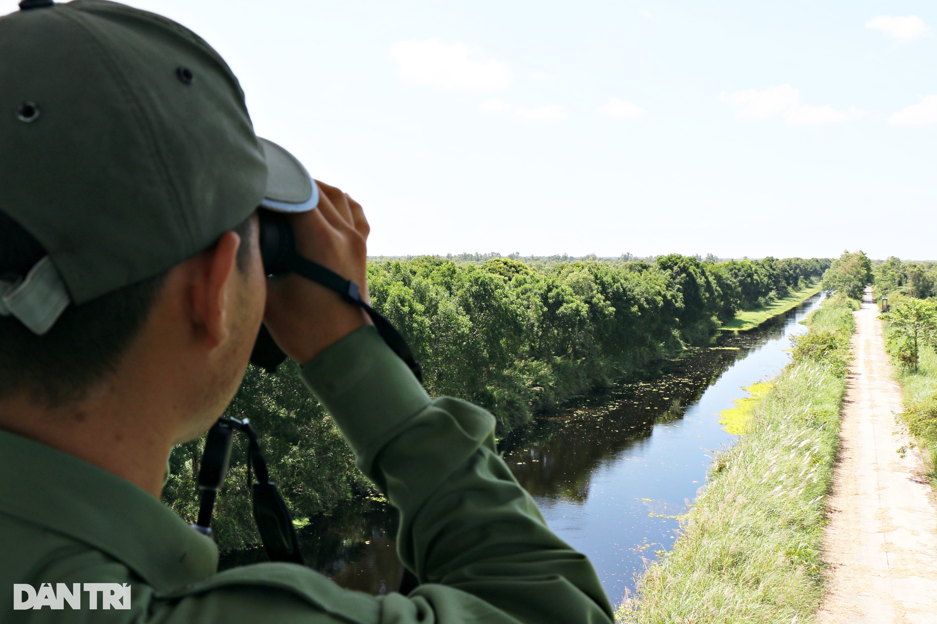

"That depression is a forest. We often tell each other to stand in the forest when we get lost," Mr. Dien said, pointing his binoculars at the green patches 5-10km from the observation tower.

On the other hand, the road patrol team also had to struggle to get into the core of the primary forest, check the humidity inside the forest foot, and remove flammable materials on the patrol route.
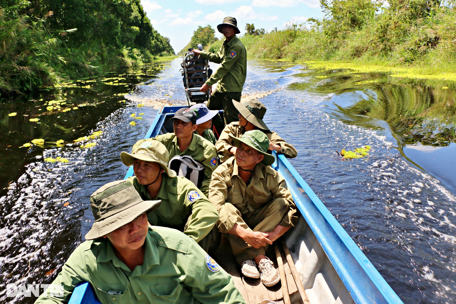

Over the years, the national park has increased the capacity of the pumping station, has a closed system of canals, dykes, peat dykes and drainage culverts. On the central canal axis, Vo Lai has brought the patrol team into the middle of the forest, one side is the primeval forest, the other side is the burnt cajuput forest.
To regulate water between areas, dams were also built to block canals and pumping stations to bring more fresh water into the core area.
The canal and dike system surrounding the core area is 38.4km long, forming an irregular diamond-shaped polygon. It was dug in 1978 and upgraded and completed in 2003. The dike surface is 8m wide, elevation +2.
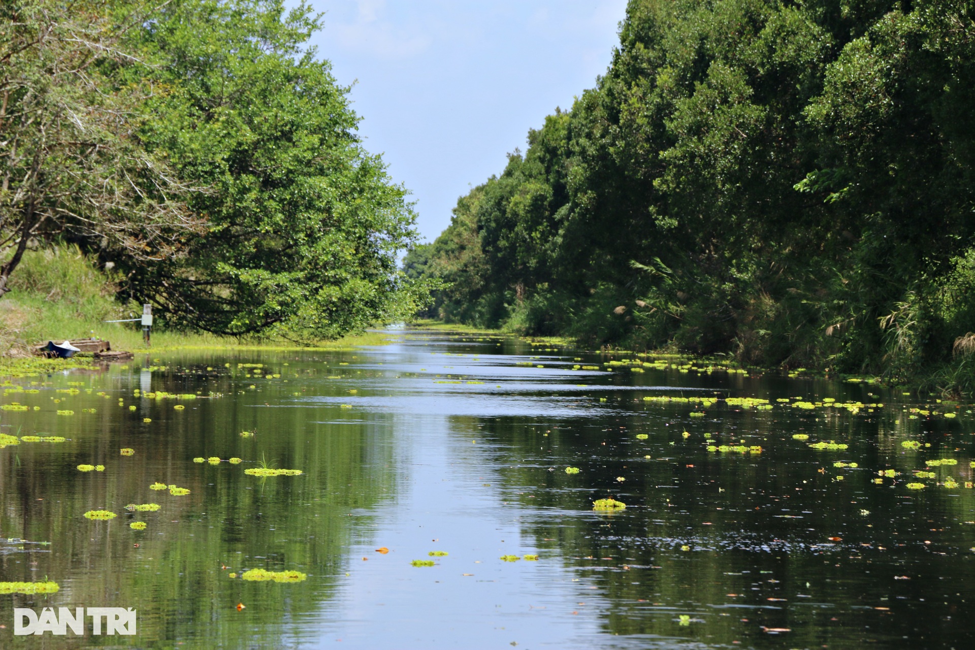
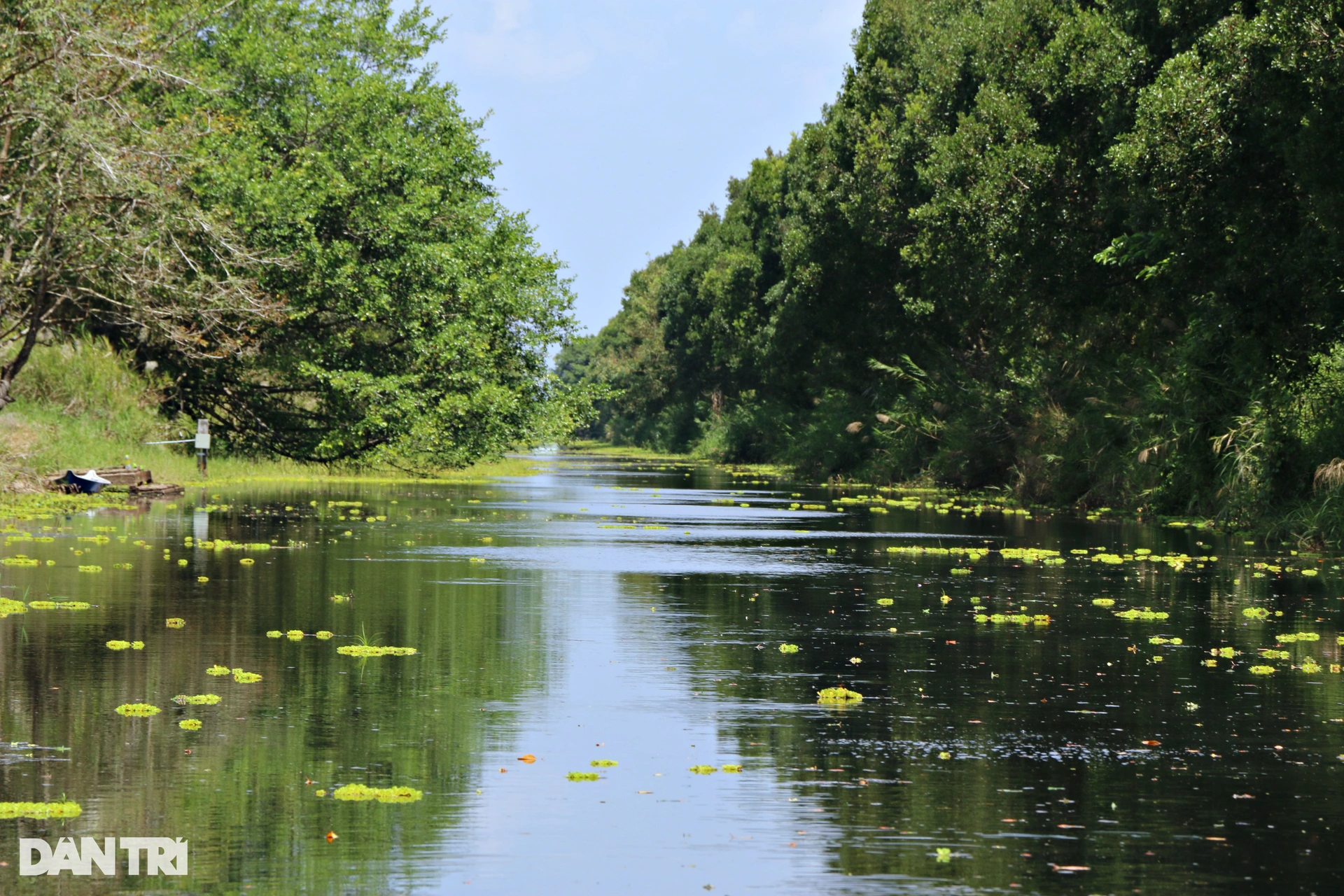
The canals in the core zone must be kept clear during the dry season because they are the main routes for transporting firefighting equipment into the core zone of the national park.

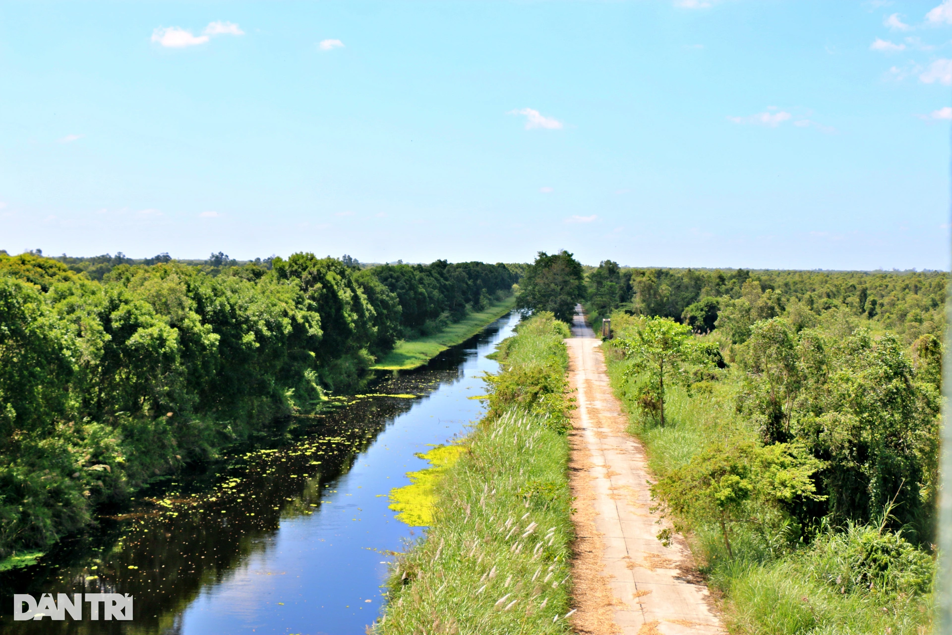
On the dike system, the main axes are built with concrete: the central canal is 10.7km and the cross canal is 7.9km. The concrete road on the dike surrounding the core area is 30.1km long. The concrete road is 2.5-5m wide, with a load capacity of 5 tons or more.
After completing their patrols, the officers return to their assigned barracks where they shower, clean up, cook, and participate in activities similar to those at home.


Meat and fish were assigned by the officers and they proactively went to buy them early in the morning. Before patrolling, they took turns cooking. By evening, they had a simple meal together as a small family.
U Minh Thuong National Park, located in An Minh Bac and Minh Thuan communes of U Minh Thuong district, Kien Giang province, has a total natural area of about 21,107 hectares. Of which, the core area accounts for 8,038 hectares, including a strictly protected area of about 914 hectares, and a buffer zone of more than 13,000 hectares.
U Minh Thuong National Park is a world biosphere reserve and is one of the areas recognized as Ramsar sites. This is an international wetland reserve, registered under the Ramsar Convention on the protection and sustainable use of globally important wetlands.
Mr. Nguyen Van Thang - Deputy Director of U Minh Thuong National Park - estimated that the current forest fire warning level of the national park is at level I, by around May, most of the forest area will be at level IV, V - dangerous level, extremely dangerous level.
The leaders of U Minh Thuong National Park have deployed solutions to prevent and fight fires during the peak dry season, such as organizing 100% of the force to participate in 24/7 duty, proactively detecting, preventing and promptly handling forest fires to minimize the possibility of forest fires occurring.
Along with that, the garden dredged and reinforced 5 water reservoirs, with a radius of 500 m/hole to store 150 m³/hole in areas at high risk of fire, ensuring a water source for fire fighting and keeping the forest foot area moist.
The garden also continues to reinforce 6 water-regulating sluices to prevent leaks during the dry season, and at the same time, start 2 pumping stations to pump additional water for fire prevention and fighting when necessary.
Dantri.com.vn
Source: https://dantri.com.vn/xa-hoi/cang-minh-canh-giac-lua-de-bao-ton-kho-bau-o-rung-u-minh-thuong-20250309091802094.htm
![[Photo] Binh Trieu 1 Bridge has been completed, raised by 1.1m, and will open to traffic at the end of November.](https://vphoto.vietnam.vn/thumb/1200x675/vietnam/resource/IMAGE/2025/10/2/a6549e2a3b5848a1ba76a1ded6141fae)


![[Photo] Binh Trieu 1 Bridge has been completed, raised by 1.1m, and will open to traffic at the end of November.](https://vphoto.vietnam.vn/thumb/402x226/vietnam/resource/IMAGE/2025/10/2/a6549e2a3b5848a1ba76a1ded6141fae)


Comment (0)