
To celebrate the 220th anniversary of the Provincial Capital (1804 - 2024), the 30th anniversary of the establishment of Thanh Hoa City (1994 - 2024) and the 10th anniversary of the first-class urban area, Thanh Hoa Newspaper would like to introduce the collected documentary images of the ancient Thanh Hoa Citadel.

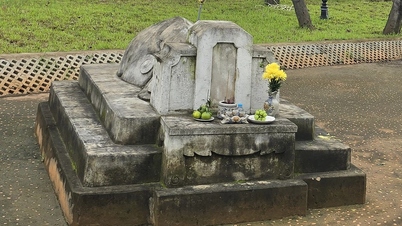
Thanh Hoa citadel under the Nguyen dynasty.
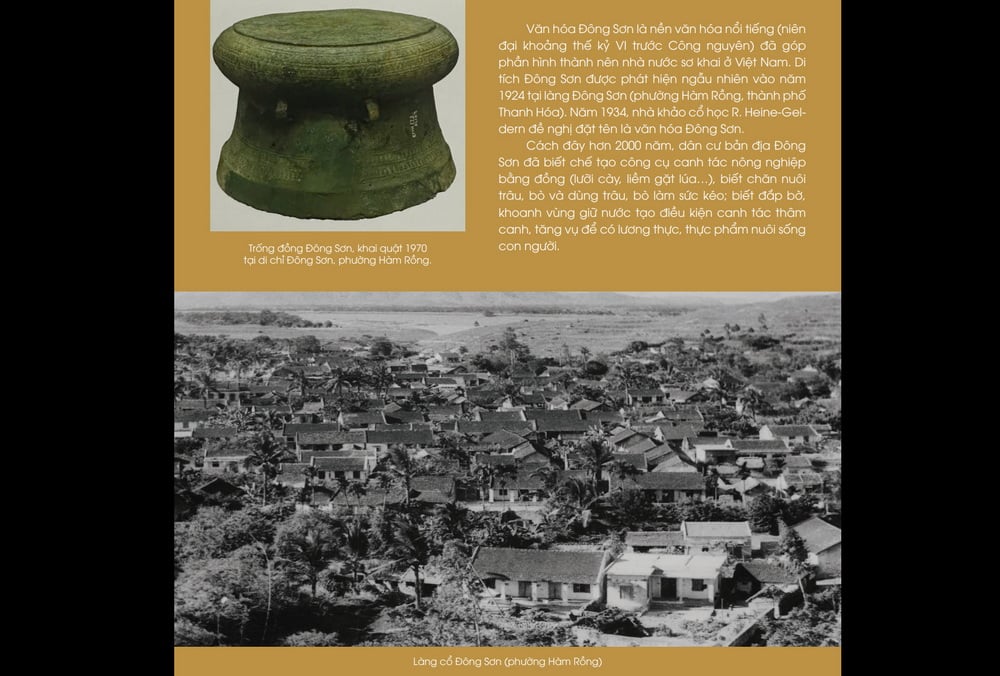
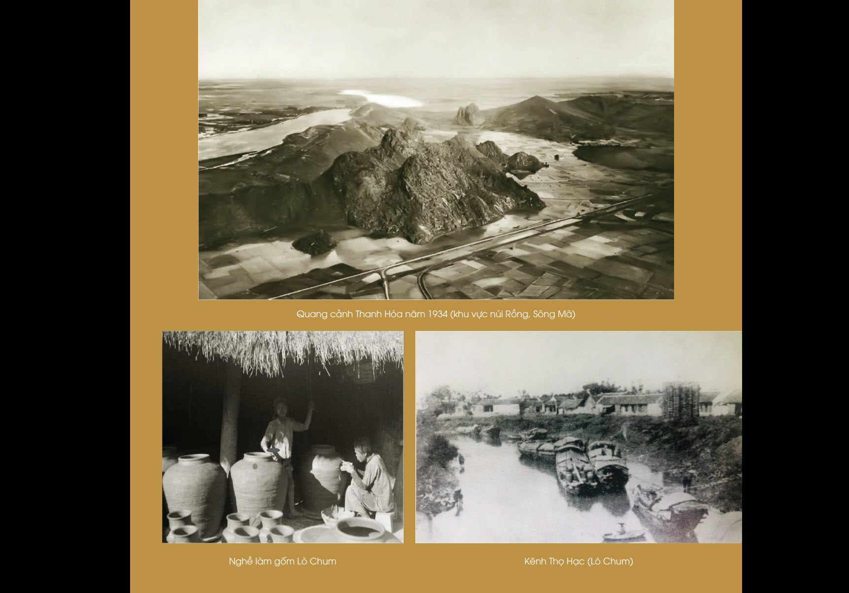
Thanh Hoa City is located on an ancient land with high mountains, fertile fields, and the Ma River flowing from the high mountains, depositing alluvium to the lush fields. The shape of the mountains and rivers is engraved in history. Where Do Mountain is located, ancient people appeared, the land of the brilliant Dong Son culture, famous since the time of the Hung Kings who founded the country. Sacred mountains and rivers, a good land where cranes gather.
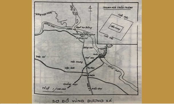
Duong Xa land map.
In 1804, Thanh Hoa citadel moved from Duong Xa village (Thieu Duong commune, Thieu Hoa district) to Tho Hac village (Dong Son district, now Dong Tho ward, Thanh Hoa city), laying the foundation for the birth of Thanh Hoa provincial capital.
Before 1804, Thanh Hoa's administrative headquarters were located in many different areas such as: Tu Pho, Dong Pho, Duong Xa town citadel, Duy Tinh (Hau Loc). The land of Thieu Khanh, Thieu Duong (belonging to Thanh Hoa city today) was twice the location of Thanh Hoa's administrative headquarters (Tu Pho citadel was the place where Cuu Chan district and Tu Pho district were located; Duong Xa town citadel from the Le dynasty to the end of the Tay Son dynasty).
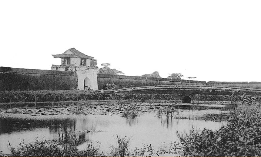
Thanh Hoa citadel under the Nguyen dynasty.
Thanh Hoa Citadel (Crane Citadel or Tho Hac Citadel) was built during the Nguyen Dynasty. The citadel has a perimeter of 630 truong, is 1 truong high, has 4 gates, a moat 8 truong 8 thuoc wide, 5 thuoc deep, and 6 toc. Hac Citadel was built on a precious type of land.
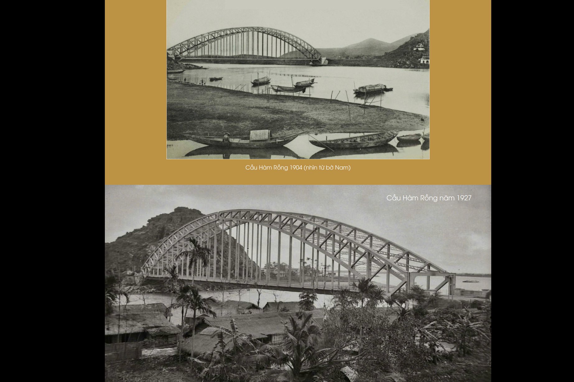
The Ma River in the North flows like a hug, like a wrap around the land. The Bo Ve River in the South is called "Ton Thuy" which is also very good. According to the famous philosopher Pham Thanh Dai: "Quy Thuy around the east of the city, forever does not see swords and soldiers", that is "Hac Thanh phi chien dia", a peaceful land forever, avoiding "disease wind". To the West are Phuong Linh (Pine Forest - Son Vien) and An Hoach (Nhoi Mountain - Nhue Son) mountains, like a phoenix spreading its wings, like elephants and horses meeting. The city has four gates, the South gate is the Tien gate, with Long Mountain and Ho Mountain as the front screen. That is "Long Ho dong hoi kien - Bang huu cong tri giao - Xa tac nhu thach dien - Ho hai bat ba dao" (Dragons and tigers meet together like friends living together. The country is as stable as a stone palace. Rivers and seas never have waves and winds).
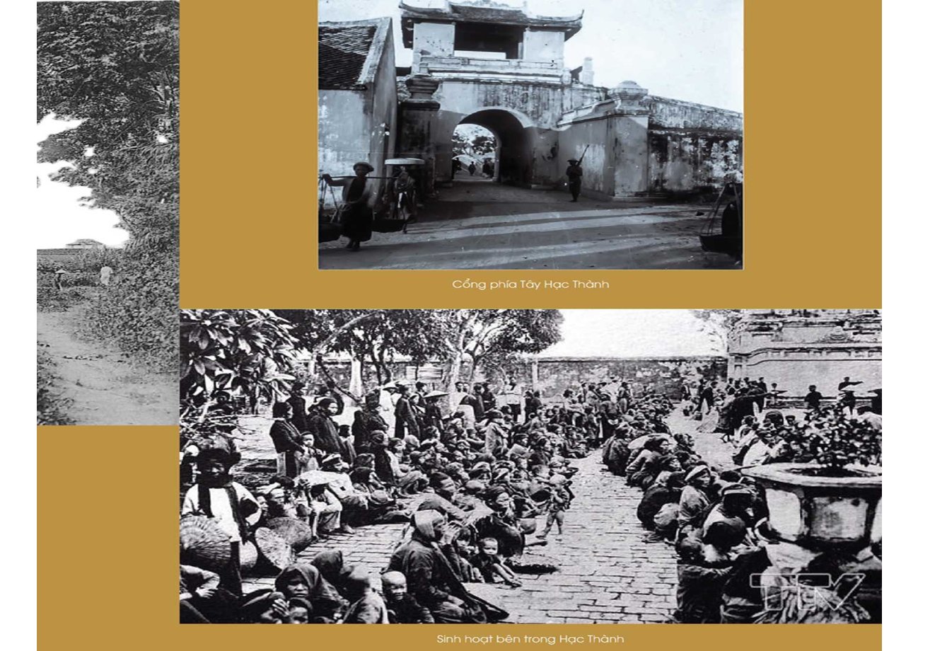
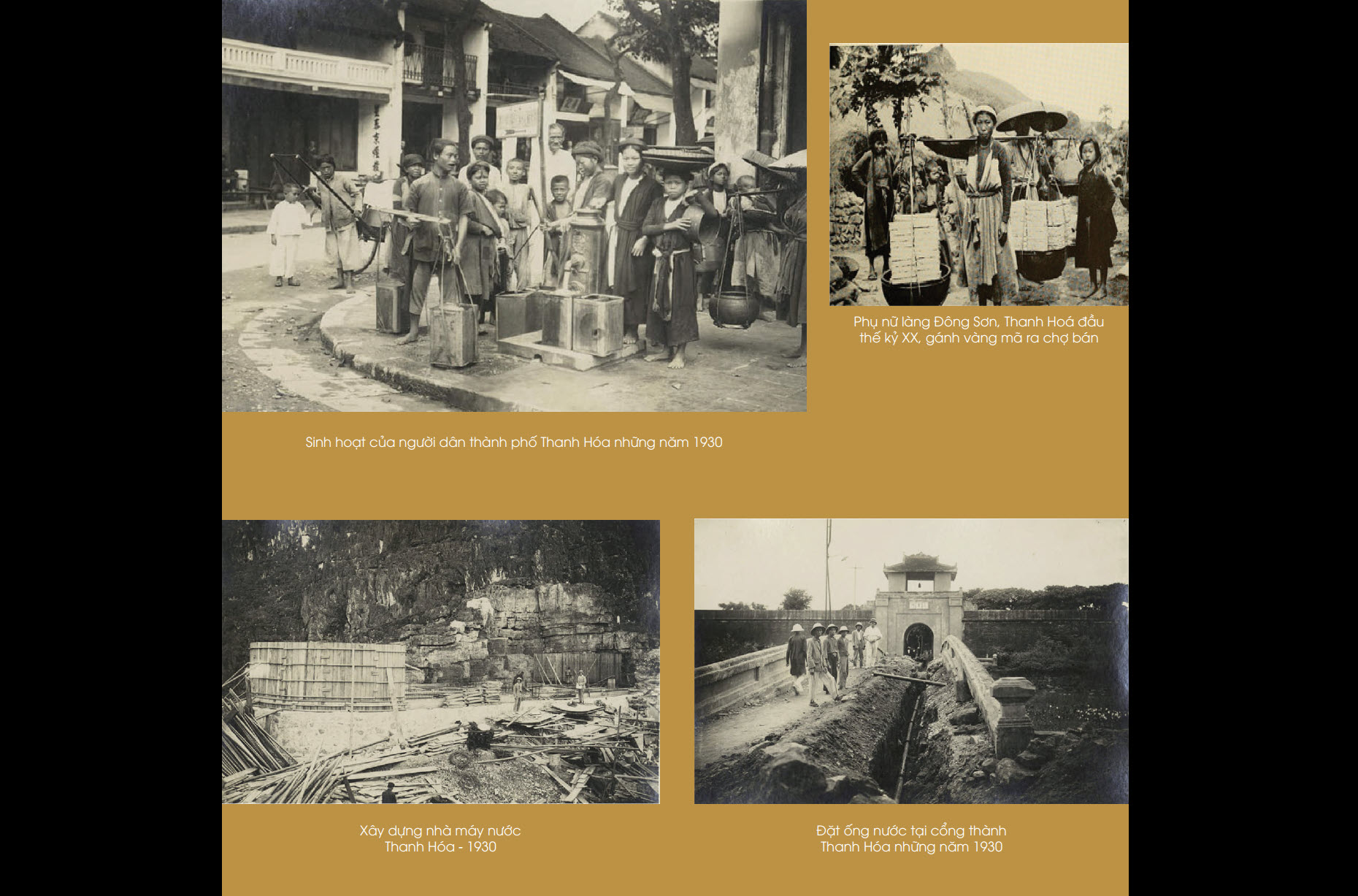
Life inside Crane City.
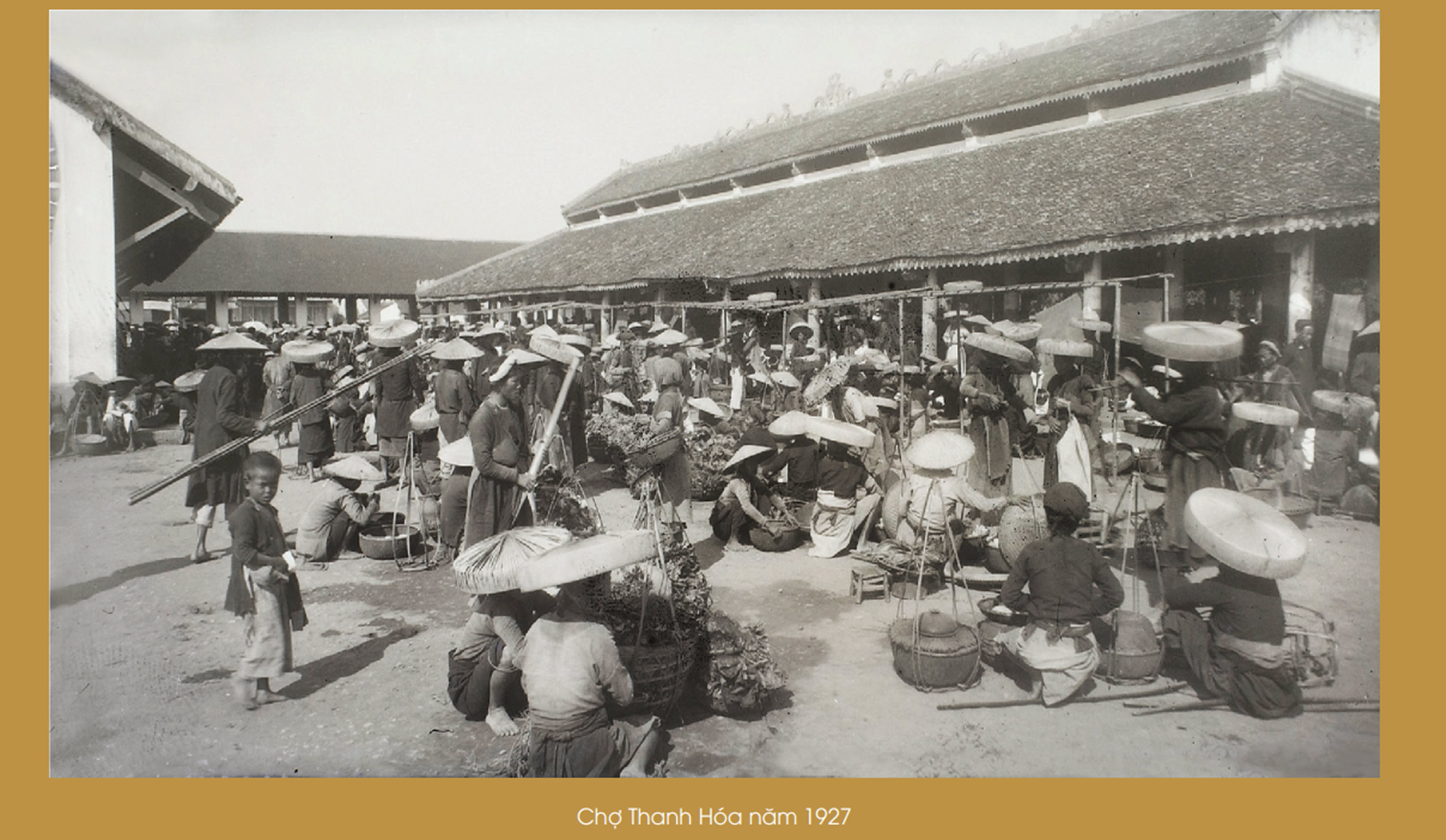
Provincial market (the land bounded by the streets of Tong Duy Tan, Le Hoan, Cao Thang, Hang Than); the streets and craft guilds are concentrated such as: Hang Huong, Hang Dong, Hang Than, Hang Thao, Tho Theu... is the largest market in the province, with three main sessions held each month on the seventh, seventeenth, and twenty-seventh of the lunar calendar....
Scenery of old Thanh Hoa life.
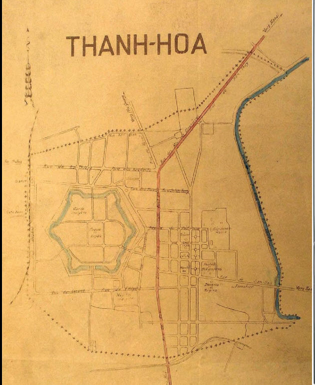
Map of Thanh Hoa urban area in 1930.
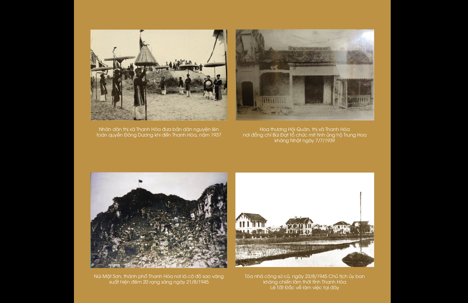
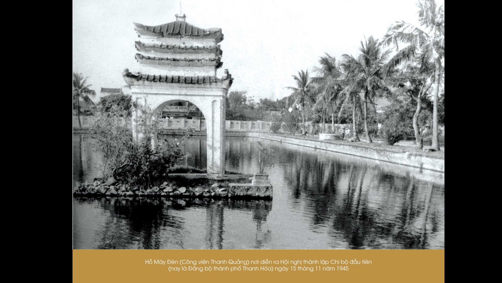
On November 15, 1945, at the Lamp Factory, comrade Bui Dat, representative of the Provincial Party Committee, convened a Conference to announce the Provincial Party Committee's Decision to establish the first Party Cell of the Town (now Thanh Hoa City Party Committee), with comrade Tran Tien Quan (Trinh Huy Lang) as Secretary.
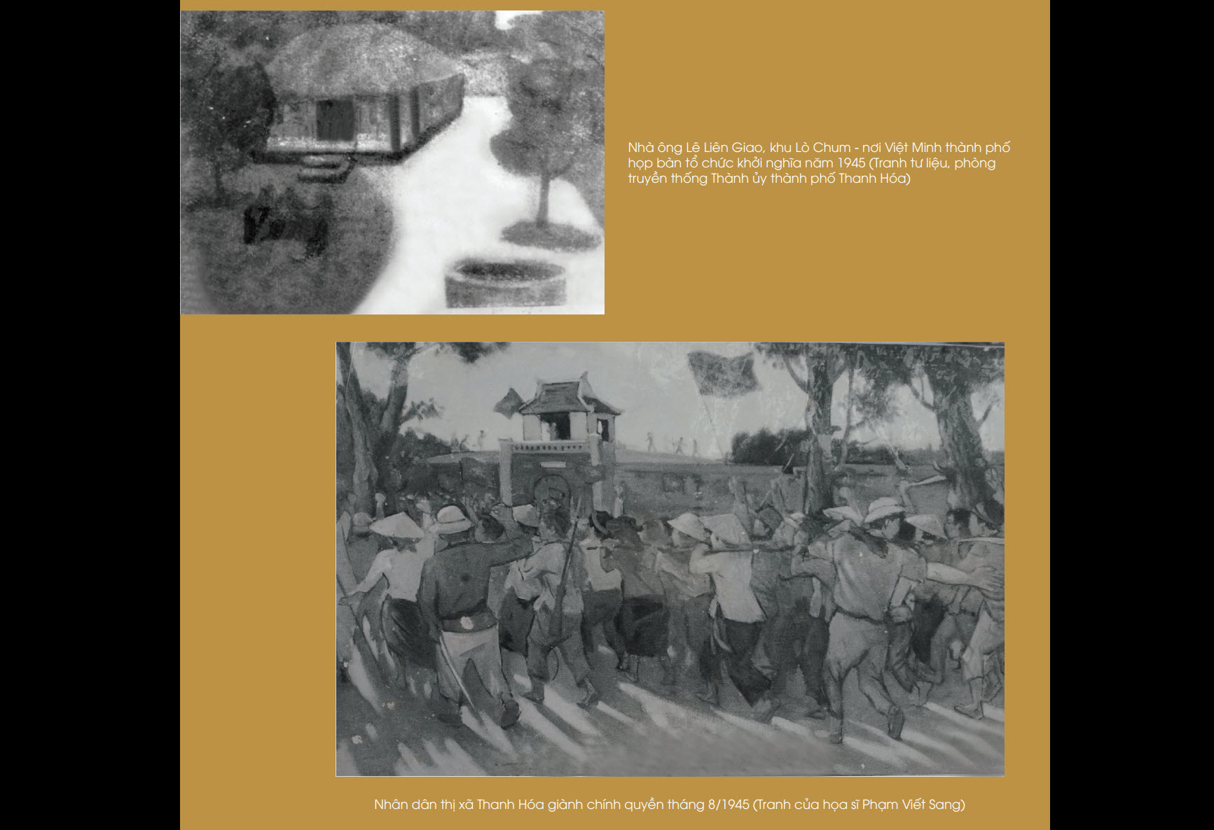
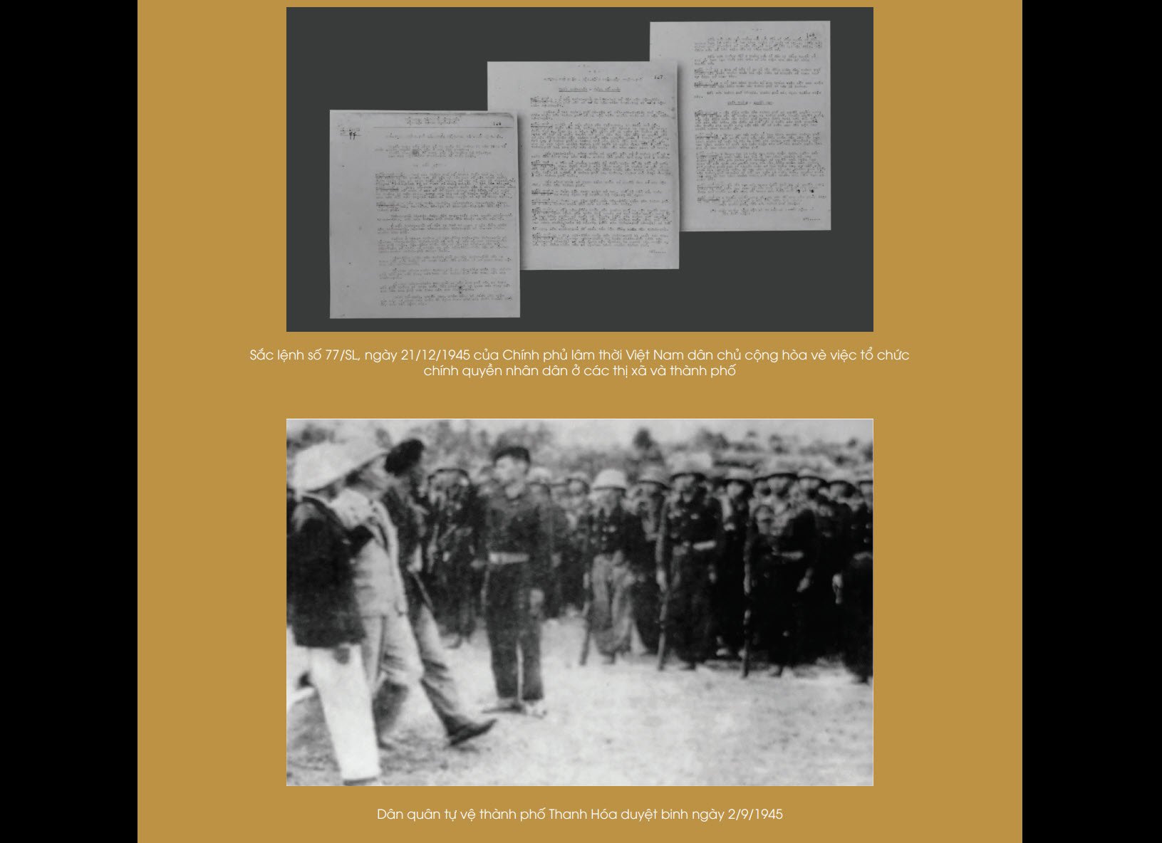
The establishment of the first Communist Party cell had a great significance in the political life of the people of the Town. For the first time, the people of Thanh Hoa Town had their own direct staff to lead the people forward under the glorious banner of the Party, together with the people of the province and the whole country to fulfill the sacred mission assigned by history.
The next part will introduce images of Thanh Hoa town from 1945 to 1994.
Minh Hieu (ST)
Source: Photo book of Thanh Hoa City past and present
Source: https://baothanhhoa.vn/hinh-anh-tran-thanh-thanh-hoa-giai-doan-1804-1945-232969.htm
![[Photo] Panorama of the cable-stayed bridge, the final bottleneck of the Ben Luc-Long Thanh expressway](https://vphoto.vietnam.vn/thumb/1200x675/vietnam/resource/IMAGE/2025/9/30/391fdf21025541d6b2f092e49a17243f)
![[Photo] President Luong Cuong receives President of the Cuban National Assembly Esteban Lazo Hernandez](https://vphoto.vietnam.vn/thumb/1200x675/vietnam/resource/IMAGE/2025/9/30/4d38932911c24f6ea1936252bd5427fa)
![[Photo] The 1st Congress of Phu Tho Provincial Party Committee, term 2025-2030](https://vphoto.vietnam.vn/thumb/1200x675/vietnam/resource/IMAGE/2025/9/30/1507da06216649bba8a1ce6251816820)
![[Photo] Solemn opening of the 12th Military Party Congress for the 2025-2030 term](https://vphoto.vietnam.vn/thumb/1200x675/vietnam/resource/IMAGE/2025/9/30/2cd383b3130d41a1a4b5ace0d5eb989d)

![[Photo] General Secretary To Lam, Secretary of the Central Military Commission attends the 12th Party Congress of the Army](https://vphoto.vietnam.vn/thumb/1200x675/vietnam/resource/IMAGE/2025/9/30/9b63aaa37ddb472ead84e3870a8ae825)


Comment (0)