
TPO – The weather forecast for the Ho Chi Minh City area in the last 10 days of September is that there will be scattered showers and thunderstorms in many places, with the possibility of moderate to heavy rains. The total rainfall is higher than the average of many years in the same period, commonly from 70-180mm.
This morning (September 21), many areas in Ho Chi Minh City experienced widespread rain. The Southern Hydrometeorological Station said that monitoring satellite cloud images, weather radar images and lightning positioning showed that the thunderstorm area was developing and causing rain with thunderstorms and lightning in Binh Tan District, District 6, District 5, District 1, District 3, Binh Thanh District, Thu Duc City. In addition, thunderstorms in Long An Province were moving towards Ho Chi Minh City.
In the next 3 hours, thunderstorms will continue to develop, causing showers, accompanied by thunderstorms and lightning in the above districts, then expanding to other neighboring areas. Rainfall is generally from 5-10mm, in some places over 15mm. During thunderstorms, beware of tornadoes, hail and strong gusts of wind of about level 5-7 (8-17m/s), heavy rain causing localized flooding.
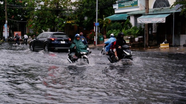 |
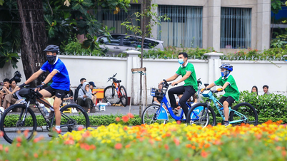
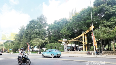
During the last 10 days of September, Ho Chi Minh City will have scattered showers and thunderstorms in many places, with the possibility of moderate to heavy rain. (Illustration: Huu Huy) |
The cause of thunderstorms in Ho Chi Minh City and the southern provinces in the past few days is the tropical convergence zone with its axis through the Central region and the northern part of the East Sea. In addition, the southwest monsoon with medium to strong intensity pushes thunderstorms from the sea to the mainland.
It is forecasted that in the last 10 days of September, the Ho Chi Minh City area will continue to be mainly affected by the southwest monsoon with medium to strong intensity. Above, the subtropical high pressure axis passing through the northern region of the North will be quite active.
The weather in the area is generally scattered showers and thunderstorms in many places, with the possibility of moderate to heavy rain in some places. Total rainfall is higher than the average of many years in the same period, commonly from 70-180mm.
“Beware of the possibility of thunderstorms, tornadoes, lightning, gusts of wind, and heavy rain during thunderstorms that can cause dangerous weather for people and property damage” - Southern Hydrometeorological Station informed.

Handling the situation of gathering to protest the Phu Huu BOT toll collection
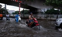
High tide reaches its peak, roads turn into rivers, people in Ho Chi Minh City struggle to wade through water to get home
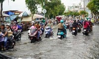
This afternoon, the tide peaked, Ho Chi Minh City still has thunderstorms this weekend

![[Photo] Bustling Mid-Autumn Festival at the Museum of Ethnology](https://vphoto.vietnam.vn/thumb/1200x675/vietnam/resource/IMAGE/2025/10/4/da8d5927734d4ca58e3eced14bc435a3)

![[Photo] General Secretary To Lam attends the 8th Congress of the Central Public Security Party Committee](https://vphoto.vietnam.vn/thumb/1200x675/vietnam/resource/IMAGE/2025/10/4/79fadf490f674dc483794f2d955f6045)

![[Photo] Solemn opening of the 8th Congress of the Central Public Security Party Committee, term 2025-2030](https://vphoto.vietnam.vn/thumb/1200x675/vietnam/resource/IMAGE/2025/10/4/f3b00fb779f44979809441a4dac5c7df)


![[VIDEO] Summary of Petrovietnam's 50th Anniversary Ceremony](https://vphoto.vietnam.vn/thumb/402x226/vietnam/resource/IMAGE/2025/10/4/abe133bdb8114793a16d4fe3e5bd0f12)

![[VIDEO] GENERAL SECRETARY TO LAM AWARDS PETROVIETNAM 8 GOLDEN WORDS: "PIONEER - EXCELLENT - SUSTAINABLE - GLOBAL"](https://vphoto.vietnam.vn/thumb/402x226/vietnam/resource/IMAGE/2025/7/23/c2fdb48863e846cfa9fb8e6ea9cf44e7)


Comment (0)