
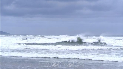
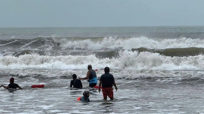
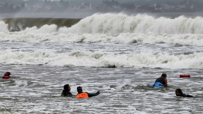
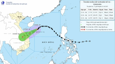
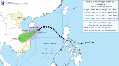
Due to the impact of the storm, the sea area of the South and Ho Chi Minh City (from Lam Dong to Ca Mau) in the North will have Northeast wind, the wind will change direction to level 3-4 in the South, wave height from 0.5-1.5m. The sea area from Ca Mau - An Giang - Phu Quoc will have light wind, wave height under 1.0m. In both sea areas, there will be scattered showers and thunderstorms. During thunderstorms, beware of tornadoes and strong gusts of wind level 6-7.

Weather in Ho Chi Minh City: variable clouds, sunny during the day, showers in many places in the afternoon and evening, scattered thunderstorms, some places have moderate to heavy rain, during thunderstorms, beware of tornadoes, lightning, and strong gusts of wind.
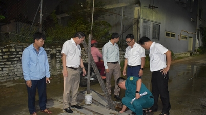
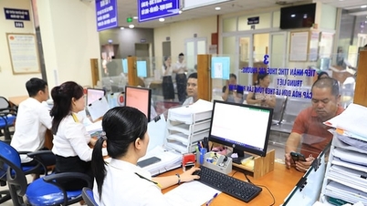
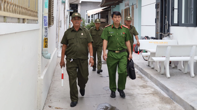
According to Mr. Nguyen Xuan Hoang, Deputy Director of the Department of Agriculture and Environment of Ho Chi Minh City, implementing the direction of the National Civil Defense Steering Committee on proactively responding to storm No. 12, the Department of Agriculture and Environment of Ho Chi Minh City has also requested units and localities to closely monitor warning bulletins and forecast the storm's developments; People's Committees of communes, wards, island communes, special zones, the City Border Guard Command, the Department of Fisheries and Fisheries Control, and the City Coastal Information Station regularly inform vehicles and boats operating at sea about the storm's developments to have appropriate plans for production and exploitation of aquatic products.
Organize monitoring, counting, and statistics of the number of vessels operating in the affected area; maintain contact with vehicle owners to provide safety instructions for vessels, boats, and vehicles. Prepare forces, vehicles, and equipment to carry out search and rescue when situations arise...
Source: https://www.sggp.org.vn/tphcm-chu-dong-cac-phuong-an-ung-pho-voi-bao-so-12-post819122.html
![[Photo] Prime Minister Pham Minh Chinh meets with Speaker of the Hungarian National Assembly Kover Laszlo](https://vphoto.vietnam.vn/thumb/1200x675/vietnam/resource/IMAGE/2025/10/20/1760970413415_dsc-8111-jpg.webp)


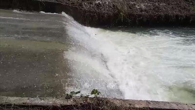
![[Photo] Da Nang residents "hunt for photos" of big waves at the mouth of the Han River](https://vphoto.vietnam.vn/thumb/1200x675/vietnam/resource/IMAGE/2025/10/21/1761043632309_ndo_br_11-jpg.webp)

![[Photo] Prime Minister Pham Minh Chinh received Mr. Yamamoto Ichita, Governor of Gunma Province (Japan)](https://vphoto.vietnam.vn/thumb/1200x675/vietnam/resource/IMAGE/2025/10/21/1761032833411_dsc-8867-jpg.webp)


Comment (0)