
Typhoon Toraji has entered the eastern sea of the North East Sea, becoming the 8th typhoon of 2024. It is forecast that in the next 2-3 days, the storm will weaken rapidly and dissipate at sea.
According to the National Center for Hydro-Meteorological Forecasting, at 10:00 p.m. on November 11, the center of storm No. 8 (Toraji storm) was located in the eastern sea of the North East Sea. The strongest wind near the center of the storm was level 11 (103-117 km/h), gusting to level 13. Moving northwest at a speed of about 20 km/h.
In the next 24 hours, storm No. 8 will maintain its direction of movement, at a speed of 15-20km/h. By 10pm tomorrow night (November 12), the center of the storm will be located in the eastern sea of the North East Sea, with its intensity reduced to level 9-10, gusting to level 12.
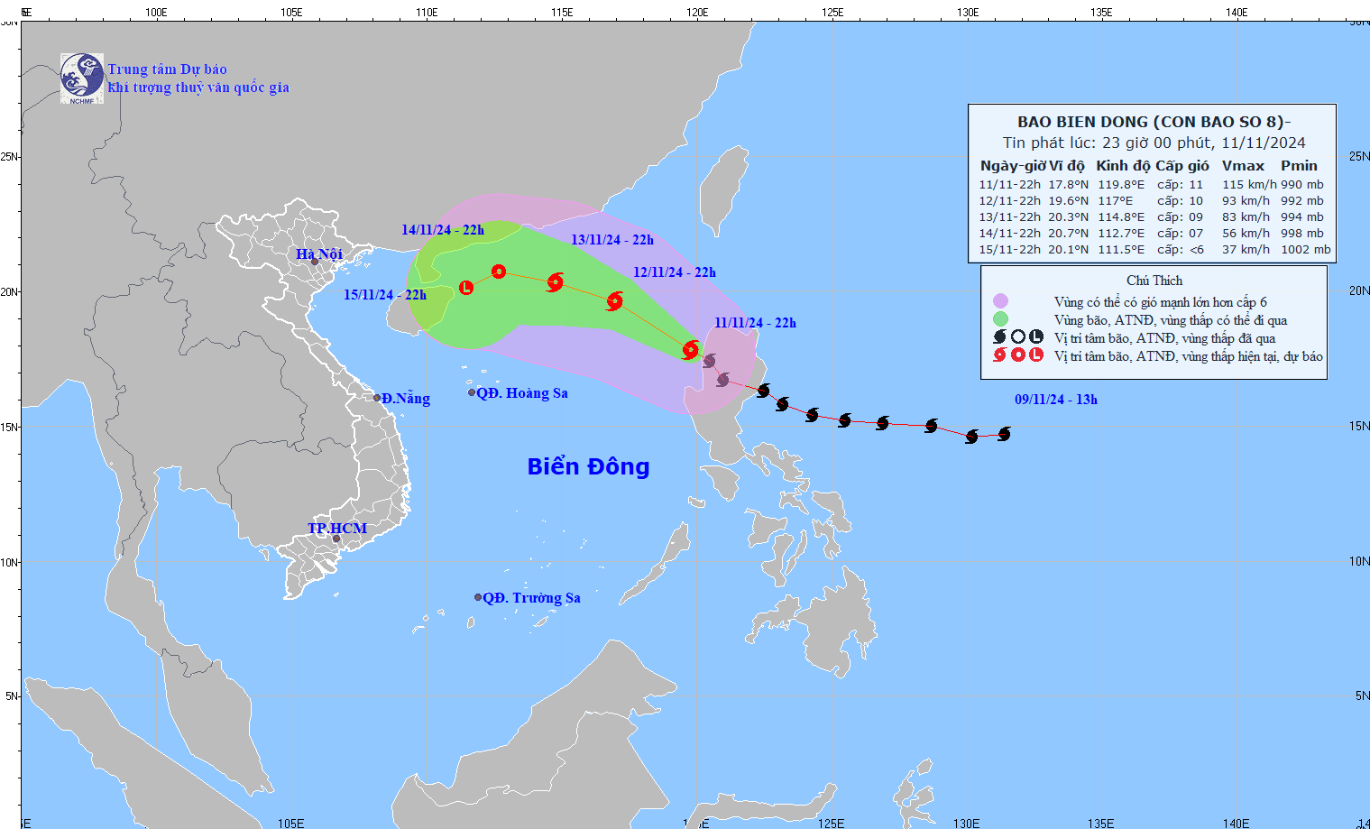
The storm then changed direction and moved west-northwest at a speed of 10-15km/h, gradually weakening in intensity. By 10pm on November 13, the storm's center was in the northern sea area of the North East Sea and its intensity had decreased to level 8-9, gusting to level 11.
In the following hours, the storm moved northward into the North East Sea at a speed of about 10km/h and gradually weakened into a tropical depression.
From the next 72 to 96 hours, the tropical depression will move in the West Southwest direction, about 5km per hour, and its intensity will continue to weaken.
Thus, storm number 8 after entering the East Sea tends to weaken quickly and dissipate at sea.
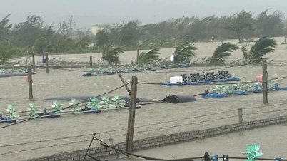
However, due to the influence of storm No. 8, the sea area to the east of the North East Sea has strong winds of level 6-7, then increasing to level 8, the area near the storm's eye has levels 9-11, gusts of level 12, waves 3-5m high, the area near the storm's eye is 5-7m; the sea is very rough.
Vessels operating in the above mentioned dangerous areas are susceptible to the impact of storms, whirlwinds, strong winds and large waves.
In addition, meteorological experts say the East Sea may welcome storm No. 9 in the near future, as off the coast of the Philippines there is a tropical depression and a distant storm active.
A series of 3 storms and tropical depressions, the possibility of storm number 9 appearing

Cold air conditions are expected to change unexpectedly from now until December.
Source: https://vietnamnet.vn/bao-toraji-tro-thanh-bao-so-8-kha-nang-tan-ngay-tren-bien-dong-2341060.html
![[Photo] Many streets in Hanoi were flooded due to the effects of storm Bualoi](https://vphoto.vietnam.vn/thumb/1200x675/vietnam/resource/IMAGE/2025/9/29/18b658aa0fa2495c927ade4bbe0096df)
![[Photo] National Assembly Chairman Tran Thanh Man chairs the 8th Conference of full-time National Assembly deputies](https://vphoto.vietnam.vn/thumb/1200x675/vietnam/resource/IMAGE/2025/9/29/2c21459bc38d44ffaacd679ab9a0477c)
![[Photo] General Secretary To Lam attends the ceremony to celebrate the 80th anniversary of the post and telecommunications sector and the 66th anniversary of the science and technology sector.](https://vphoto.vietnam.vn/thumb/1200x675/vietnam/resource/IMAGE/2025/9/29/8e86b39b8fe44121a2b14a031f4cef46)
![[Photo] General Secretary To Lam receives US Ambassador to Vietnam Marc Knapper](https://vphoto.vietnam.vn/thumb/1200x675/vietnam/resource/IMAGE/2025/9/29/c8fd0761aa184da7814aee57d87c49b3)
![[Photo] General Secretary To Lam chairs the meeting of the Central Steering Committee on preventing and combating corruption, waste and negativity](https://vphoto.vietnam.vn/thumb/1200x675/vietnam/resource/IMAGE/2025/9/29/fb2a8712315d4213a16322588c57b975)


Comment (0)