
Storm Usagi is currently north of Luzon Island (Philippines) with a level 13 intensity. It is forecast that on November 15, Storm Usagi will enter the northeastern waters of the East Sea and may become storm number 9. Storm number 8 will weaken into a tropical depression tonight.
This afternoon (November 14), the National Center for Hydro-Meteorological Forecasting said that a storm with the international name Usagi is active in the sea north of Luzon Island (Philippines).
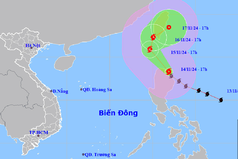
At 5:00 p.m., the eye of the storm was located on the northern coastal area of Lu Dong Island. The strongest wind near the eye of the storm was level 13 (134-149 km/h), gusting to level 16. Moving northwest at a speed of about 15 km/h.
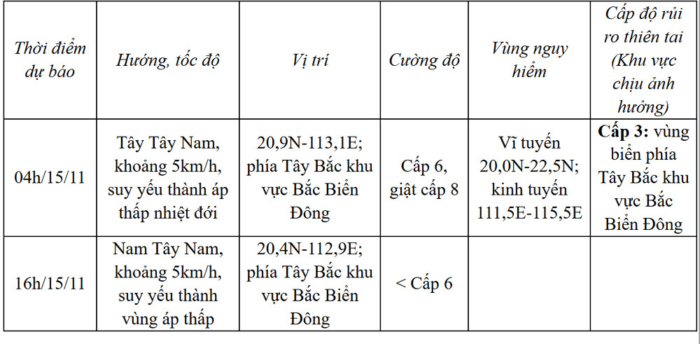
Storm forecast (next 12 to 24 hours) :
Thus, compared to 7am this morning, storm Usagi has decreased by 2 levels. It is forecasted that tomorrow (November 15), storm Usagi will move into the northeastern area of the North East Sea, causing strong winds of level 11-13, gusts of level 16, and waves of 5-7m around the storm center. This could be the 9th storm to enter the East Sea this year. The storm will then move northeast towards Taiwan (China), weaken and gradually dissipate.
Due to the influence of storm Usagi, the northwest sea area of the North East Sea has strong winds of level 6, the area near the storm's eye has winds of level 7-8, gusts of level 10, waves 2-4m high; rough seas.
Vessels operating in the above mentioned danger zones are susceptible to storms, whirlwinds, strong winds and large waves.
At the same time, the meteorological agency also informed that as of 4:00 p.m. this afternoon, the center of storm No. 8 Toraji was located in the northern sea area of the North East Sea. The strongest wind near the center of the storm was level 8 (62-74 km/h), gusting to level 10. Moving westward at a speed of about 5 km/h.
It is forecasted that in the next 12 to 24 hours, the storm will move West Southwest then South Southwest, about 5km/h, weaken into a tropical depression and low pressure area in the Northwest of the North East Sea.
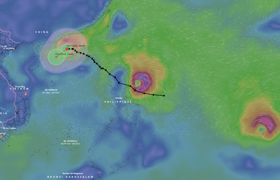
Notably, typhoon Manyi, currently nearly 2,000km from Luzon Island (Philippines), is moving very fast at 25-30km/h. It is forecasted that around November 17, typhoon Manyi will make landfall in the Luzon Island area with a strong intensity of level 15, gusting over level 17.
Experts say that storm Manyi is a very strong, fast-moving storm, likely to move into the East Sea around November 18.
Storm No. 8 weakens, high possibility of storm No. 9 appearing early next week

Hanoi weather for the next 3 days: Strong sunshine up to 33 degrees, cold air coming soon
Source: https://vietnamnet.vn/bao-usagi-ap-sat-bien-dong-co-the-tro-thanh-bao-so-9-2342087.html


Comment (0)