
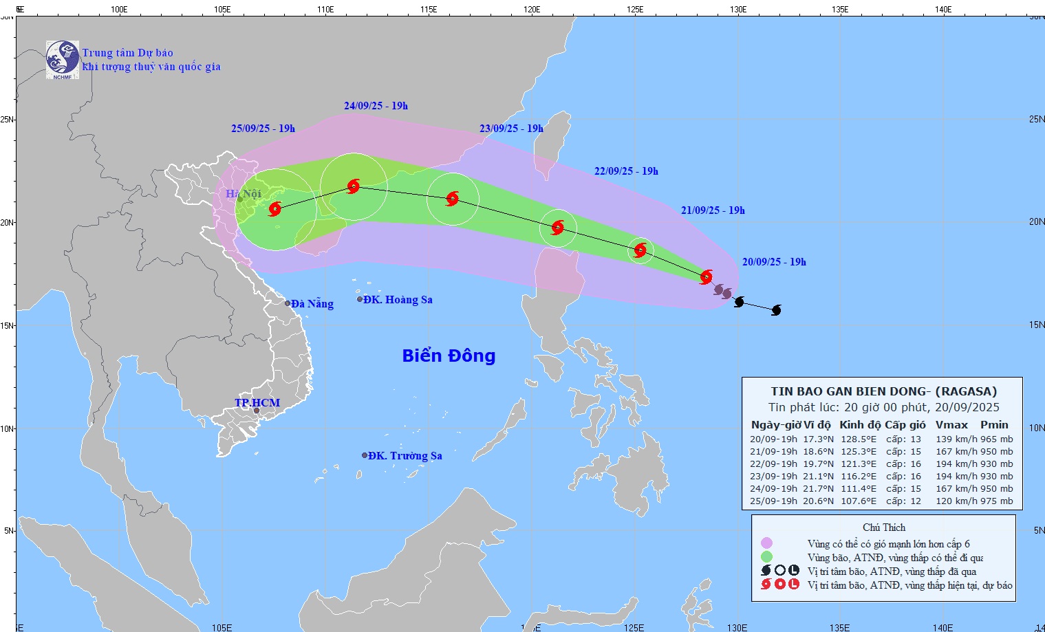
The strongest wind is level 13 (134–149 km/h), gusting to level 16. The storm is moving northwest at a speed of 10–15 km/h.
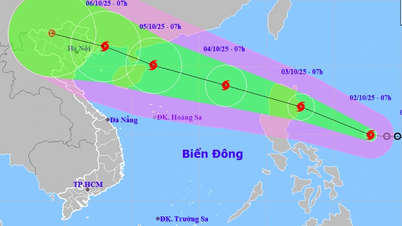
Storm RAGASA moves in the West Northwest direction
At 7:00 p.m. on September 21, the storm was about 340 km east of Luzon Island (Philippines) with strong winds of level 14-15, gusting to level 17; moving west-northwest at a speed of about 15 km/h and likely to strengthen.
At 7:00 p.m. on September 22, the storm was in the sea north of Luzon Island (Philippines) with strong winds of level 16, gusting over level 17; moving in the West Northwest direction at a speed of about 15-20 km/h and continuing to strengthen.
At 7:00 p.m. on September 23, the storm was in the Northeast Sea, the North East Sea area of Hong Kong (China) about 270 km to the Southeast with strong winds of level 16, gusting over level 17; moving in the West Northwest direction at a speed of about 20-25 km/h and entering the East Sea. The affected area is the sea area east of the North East Sea area. Natural disaster risk level 4.
From the next 72 to 120 hours, the storm will move mainly in the West-Northwest direction, then turn West-Southwest at about 20km per hour, gradually weakening in intensity.
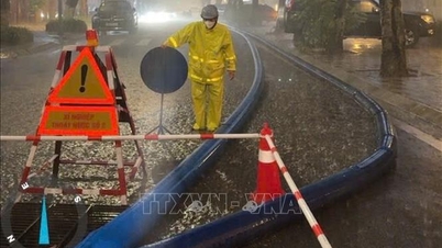
Dr. Hoang Phuc Lam, Deputy Director of the National Center for Hydro-Meteorological Forecasting, warned: Due to the influence of the storm, from the afternoon of September 22, the eastern sea area of the North East Sea will have strong winds of level 6-7, then increasing to level 8-9, gusting to level 11; from the night of September 22, it will increase to level 10-13, the area near the storm's eye will have levels 14-16, gusting to level 17, waves 4-8m high, the area near the storm's eye will have waves over 10m; the sea will be very rough.
Vessels operating in the above mentioned dangerous areas are susceptible to the impact of storms, whirlwinds, strong winds and large waves.
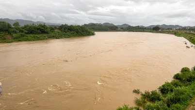
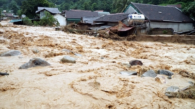
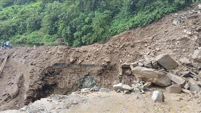
Beware of flash floods and landslides in Gia Lai province
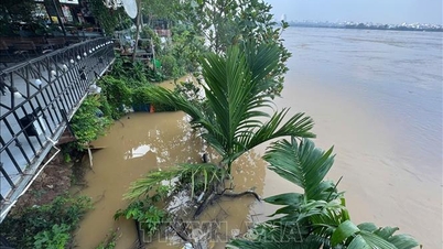
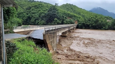
The National Center for Hydro-Meteorological Forecasting said that from 7:30 p.m. on September 20 to 0:30 a.m. on September 21, Gia Lai province will continue to have rain with accumulated rainfall ranging from 20-40 mm, with some places over 60 mm.
Warning of the risk of flash floods on small rivers and streams, landslides on steep slopes in the above province, especially in the following communes/wards: An Hao, An Hoa, An Lao, Vinh Son; An Toan, An Tuong, An Vinh, Bau Can, Binh Hiep, Bo Ngoong, Chu Prong, Duc Co, Gao, Hoai An, Hoi Son, Ia Bang, Ia Boong, Ia Nan, Ia Pnôn, Kim Son, Mang Yang, Hoai Nhon Bac, Hoai Nhon Tay, Hoi Phu, Tam Quan, Phu My Bac, Van Duc, Vinh Thinh.
Level of natural disaster risk due to flash floods, landslides, land subsidence due to heavy rain or level 1 flow.
Flash floods and landslides can have very negative impacts on the environment, threaten people's lives; cause local traffic congestion, affect the movement of vehicles; destroy civil and economic works, causing damage to production and socio-economic activities.
The hydrometeorological agency recommends that local authorities pay attention to reviewing bottlenecks and vulnerable locations in the area to have prevention and response measures.
From 4:00 p.m. to 6:00 p.m. on September 20, Gia Lai province had moderate rain, some places had heavy rain such as: An Quang 48.3mm; Ho A - Vinh Son Hydropower Plant 41.8mm;...
Soil moisture models show that some areas in the province are near saturation (over 85%) or have reached saturation.
Source: https://baotintuc.vn/van-de-quan-tam/canh-bao-cap-do-rui-ro-thien-tai-do-baoragasa-cap-4-cap-rat-nguy-hiem-20250920203526826.htm


Comment (0)