
With the greatest efforts and endeavors, the road management units of the Vietnam Road Administration have mobilized maximum human resources, equipment, and materials, working through the night with the highest determination in the past days.
By 2:00 p.m. on October 9, 2025, basically all flooded national highways and expressways had been reopened; only a few points on national highways managed by localities were still congested due to deep flooding or landslides of large volumes of rock and soil... At these locations, road management units also had plans to organize traffic flow remotely to ensure safety and avoid congestion.
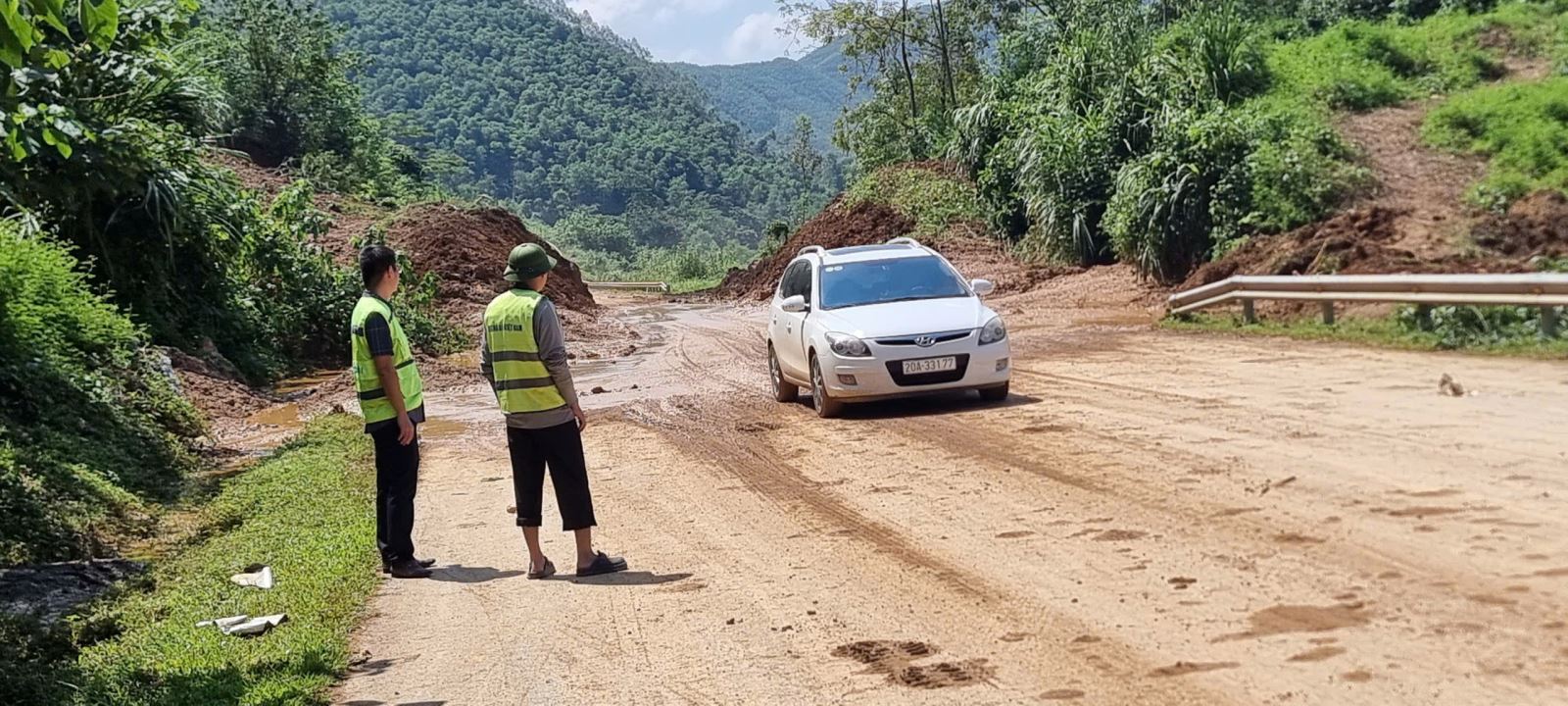
Specifically, the current traffic situation on some routes has just been informed by the Department:
The Hanoi - Thai Nguyen Expressway, National Highway 3, the Thai Nguyen - Cho Moi BOT route, and Ho Chi Minh Road connecting with Thai Nguyen and Cao Bang provinces have now been opened to traffic; at Km120+700, Ho Chi Minh Road has opened one lane and vehicles can choose to follow National Highway 3 through Ngan Son Town (old) to continue to Cao Bang; Km200+903/National Highway 3 has opened one lane for cars, passenger cars, and trucks under 3.5 tons. It is expected that on October 9, 2025, it will be completely open to all types of vehicles.
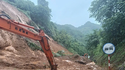
On national highways managed by localities, there are still some locations where traffic is congested due to large amounts of landslides or deep floodwater that has not yet receded, such as: Thai Nguyen still has 7 traffic jams, including 4 points on the section Km116+300-Km122+800/QL3B (Tan Ky commune), Km52+230 (Ba Be commune), Km 275+600-Km276+660/QL279 (Hiep Luc commune), Km116+330/QL3B (Tan Ky commune); Cao Bang still has 9 traffic jams due to landslides at Km124+100/QL34 (Bao Lac), Km52+600/QL34B (old Cao Bang city), Km162+200 (Ha Lang), Km314+550 (Ha Quang), Km316+100, Km316+300, Km332+100, Km317+280 Km340+800/QL4A (Bao Lac) and 2 traffic jams due to flooding at Km83+150/QL34 (Bao Lam) and Km3+600/QL34B (Thach An).
Provinces: Lang Son still has 2 traffic jams due to flooding at Km50 and Km52/QL3B (Tan Tien commune), the water is gradually receding; Tuyen Quang still has 1 traffic jam at Km63+710-Km63+900/QL34 in the Bac Me hydropower area, expected to open to the positive slope to temporarily clear the road before October 15, 2025.
The Vietnam Road Administration is continuing to make efforts to direct units to urgently overcome and closely coordinate, supporting localities to clear traffic jams at the earliest possible time.
Source: https://baotintuc.vn/xa-hoi/co-ban-thong-xe-cac-tuyen-quoc-lo-cao-toc-bi-ngap-do-mua-lu-tai-cac-tinh-phia-bac-20251009145142036.htm


![[Photo] General Secretary To Lam visits Kieng Sang Kindergarten and the classroom named after Uncle Ho](https://vphoto.vietnam.vn/thumb/1200x675/vietnam/resource/IMAGE/2025/10/09/1760023999336_vna-potal-tong-bi-thu-to-lam-tham-truong-mau-giao-kieng-sang-va-lop-hoc-mang-ten-bac-ho-8328675-277-jpg.webp)
![[Photo] Prime Minister Pham Minh Chinh chairs a meeting of the Government Standing Committee on overcoming the consequences of natural disasters after storm No. 11](https://vphoto.vietnam.vn/thumb/1200x675/vietnam/resource/IMAGE/2025/10/09/1759997894015_dsc-0591-jpg.webp)
![[Photo] President Luong Cuong attends the 80th Anniversary of the Traditional Day of Vietnamese Lawyers](https://vphoto.vietnam.vn/thumb/1200x675/vietnam/resource/IMAGE/2025/10/09/1760026998213_ndo_br_1-jpg.webp)


Comment (0)