
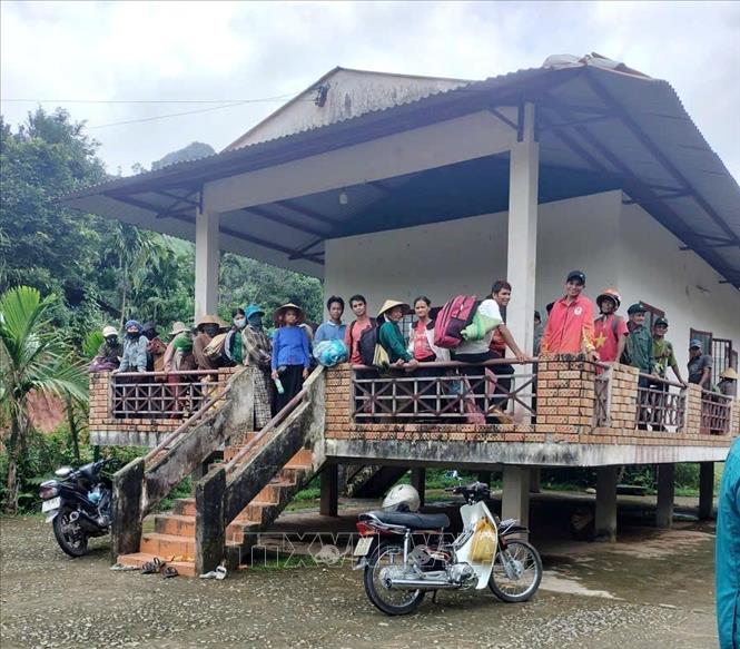
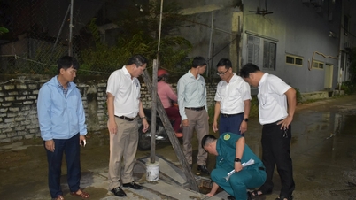
Previously, through field inspection, the People's Committee of Ba Vinh commune determined that there were 2 high-risk landslide points at the foot of Go Oat mountain. One point had a crack across the mountainside about 50m long, 0.6m wide, 0.5 - 1m deep, 45% slope, with a tendency to increase in width; 1 point had many underground water streams flowing out abnormally when there was heavy rain. The area around the crack had many large rocks scattered about. If a landslide occurred, the possibility of soil and rocks flowing down to the residential areas of households at any time.
Mr. Pham Van Rach said that in addition to the emergency plan to move people to safety, the Commune People's Committee has organized forces to closely monitor the cracks 24/7; and has written documents recommending relevant departments and branches to promptly deploy plans to survey, handle and repair the cracks. In the long term, the locality hopes that superiors will pay attention to allocating funding to build resettlement areas for households in the affected areas to stabilize their lives.
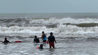
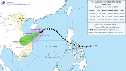
According to the quick report No. 3 from the Irrigation Department of Quang Ngai province, due to the impact of storm No. 12, on October 19-20, Quang Ngai province had heavy to very heavy rain with an average rainfall of 100-300mm, mainly concentrated in the eastern communes of the province; high risk of flooding, landslides, and flash floods.
Source: https://baotintuc.vn/xa-hoi/khan-cap-dua-61-ho-dan-o-quang-ngai-den-noi-an-toan-sau-khi-phat-hien-vet-nut-nui-20251021165229356.htm
![[Photo] Prime Minister Pham Minh Chinh meets with Speaker of the Hungarian National Assembly Kover Laszlo](https://vphoto.vietnam.vn/thumb/1200x675/vietnam/resource/IMAGE/2025/10/20/1760970413415_dsc-8111-jpg.webp)
![[Photo] Da Nang residents "hunt for photos" of big waves at the mouth of the Han River](https://vphoto.vietnam.vn/thumb/1200x675/vietnam/resource/IMAGE/2025/10/21/1761043632309_ndo_br_11-jpg.webp)
![[Photo] Prime Minister Pham Minh Chinh received Mr. Yamamoto Ichita, Governor of Gunma Province (Japan)](https://vphoto.vietnam.vn/thumb/1200x675/vietnam/resource/IMAGE/2025/10/21/1761032833411_dsc-8867-jpg.webp)


Comment (0)