
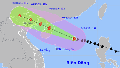
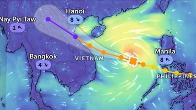
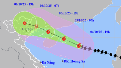
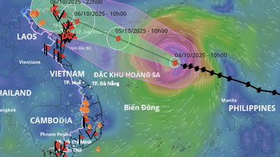
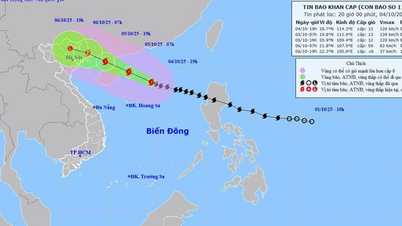
Forecast of location and direction of super typhoon Ragasa at 1:00 p.m. on September 22 - Photo: NCHMF
Mr. Nguyen Van Huong - Head of Weather Forecast Department, National Center for Hydro-Meteorological Forecasting - said when assessing the developments of super typhoon Sagara on September 22.
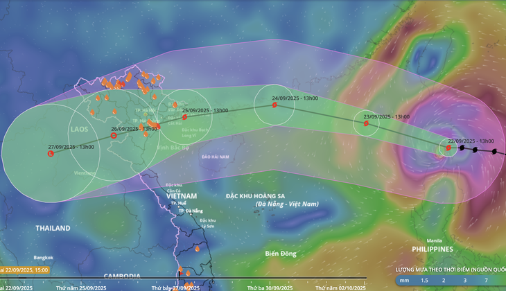
At 1 p.m. on September 22, the center of super typhoon Ragasa was about 140 kilometers north of Luzon Island. The strongest wind near the center of the super typhoon was level 17 (202 - 220 km/h), gusting above level 17.
Two scenarios for the path of super typhoon Ragasa
According to Mr. Huong, around this evening to tonight, super typhoon Ragasa will enter the East Sea, becoming the 9th typhoon this year.
"According to assessments, this will be one of the six strongest storms in the past 50 years in the East Sea, and is likely to be stronger than storm Yagi in 2024," Mr. Huong said.
Mr. Huong said that when entering the East Sea, super typhoon Ragasa's movement is relatively complicated and there are two possible scenarios.
Scenario 1: After entering the East Sea, the storm moves west-northwest, when entering the sea area south of Guangdong province (China). With this scenario, the storm will rub against the mainland so its intensity will weaken and when entering the Gulf of Tonkin, the storm's intensity is likely to weaken from level 2 to 4.
The second worse scenario is that after entering the East Sea, the storm will move westward. When entering the Gulf of Tonkin, the storm will still be quite strong, causing strong winds and heavy rain in the North and North Central regions.
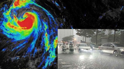
"In addition, when the storm enters the Gulf of Tonkin, a cold air mass moving down from China will change the direction, intensity and impact area of storm Ragasa. Therefore, people need to continue to monitor updated forecasts in the coming time," Mr. Huong noted.
Forecast of location and direction of super typhoon Ragasa after entering the East Sea tonight
People in the coastal areas of the North and North Central regions need to proactively prepare storm response plans.
Regarding the early zoning of areas in Vietnam that are likely to be directly affected by super typhoon Ragasa, Mr. Huong said that from today (September 22), the northern sea area of the northern East Sea will begin to gradually increase in wind to level 8-9, then increase to level 10-14, the area near the center of the super typhoon will have wind level 15-17, gusts above level 17, waves over 10m high. All large tonnage vessels operating in this area can be affected by the storm.
From September 24, the wind in the Gulf of Tonkin will gradually increase to level 6-7, then increase to level 8-10, the area near the storm center will have level 12-14, gusting to level 15-16, waves 5-7m high, rough seas, accompanied by thunderstorms and strong gusts of wind.
Regarding the mainland, Mr. Huong said that whether the storm moves west-northwest or west, the Northern and North Central regions will be affected.
The strong wind area will stretch from the coast, along the coast of provinces and cities from Quang Ninh - Ha Tinh , even extending down to northern Quang Tri if the storm moves further south.
"Super typhoon Ragasa is very strong, with a wide circulation, so it should be noted that although the eye of the storm is still very far from the mainland, the circulation west of the eye of the storm, the coastal area of the Gulf of Tonkin, from Quang Ninh - northern Quang Tri, even the sea areas of Lam Dong - Ca Mau, Ca Mau - An Giang , there is a possibility of thunderstorms appearing before the storm, this is a very dangerous phenomenon for ships operating near the shore.
When the storm affects the Gulf of Tonkin, it will cause strong winds and big waves, so from now on, fishermen in the North and North Central regions need to have a plan to ensure the safety of their cages.
People in areas that are likely to be affected by the storm, such as the North, Thanh Hoa, Nghe An, and Ha Tinh, need to have plans to reinforce their houses to cope with storm Ragasa," Mr. Huong emphasized.
Source: https://tuoitre.vn/khong-khi-cold-se-lam-thay-doi-huong-di-cuong-do-sieu-bao-ragasa-20250922153423743.htm


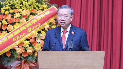
![[Photo] General Secretary To Lam attends the 8th Congress of the Central Public Security Party Committee](https://vphoto.vietnam.vn/thumb/1200x675/vietnam/resource/IMAGE/2025/10/4/79fadf490f674dc483794f2d955f6045)
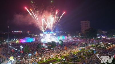
![[Photo] Bustling Mid-Autumn Festival at the Museum of Ethnology](https://vphoto.vietnam.vn/thumb/1200x675/vietnam/resource/IMAGE/2025/10/4/da8d5927734d4ca58e3eced14bc435a3)
![[Photo] Solemn opening of the 8th Congress of the Central Public Security Party Committee, term 2025-2030](https://vphoto.vietnam.vn/thumb/1200x675/vietnam/resource/IMAGE/2025/10/4/f3b00fb779f44979809441a4dac5c7df)


![[VIDEO] Summary of Petrovietnam's 50th Anniversary Ceremony](https://vphoto.vietnam.vn/thumb/402x226/vietnam/resource/IMAGE/2025/10/4/abe133bdb8114793a16d4fe3e5bd0f12)

![[VIDEO] GENERAL SECRETARY TO LAM AWARDS PETROVIETNAM 8 GOLDEN WORDS: "PIONEER - EXCELLENT - SUSTAINABLE - GLOBAL"](https://vphoto.vietnam.vn/thumb/402x226/vietnam/resource/IMAGE/2025/7/23/c2fdb48863e846cfa9fb8e6ea9cf44e7)


Comment (0)