
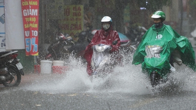
Hanoi may be at the eye of the passing storm.
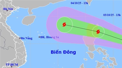
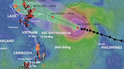
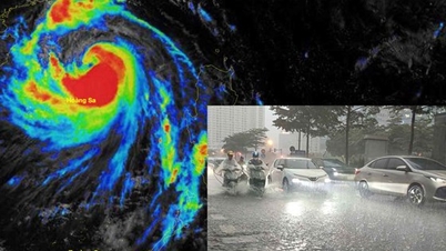
At 4am this morning (September 24), the super typhoon's center was in the northern part of the North East Sea, about 650km east of Mong Cai (Quang Ninh). The strongest typhoon in the world this year is still maintaining a level 15-16 intensity, gusting to level 17.
The National Center for Hydro-Meteorological Forecasting said that during today and tonight, storm Ragasa will move west-northwest at a very fast speed, about 20-25km per hour and begin to enter a rapid weakening cycle.
At 4am on September 25, the storm center was on the coastal area of Guangxi province (China), about 150km east of Mong Cai ( Quang Ninh ). Due to friction with the terrain of mainland China, followed by a cold, dry air mass, the storm was still at level 11, gusting to level 13.
It is forecasted that on September 25, the storm will move mainly westward at a speed of up to 25-30km/h. From the morning of September 25, the storm clouds will begin to affect the mainland of our country. At noon on September 25, the storm center will make landfall in the Quang Ninh - Hai Phong area with a level 9 intensity, gusting to level 11.

Forecast of the path of storm Ragasa
After making landfall, the storm continued to move rapidly westward, weakening into a tropical depression, passing through the Hanoi and Phu Tho areas, and continuing to weaken into a low pressure area. At 4 a.m. on September 26, the center of the low pressure area was on land in the Northwest region with an intensity below level 6.
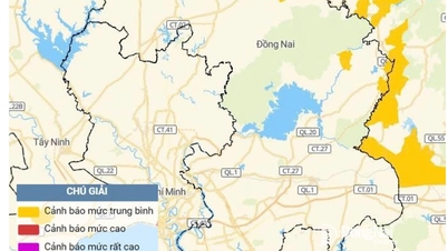
Before the forecast of the path and intensity of storm Ragasa, the National Center for Hydro-Meteorological Forecasting issued a level 3 natural disaster risk (in Vietnam's 5-level scale) in the Northern Gulf of Tonkin and the Northeast.
This is a high risk level, can cause loss of life, livestock, major damage to property, infrastructure. Negative impact and serious consequences for the environment.
Beware of sudden thunderstorms
Due to the influence of storm Ragasa, from noon on September 24, the eastern sea area of the Northern Gulf of Tonkin (including Bach Long Vi special zone) has gradually increased winds to level 6-7, gusting to level 9.
From the night of September 24, the Northern Gulf of Tonkin area (including Bach Long Vy, Van Don, Co To, Cat Hai and Hon Dau islands) will have winds gradually increasing to level 8, waves 2.0-4.0m high, near the storm center will have winds of level 9-11, gusts of level 13, waves 3-5m high, and very rough seas.
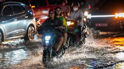
From early morning on September 25, the coastal areas of Quang Ninh to Ninh Binh will have winds gradually increasing to level 6-7, near the storm center level 8-9, gusting to level 11. This is the wind intensity capable of causing trees to fall and roofs to be blown off. The inland areas of the Northeast will have strong winds of level 5, in some places level 6, gusting to level 7-8.
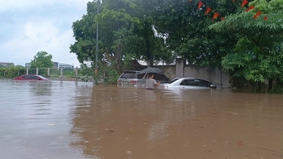
From the night of September 24 to the end of the night of September 26, the Northern region, Thanh Hoa and Nghe An will have heavy to very heavy rain with common rainfall of 100-250mm, in some places over 400mm.

Typhoon Ragasa caused devastation in the Philippines.
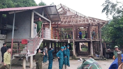
The National Steering Committee for Civil Defense noted that Ragasa storm did not cause too much rain, but the danger is that many reservoirs in the North are full of water due to the end of the season accumulation. Localities must be "on standby", monitor and operate reservoirs safely. Some large reservoirs such as Thac Ba, Son La, Hoa Binh, and Tuyen Quang are near normal water levels, with a high risk of flooding.
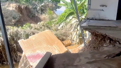
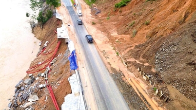
In addition, the coastal areas of Quang Ninh province have storm surges of 0.4-0.6m high. There is a high risk of landslides on sea dykes and embankments, destruction of aquaculture areas, ships and boats anchored along the coast due to strong winds, rising sea levels and big waves.
The National Center for Hydro-Meteorological Forecasting has specifically noted that the storm, when coming ashore, combined with cold air, will cause many dangerous thunderstorms on September 25-26, which cannot be accurately predicted. Therefore, it is absolutely necessary to ensure the safety of tourists and not let them stay on boats during bad weather.
Storm Ragasa formed from a tropical depression off the coast of the Philippines, strengthened into a storm on September 18, increasing in intensity by 9 levels in just 3 days, becoming the strongest super typhoon in the world to date with a maximum intensity of level 17, gusting to level 19-20.
Ragasa also surpasses the strength of storm Yagi operating in the East Sea in 2024. However, Ragasa's impact on our mainland is considered to be lighter than Yagi's due to its higher direction of movement and the impact of cold, dry air.
Tropical depression off the Philippines strengthens into a storm
Last night, the tropical depression off the coast of the Philippines intensified into a storm, becoming the 20th storm in the Northwest Pacific this year, with the international name Bualoi (the name given by Thailand, a Thai dessert). Storm Bualoi is forecast to enter the East Sea between September 26 and 27. On the morning of September 25, the National Center for Hydro-Meteorological Forecasting will issue the first news about this storm.
According to Tien Phong Newspaper
Source: https://baotuyenquang.com.vn/xa-hoi/202509/sieu-bao-ragasa-huong-ve-quang-ninh-hai-phong-rui-ro-thien-tai-cap-3-52167a1/

![[Photo] Bustling Mid-Autumn Festival at the Museum of Ethnology](https://vphoto.vietnam.vn/thumb/1200x675/vietnam/resource/IMAGE/2025/10/4/da8d5927734d4ca58e3eced14bc435a3)
![[Photo] General Secretary To Lam attends the 8th Congress of the Central Public Security Party Committee](https://vphoto.vietnam.vn/thumb/1200x675/vietnam/resource/IMAGE/2025/10/4/79fadf490f674dc483794f2d955f6045)


![[Photo] Solemn opening of the 8th Congress of the Central Public Security Party Committee, term 2025-2030](https://vphoto.vietnam.vn/thumb/1200x675/vietnam/resource/IMAGE/2025/10/4/f3b00fb779f44979809441a4dac5c7df)


![[VIDEO] Summary of Petrovietnam's 50th Anniversary Ceremony](https://vphoto.vietnam.vn/thumb/402x226/vietnam/resource/IMAGE/2025/10/4/abe133bdb8114793a16d4fe3e5bd0f12)

![[VIDEO] GENERAL SECRETARY TO LAM AWARDS PETROVIETNAM 8 GOLDEN WORDS: "PIONEER - EXCELLENT - SUSTAINABLE - GLOBAL"](https://vphoto.vietnam.vn/thumb/402x226/vietnam/resource/IMAGE/2025/7/23/c2fdb48863e846cfa9fb8e6ea9cf44e7)


Comment (0)