
Updated from the National Center for Hydro-Meteorological Forecasting, at 12 noon today, September 22, storm Ragasa was passing through the sea area between the Philippines and Taiwan, about 190km from the 120E meridian. It is forecasted that by 12 midnight on September 22, the storm will enter the northeastern sea area of the East Sea with maximum intensity.
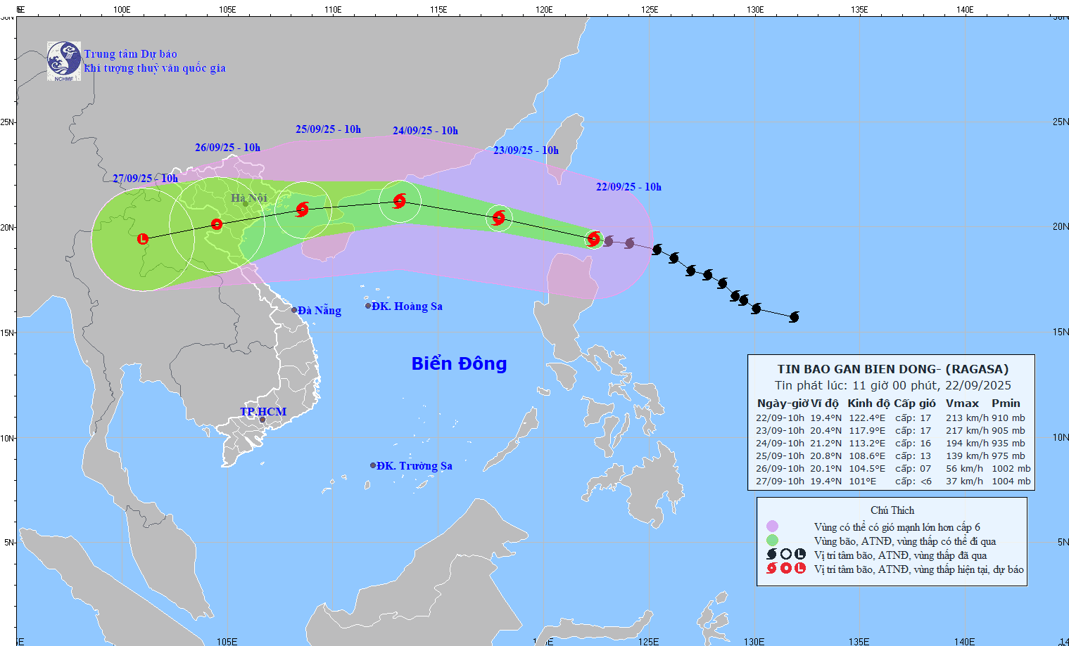
It is forecasted that in the next 24 hours, the super storm will move in the West-Northwest direction at a speed of 20-25km/hour and enter the East Sea.
At 10:00 a.m. on September 23, the center of the storm was at about 20.4 degrees north latitude; 117.9 degrees east longitude, in the northeastern sea area of the northern East Sea. The intensity is level 17, gusting above level 17.
The danger zone is the area north of latitude 18 degrees north and longitude 115.5 degrees east. The disaster risk level is level 4 for the northeastern sea area of the northern East Sea.
It is forecasted that in the next 48 hours, the super storm will continue to move west-northwest at a speed of 20-25km/hour.
At 10:00 a.m. on September 24, the center of the storm was at about 21.2 degrees north latitude; 113.2 degrees east longitude, in the northern sea area of the North East Sea, about 290km east of Leizhou Peninsula (China). The intensity is level 16, gusting above level 17.
The danger zone is the area north of latitude 18.5 degrees north and longitude 110.5 degrees east. The natural disaster risk level is level 4 for the sea area north of the northern East Sea.
.jpg)
Forecast in the next 72 hours , the super storm will move west-southwest at a speed of about 20km/hour and gradually weaken.
At 10:00 a.m. on September 25, the center of the storm was at about 20.8 degrees north latitude; 108.6 degrees east longitude, in the northern area of the Gulf of Tonkin. The storm intensity was level 13, gusting to level 16.
The danger zone is the area north of the 18th parallel north latitude and west of the 112th parallel east longitude. The disaster risk level is level 4 for the northwest sea area of the northern East Sea and the Gulf of Tonkin.
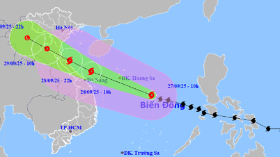
Forecast in the next 72 to 120 hours , the storm will move west-southwest, about 20km per hour, intensity will continue to weaken.
Regarding the impact of the storm at sea , the sea area north of the North East Sea will gradually increase to level 8 - 9, then increase to level 10 - 14, the area near the center of the super storm will have level 15 - 17, gusting above level 17. Waves will be over 10m high, the sea will be very rough.
From September 24, the wind in the Gulf of Tonkin will gradually increase to level 6 - 7, then increase to level 8 - 10, the area near the storm center will be level 11 - 13, gusting over level 16. Waves will be 5 - 7m high, the sea will be rough. Ships operating in the above-mentioned dangerous areas are likely to be affected by storms, whirlwinds, very strong winds and big waves.
Source: https://baonghean.vn/sieu-bao-ragasa-luc-12h-ngay-22-9-giat-tren-cap-17-sap-di-vao-bien-dong-10306892.html


![[Photo] Soldiers guard the fire and protect the forest](https://vphoto.vietnam.vn/thumb/1200x675/vietnam/resource/IMAGE/2025/9/27/7cab6a2afcf543558a98f4d87e9aaf95)


![[Photo] Prime Minister Pham Minh Chinh attends the 1st Hai Phong City Party Congress](https://vphoto.vietnam.vn/thumb/1200x675/vietnam/resource/IMAGE/2025/9/27/676f179ddf8c4b4c84b4cfc8f28a9550)


Comment (0)