
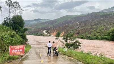
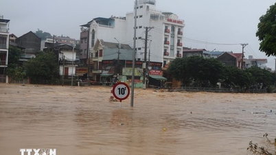
According to a quick report from the Department of Agriculture and Environment, the water level on the rivers at 1:00 a.m. on October 5: The water level on the Thai Binh River (at Pha Lai) was 4.22 m, 0.22 m above alert level 1; (at Cat Khe) was 3.79 m, 0.29 m above alert level 1; Kinh Thay River (at Ben Binh) was 3.22 m, 0.72 m above alert level 1.
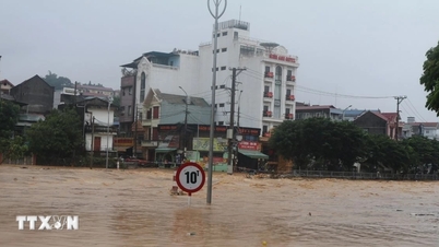
Due to the influence of storm No. 11, from October 5, the whole city will have showers and thunderstorms. During thunderstorms, beware of tornadoes, lightning, and strong gusts of wind. From the night of October 5 to the end of the night of October 7, there will be moderate rain, heavy rain, and locally very heavy rain. The common rainfall in the following areas: Bach Long Vi special zone, Cat Hai special zone - Lan Ha bay, Hon Dau island, Nam Do Son ward, Do Son ward, inland areas in the Northeast and Southeast (including forecast points: Thuy Nguyen, Le Chan, Hai An, Duong Kinh, An Duong, An Lao, Kien An, Tien Lang, Vinh Bao) with common rainfall of 70 - 120mm, locally over 150mm.
Inland areas in the Northwest and Southwest of the city (including forecast points: Hai Duong , Chi Linh, Thanh Ha, Kim Thanh, Ninh Giang, Thanh Mien, Cam Giang, Kinh Mon and Tu Ky) with common rainfall of 50 - 100mm, locally over 100mm
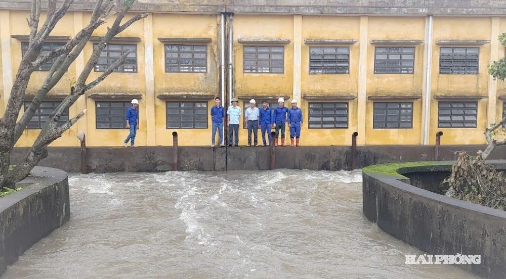
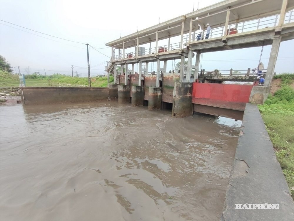
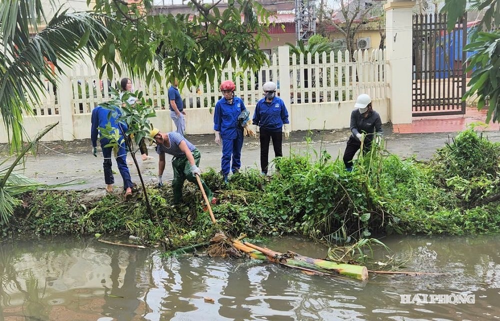
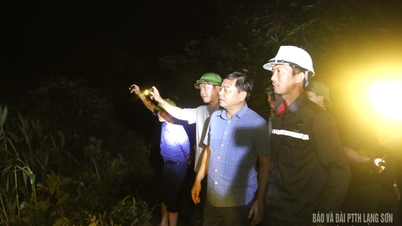
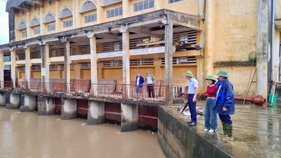
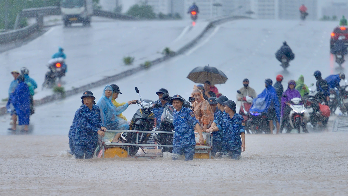
In order to proactively prevent rain, floods and storm No. 11, in recent days, localities in the city have proactively deployed early and remote prevention solutions. In the eastern localities of Hai Phong , irrigation works exploitation companies operate sluices under the dike to lower the buffer water level in the system; in the western localities, Hai Duong Irrigation Works Exploitation One Member Co., Ltd. proactively operates 25 pumping stations to lower the buffer water level in the canal system.
Currently, the city's dike system has 43 dike routes with a total length of 790.1 km, including 58.2 km of sea dikes; 127.9 km of river mouth dikes; 604 km of river dikes. The entire city has 75 key locations of dikes (13 key dike locations; 11 key embankments; 43 key culvert locations; 1 border gate; 7 landslides), of which 8 are at the city level (1 point in the west in Chi Minh commune; 7 points in the east in the wards: Viet Khe, Le Ich Moc, Thuy Nguyen).
In recent days, in localities, 160 specialized dike management forces have been mobilized at the Dike Management Districts to inspect, guide and urge localities to implement.
Dike patrol and guard work according to flood warning levels; coordinate with localities and irrigation companies to guide dike patrol and guard work for communes and wards to promptly detect damage incidents of dikes, embankments, and culverts to handle them promptly from the first hour according to the "four on-site" motto, ensuring absolute safety for the dike system in the city.
Source: https://baohaiphong.vn/tu-ngay-5-7-10-luong-mua-tren-dia-ban-thanh-pho-hai-phong-pho-bien-tu-70-120-mm-522640.html

![[Photo] Prime Minister Pham Minh Chinh chairs the 16th meeting of the National Steering Committee on combating illegal fishing.](https://vphoto.vietnam.vn/thumb/1200x675/vietnam/resource/IMAGE/2025/10/07/1759848378556_dsc-9253-jpg.webp)


![[Photo] Super harvest moon shines brightly on Mid-Autumn Festival night around the world](https://vphoto.vietnam.vn/thumb/1200x675/vietnam/resource/IMAGE/2025/10/07/1759816565798_1759814567021-jpg.webp)


Comment (0)