
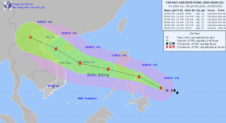
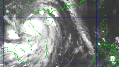
Forecast of location and direction of storm Bualoi - Photo: NCHMF
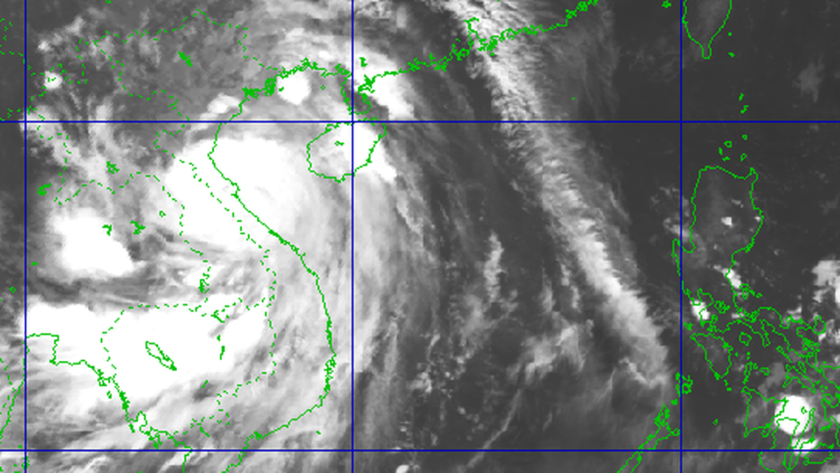
According to the National Center for Hydro-Meteorological Forecasting at 7:00 a.m. on September 25, the center of storm Bualoi was in the sea east of the Philippines.
The strongest wind near the storm center is level 12 (118-133km/h), gusting to level 15 - two levels higher than at 7:00 p.m. last night.
Forecast today and tomorrow, the storm will move west-northwest at a speed of about 20km/h, and its intensity is likely to increase.
By 7am tomorrow morning, the storm center will be on the east coast of the central Philippines, with storm intensity at level 13 (134-14km/h), gusting to level 16.
The storm is forecast to sweep across the Philippines tomorrow, and by tomorrow night, it will enter the East Sea and become the 10th storm of 2025.
At 7:00 a.m. on September 27, the storm's center was over the eastern sea area of the central East Sea, with a storm intensity of level 12, gusting to level 15.
The storm then moved rapidly west-northwest at a speed of about 25km/h, towards the Hoang Sa archipelago and is likely to strengthen.
At 7:00 a.m. on September 28, the storm center was in the sea south of Hoang Sa archipelago, the storm intensity was now level 12-13, gusting to level 16.
From the next 72 to 120 hours, the storm will continue to move rapidly in the west-northwest to northwest direction, towards the southern Gulf of Tonkin and then North Central Coast, and its intensity is likely to increase.
Due to the influence of storm Bualoi from the evening and night of September 26, the sea area east of the northern and central East Sea has strong winds of level 6-7, then increasing to level 8-9, the area near the storm's center has winds of level 10-12, gusts of level 15, waves over 5-7m high, rough seas, especially dangerous for ships operating in the northern and central East Sea.
Storm Ragasa weakens into a tropical depression in the next 6 hours
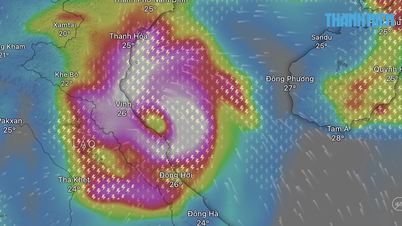
According to the National Center for Hydro-Meteorological Forecasting, at 7am this morning, the center of storm Ragasa was about 100km east of Mong Cai ( Quang Ninh ). The strongest wind was level 8 (62-74km/h), gusting to level 10 - down 4 levels compared to last night.
Forecast in the next 6 hours, the storm will move west at a speed of about 20km/h, and gradually weaken into a tropical depression.
At 1:00 p.m. this afternoon, the center of the tropical depression is on land in the Mong Cai area, Quang Ninh province. It will then move inland and weaken into a low pressure area in the Northeast region.
Due to the storm's influence, the northern area of Bac Bo Gulf (including Bach Long Vy, Van Don, Co To, Cat Hai and Hon Dau Island) has strong winds of level 6-7, near the storm center of level 8, gusts of level 10, waves 2-3m high, rough seas.
Coastal areas from Quang Ninh - Hai Phong have strong winds of level 6, some places level 7, gusting to level 8-9, deep inland areas in the Northeast have strong gusts of level 6-7.
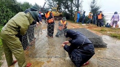
From this morning until the end of the night of September 26, in the Northern region, Thanh Hoa and Nghe An, there will be heavy to very heavy rain with common rainfall of 100-200mm, locally over 300mm. Beware of heavy rain causing urban flooding.
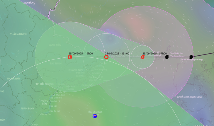
Forecast of the location and direction of storm Ragasa at 7:00 a.m. on September 25 - Photo: VNDMS
Source: https://tuoitre.vn/bao-bualoi-o-bien-dong-co-the-manh-cap-12-13-20250925085147852.htm
![[Photo] The 4th meeting of the Inter-Parliamentary Cooperation Committee between the National Assembly of Vietnam and the State Duma of Russia](https://vphoto.vietnam.vn/thumb/1200x675/vietnam/resource/IMAGE/2025/9/28/9f9e84a38675449aa9c08b391e153183)

![[Photo] High-ranking delegation of the Russian State Duma visits President Ho Chi Minh's Mausoleum](https://vphoto.vietnam.vn/thumb/1200x675/vietnam/resource/IMAGE/2025/9/28/c6dfd505d79b460a93752e48882e8f7e)
![[Photo] Joy on the new Phong Chau bridge](https://vphoto.vietnam.vn/thumb/1200x675/vietnam/resource/IMAGE/2025/9/28/b00322b29c8043fbb8b6844fdd6c78ea)


Comment (0)