
According to the National Center for Hydro-Meteorological Forecasting, storm Bualoi is in the central region of the Philippines with the strongest wind near the storm center at level 11 (103-117km/h), gusting to level 14. The storm is moving in the West-Northwest direction at a speed of 25-30km/h.
It is forecasted that around tonight (September 26), storm Bualoi will enter the eastern sea area of the central East Sea, becoming storm number 10 in 2025.
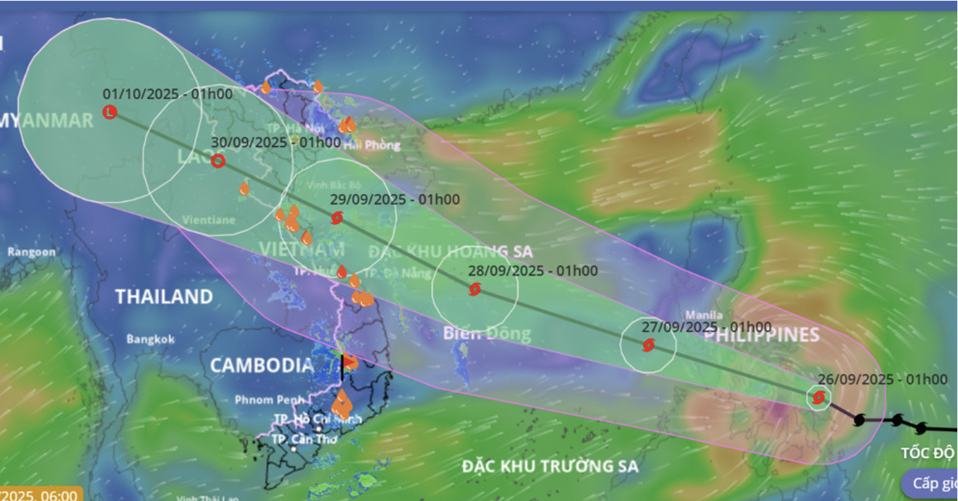
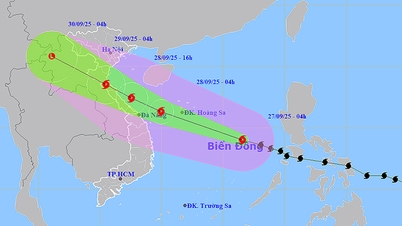
The movement of storm Bualoi updated on the morning of September 26. Source: VNDMS
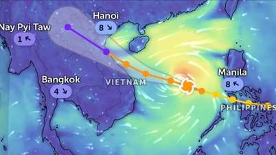
Experts said that storm Bualoi is moving steadily in the West-Northwest direction, at a speed of 25-30km/h. After entering the East Sea, the storm will move towards the Hoang Sa archipelago (September 28) and the sea areas of the Central provinces (September 29) with increasing intensity; it is likely to reach very strong storm level (level 12-13, gust level 16). It is forecasted that the storm may make landfall in the North Central provinces on September 29.
Specifically, at 1:00 a.m. on September 27, the storm was in the East Sea, located at about 13.8 degrees North latitude - 118.9 degrees East longitude, with winds of level 11, gusts of level 14 and likely to intensify. Disaster risk level: level 3 (Northeast and central East Sea).
1:00 a.m. on September 28, the storm was located at 15.8 degrees North latitude - 112.5 degrees East longitude, wind force level 12, gust level 15. Natural disaster risk level: level 3 (North and central East Sea, including Hoang Sa).
At 1:00 a.m. on September 29, the storm continued to strengthen, at 18.3 degrees North latitude - 107.4 degrees East longitude, wind force level 12-13, gust level 16. Natural disaster risk level: level 3 (Northwest and central East Sea, Hoang Sa, Southern Gulf of Tonkin, sea area from Quang Tri to Quang Ngai ).
From the next 72 to 120 hours, the storm continued to move rapidly in the West Northwest direction, traveling 20-25km per hour, gradually weakening in intensity.
Due to the influence of storm Bualoi, from this evening, the eastern sea area of the North and the middle of the East Sea will have strong winds of level 6-7, then increasing to level 8-9, the area near the storm's center will have winds of level 10-12, gusting to level 15, waves 5-7m high, and rough seas.
Vessels operating in the above mentioned dangerous areas are susceptible to the impact of storms, whirlwinds, strong winds and large waves.
Vietnamnet.vn
Source: https://vietnamnet.vn/bao-bualoi-di-chuyen-nhanh-ap-sat-bien-dong-du-bao-huong-vao-mien-trung-2445615.html


![[Photo] Prime Minister Pham Minh Chinh attends the groundbreaking ceremony of two key projects in Hai Phong city](https://vphoto.vietnam.vn/thumb/1200x675/vietnam/resource/IMAGE/2025/9/27/6adba56d5d94403093a074ac6496ec9d)


Comment (0)