
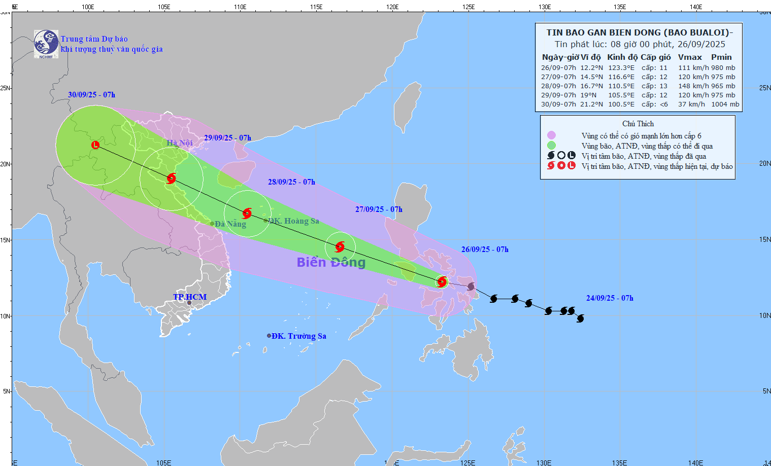
According to the National Center for Hydro-Meteorological Forecasting, at 7:00 a.m. on September 26, the center of the storm was at about 12.2°N - 123.3°E, in the central region of the Philippines. The strongest wind was level 11 (103 - 117 km/h), gusting to level 14. The storm moved in a West-Northwest direction at a speed of about 30 km/h.
Forecast, at about 7am on September 27, the storm will move in the West Northwest direction, speed 30-35 km/h, enter the East Sea, tending to strengthen. The storm is located at 14.5°N - 116.6°E, wind speed level 11-12, gust level 15. Danger zone 11.5-17.0°N; East longitude 114.0°E. Natural disaster risk level 3, affected areas are the Northeast and the middle of the East Sea.
At 7:00 a.m. on September 28, the storm moved in the West Northwest direction at a speed of 30 km/h, continuing to strengthen. The storm was located at 16.7°N – 110.5°E, wind speed level 13, gust level 16. Danger zone 12.0–20.0°N; East longitude 108.0°E. Disaster risk level 3, affected areas are the North and the middle of the East Sea, Hoang Sa, the sea area of South Quang Tri – Quang Ngai .
At around 7:00 a.m. on September 29, the storm moved in the West-Northwest direction at a speed of 25 km/h. The storm was located at 19.0°N – 105.5°E, with winds of level 12 and gusts of level 15. Danger zone 13.5–21.0°N; West longitude 113.5°E. Disaster risk level 3, affected areas are the Northwest and central East Sea, Hoang Sa, South Quang Tri – Quang Ngai, and South Bac Bo Gulf.
Warning: In the next 72-96 hours, the storm will continue to move rapidly in the West Northwest direction, at a speed of 25 km/hour. The intensity will gradually weaken.
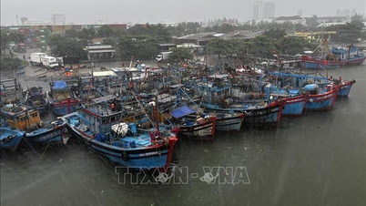
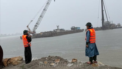
Due to the storm's influence, from the afternoon of September 26, the northeastern sea area and the central East Sea will have winds of level 6-7, then increasing to level 8-9. The area near the storm's center will have winds of level 10-12, gusting to level 15, waves 5-7 m high, and rough seas. Ships in the danger zone may be affected by thunderstorms, whirlwinds, strong winds, and large waves.
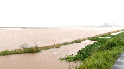
Meteorological experts added that on the night of September 25 and the morning of September 26, in the Northeast region, there will be rain, moderate rain, locally heavy rain to very heavy rain; the area from Ha Tinh to Da Nang , the Central Highlands and the South will have scattered showers and thunderstorms, locally heavy rain to very heavy rain. The rainfall from 7:00 p.m. on September 25 to 8:00 a.m. on September 26 was over 90 mm in some places, such as: Quat Dong (Quang Ninh) 217.4 mm, Huong Trach (Ha Tinh) 98.6 mm, Huong Hoa (Quang Tri) 143.4 mm, Quan Tuong Dai (Hue City) 186.2 mm.
It is forecasted that from the morning of September 26 to the morning of September 27, in the Northeast region, Southern Phu Tho and Thanh Hoa, there will be moderate rain, heavy rain and thunderstorms, and locally very heavy rain. Total rainfall is generally 30 - 70 mm. Locally, over 150 mm. Rainfall will mainly last from the morning of September 26 to the morning of September 27. Warning of heavy rain intensity greater than 100 mm/3 hours
In addition, on the day and night of September 26, the Northwest region, from Nghe An to Da Nang City, the Central Highlands and the South will have scattered showers and thunderstorms. The total rainfall is generally 20-40 mm. Some places will have over 100 mm. Warning of heavy rain intensity over 80 mm/3 hours. During thunderstorms, there is a possibility of tornadoes, lightning, hail and strong gusts of wind.
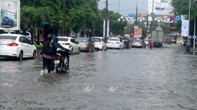
Warning for the day and night of September 28, the area from Thanh Hoa to Da Nang City is likely to have widespread heavy rain. Disaster risk level 1 (due to heavy rain, tornadoes, lightning, hail).
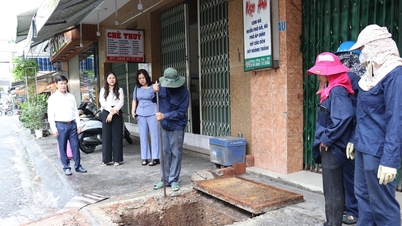
Heavy rain can cause: Flooding in low-lying areas, urban areas and industrial zones; Flash floods on small rivers and streams; Landslides on steep slopes...
Source: https://baotintuc.vn/xa-hoi/bao-bualoi-tiep-tuc-manh-them-khi-vao-bien-dong-mien-trung-mua-lon-20250926093339392.htm


![[Photo] Prime Minister Pham Minh Chinh attends the groundbreaking ceremony of two key projects in Hai Phong city](https://vphoto.vietnam.vn/thumb/1200x675/vietnam/resource/IMAGE/2025/9/27/6adba56d5d94403093a074ac6496ec9d)


Comment (0)