
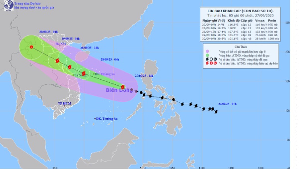
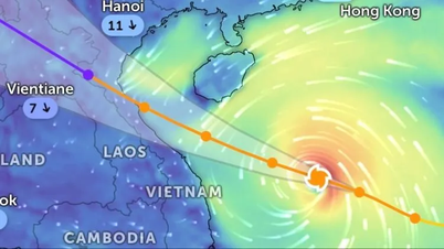
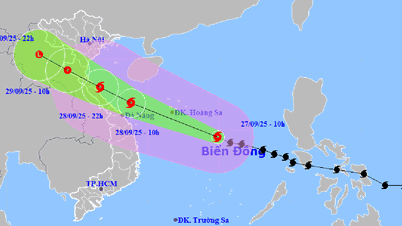
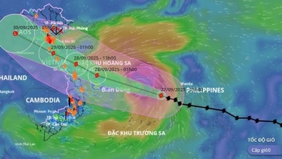
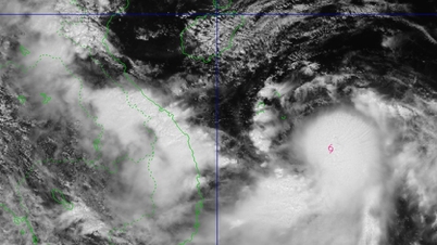
According to the National Center for Hydro-Meteorological Forecasting, at 4:00 a.m. on September 27, the center of the storm was at about 14.0 degrees North latitude; 116.6 degrees East longitude, about 580 km East Southeast of Hoang Sa special zone.
The strongest wind near the storm center is level 11-12 (103 - 133 km/h), gusting to level 15. Moving in the West Northwest direction at a speed of 35-40 km/h.
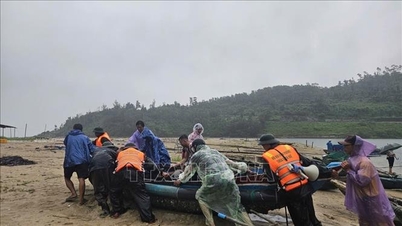
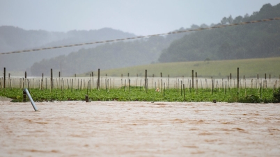
This is a very fast moving storm (nearly twice the average speed), with strong storm intensity and wide range of influence, which can cause combined impacts of many types of natural disasters such as strong winds, heavy rains, floods, flash floods, landslides and coastal flooding.
Forecast as of 4:00 a.m. on September 28, the storm center is at 16.3 degrees North latitude; 110.0 degrees East longitude, about 180 km east of Da Nang . Strong winds of level 12 - 13, gusts of level 16. The dangerous area in the East Sea is determined from 11.5 - 18.5 degrees North latitude and east of longitude 108.0 degrees East longitude. Natural disaster risk level is level 3.
The areas directly affected include the North and Central East Sea (including the Hoang Sa sea area) and the sea area from Ha Tinh to Quang Ngai.
At 4:00 p.m. the same day, the storm entered the sea area from Ha Tinh - Thua Thien Hue with sustained winds of level 12 - 13, gusting to level 16.
From the morning of September 29, the storm's eye is expected to make landfall from Nghe An to Northern Quang Tri, gradually weakening to level 8 - 9, gusting to level 11. After that, the storm will continue to move to Upper Laos and gradually dissipate.
Affected by the storm, the northern and central East Sea (including Hoang Sa special zone) has strong winds of level 8 - 9, the area near the storm's eye has winds of level 10 - 13, gusts of level 16, waves from 6.0 - 8.0 m high, the area near the storm's eye has waves of 8.0 - 10.0 m, and the sea is very rough.
From the evening of September 27, the sea area from Thanh Hoa to Quang Ngai (including Hon Ngu island, Con Co special zone and Ly Son) will have winds gradually increasing to level 6 - 7, gusting to level 8 - 9, waves 3.0 - 5.0 m high, and rough seas.
From early morning on September 28, the wind increased to level 8-9, the area near the storm center passed level 10-13, gusting to level 16, waves from 5.0-7.0m high, violent sea (extremely destructive, extremely strong waves. Sinking large tonnage ships).
Impact on Hai Phong:
From early morning on September 28, in the Northern Gulf of Tonkin (including Bach Long Vy special zone, Cat Hai special zone, Lan Ha Bay and Hon Dau island), the wind gradually increased to level 6 - 7, then increased to level 8 - 9 (very rough sea, very dangerous for boats), gusting to level 11, waves from 3.0 - 5.0 m high, very rough sea.
From noon on September 28, coastal waters of localities including Hai An, Dong Hai, Nam Trieu, Do Son, Nam Do Son, Duong Kinh, Chan Hung, Hung Thang, Kien Hai will have winds gradually increasing to level 6 - 7, gusting to level 8 - 9.
From the evening of September 28, inland communes/wards of Hai Phong city, winds will gradually increase to level 5-6, gusting to level 7-8.
From September 28 to September 30, Hai Phong is likely to experience widespread heavy rain.
The sea area of Bach Long Vy special economic zone, Cat Hai special economic zone - Lan Ha bay, the sea area of Hon Dau island, Nam Do Son ward, Do Son ward, with common rainfall from 100 - 200 mm, locally over 250 mm.
Localities including Thuy Nguyen, Le Chan, Hai An, Duong Kinh, An Duong, An Lao, Kien An, Tien Lang, Vinh Bao have common rainfall of 150 - 200 mm, locally over 200 mm.
Localities include: Hai Duong, Chi Linh, Thanh Ha, Kim Thanh, Ninh Giang, Thanh Mien, Cam Giang, Kinh Mon and Tu Ky with common rainfall of 100 - 150 mm, locally over 200 mm.
Due to the influence of the wide storm circulation, it is necessary to guard against the risk of thunderstorms, tornadoes and strong gusts of wind both before and during the storm's landfall.
PVSource: https://baohaiphong.vn/bao-so-10-bualoi-manh-len-tren-bien-dong-hai-phong-sap-co-mua-lon-tren-dien-rong-521893.html
![[Photo] Prime Minister Pham Minh Chinh attends the groundbreaking ceremony of two key projects in Hai Phong city](https://vphoto.vietnam.vn/thumb/1200x675/vietnam/resource/IMAGE/2025/9/27/6adba56d5d94403093a074ac6496ec9d)


Comment (0)