
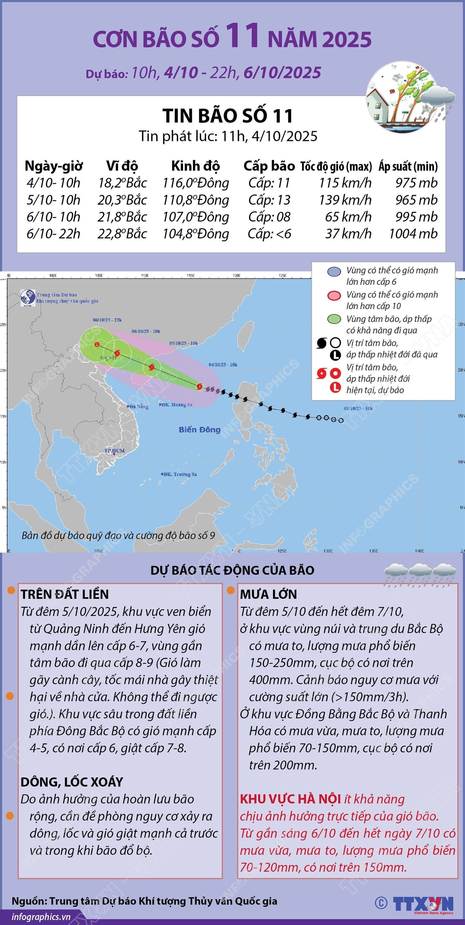
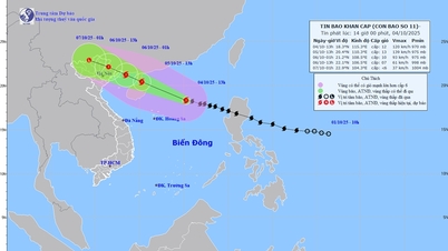
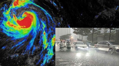
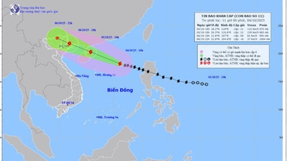
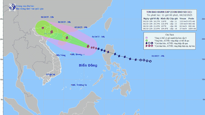
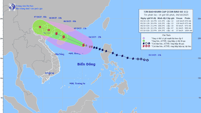
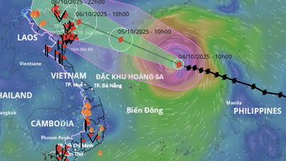
The storm moves in the West-Northwest direction at a speed of about 25km/h. Safety warning at sea and along the coast: The weather during the storm is extremely dangerous, unsafe for any vehicle or structure operating in the danger zone such as: cruise ships, passenger ships, transport ships, rafts, aquaculture areas, dykes, embankments, coastal routes. Vehicles are highly likely to capsize and be destroyed; coastal areas are at risk of flooding due to strong winds, big waves and rising sea levels. On land: From the night of October 5, 2025, coastal areas from Quang Ninh to Hung Yen will have winds gradually increasing to level 6-7, areas near the storm's center will have winds of level 8-9 (winds can break tree branches, blow off roofs, cause damage to houses and hinder movement). The inland areas of the Northeast will have strong winds of level 4-5, in some places level 6, gusting to level 7-8. Due to the influence of the wide storm circulation, it is necessary to guard against the risk of thunderstorms, tornadoes and strong gusts of wind both before and during the storm's landfall.
Source: https://baolamdong.vn/duong-di-cua-bao-so-11-nam-2025-394494.html
![[Photo] General Secretary To Lam attends the 8th Congress of the Central Public Security Party Committee](https://vphoto.vietnam.vn/thumb/1200x675/vietnam/resource/IMAGE/2025/10/4/79fadf490f674dc483794f2d955f6045)

![[Photo] Solemn opening of the 8th Congress of the Central Public Security Party Committee, term 2025-2030](https://vphoto.vietnam.vn/thumb/1200x675/vietnam/resource/IMAGE/2025/10/4/f3b00fb779f44979809441a4dac5c7df)
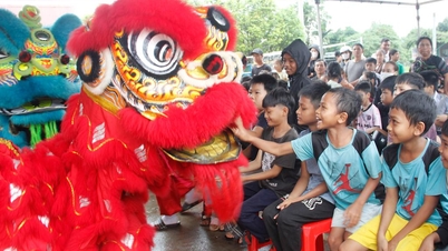
![[Photo] Bustling Mid-Autumn Festival at the Museum of Ethnology](https://vphoto.vietnam.vn/thumb/1200x675/vietnam/resource/IMAGE/2025/10/4/da8d5927734d4ca58e3eced14bc435a3)


![[VIDEO] Summary of Petrovietnam's 50th Anniversary Ceremony](https://vphoto.vietnam.vn/thumb/402x226/vietnam/resource/IMAGE/2025/10/4/abe133bdb8114793a16d4fe3e5bd0f12)
![[VIDEO] GENERAL SECRETARY TO LAM AWARDS PETROVIETNAM 8 GOLDEN WORDS: "PIONEER - EXCELLENT - SUSTAINABLE - GLOBAL"](https://vphoto.vietnam.vn/thumb/402x226/vietnam/resource/IMAGE/2025/7/23/c2fdb48863e846cfa9fb8e6ea9cf44e7)


Comment (0)