
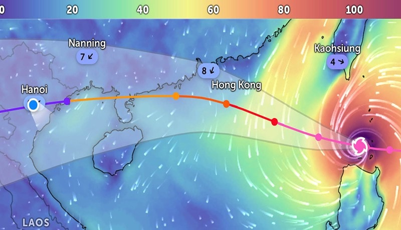
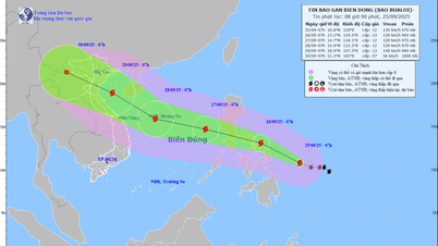
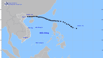
The strongest wind near the center of the super storm is level 17 (202-221km/h), gusting above level 17. Moving west-northwest at a speed of 20-25km/h.
Forecast (next 24–72 hours):
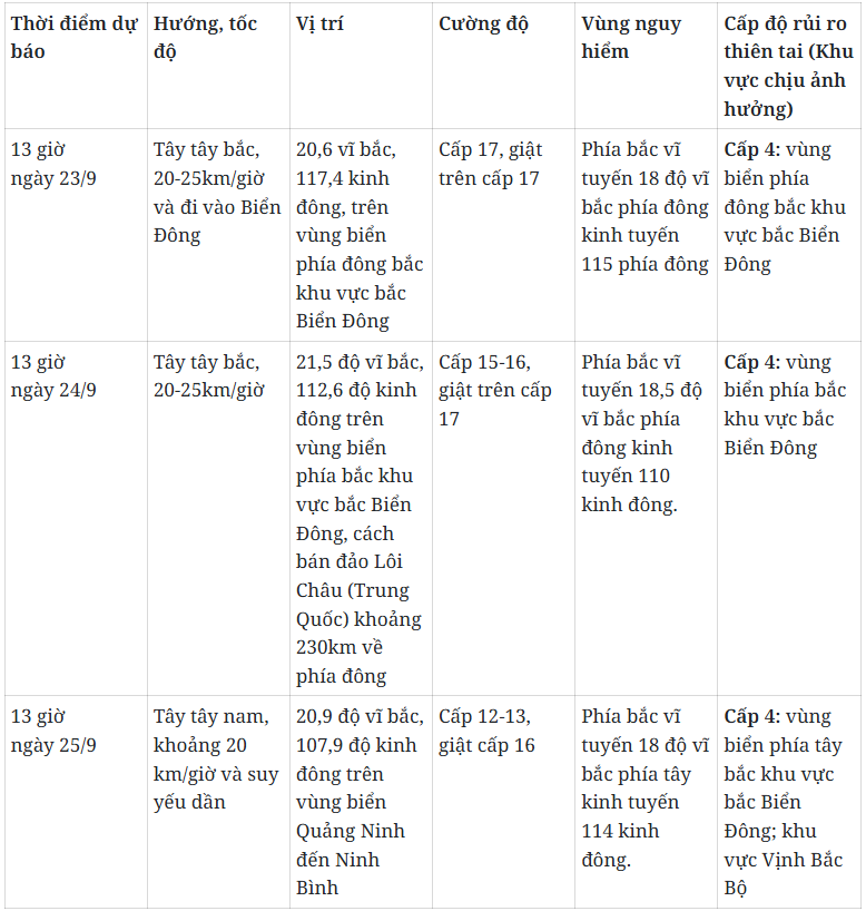
Storm warning for the next 72 to 120 hours, the storm will move west-southwest, about 20km per hour, and continue to weaken.
Forecasting the impact of super typhoons
At sea, in the northern sea area of the North East Sea, the wind gradually increases to level 8-9, then increases to level 10-14, near the center of the super storm, level 15-17, gusts above level 17, waves over 10m high, rough seas.
From September 24, the wind in the Gulf of Tonkin will gradually increase to level 6-7, then increase to level 8-10, the area near the storm center will have level 11-13, gusting to level 16, waves 5-7m high, and rough seas.
Ships operating in the above mentioned dangerous areas are likely to be affected by storms, whirlwinds, very strong winds and very large waves.
Source: https://baolamdong.vn/sieu-bao-ragasa-giat-tren-cap-17-ap-sat-bien-dong-392599.html


![[Photo] Prime Minister Pham Minh Chinh attends the groundbreaking ceremony of two key projects in Hai Phong city](https://vphoto.vietnam.vn/thumb/1200x675/vietnam/resource/IMAGE/2025/9/27/6adba56d5d94403093a074ac6496ec9d)


Comment (0)