
, Dong Thap province")
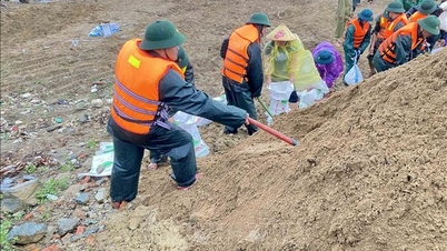
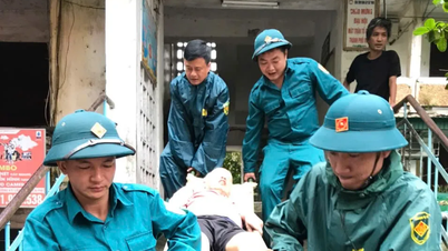
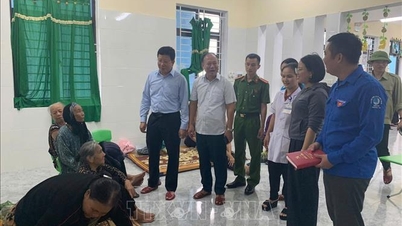
According to the People's Committee of Cao Lanh Ward, due to continuous heavy rain for many days combined with high tides and rising water levels, on September 15, a landslide occurred in the Ho Cu River area (Group 20). The landslide was about 20 meters long, about 8 meters deep inland, cutting off rural traffic and affecting 3 households.
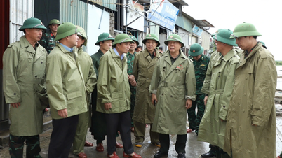
Cao Lanh Ward People's Committee urgently inspected the landslide site, put up danger signs, strictly prohibited traffic through this road section, and relocated 3 households to new safe places, mobilizing households in the area to open temporary passages for people to pass through the landslide while waiting for a plan and solution to fix the problem.
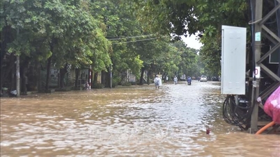
Previously, an open manhole cover on Cai Quyt canal (Phong Hoa commune, Dong Thap province) broke, causing water to overflow the dike, flooding about 9,000 square meters of land used for growing crops and fruit trees of local people...
 has been temporarily reinforced.")
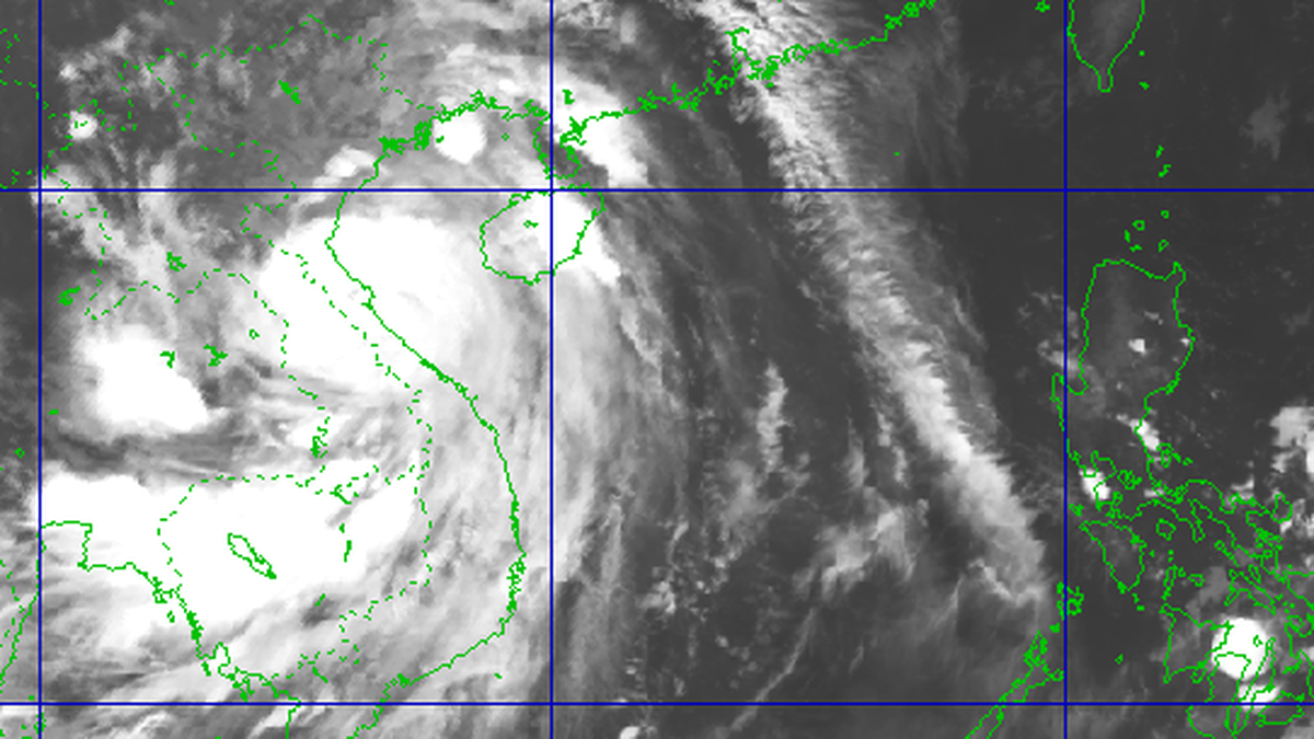
Recently, landslides have frequently occurred in riverside areas of Dong Thap province. Up to now, there have been 70 landslides recorded in the communes of My Duc Tay, An Huu, Thanh Hung, Binh Phu, Vinh Kim... with a total length of nearly 7.9km. Particularly in the Tien River embankment area in Thuong Phuoc commune, in August alone, there were 4 landslides about 350m long, causing damage to the embankment roof, embankment toe and encroaching on traffic roads...
Dong Thap Provincial People's Committee has declared an emergency situation, proposing more than 327 billion VND to handle landslides along a 2.8km length, of which 59 billion VND will be used to urgently repair the collapsed sections.
To promptly respond to heavy rains, storms, flooding, and riverbank landslides, the People's Committee of Dong Thap province requires the provincial authorities to proactively organize inspections, reviews, and implement measures to ensure the safety of key works, works under construction, works that have had incidents, and riverbank areas at risk of landslides. At the same time, arrange a standing force ready to handle emergency natural disaster situations; proactively drain water to protect production, ensure traffic, and meet the essential living needs of the people.

* In Tay Ninh, a landslide has just occurred on the North bank of Thu Doan canal (Binh Duc commune), causing the canal bank to collapse by more than 50m, about 3m wide and 1.5m deep, and there is a risk of further landslides. In Can Giuoc commune, the Han Canal river bank has collapsed (at the Xom Cau intersection), and the Can Giuoc river bank has collapsed (hamlet 4) with a length of hundreds of meters, affecting the lives and agricultural production of 10 households living in the area...
Faced with the above situation, the authorities of Tay Ninh province regularly monitor, supervise, put up warning signs and urgently evacuate households in dangerous areas. At the same time, they propagate to people not to build houses and solid structures close to the riverbank, to avoid the risk of damage when landslides occur.

According to Mr. Do Huu Phuong, Deputy Director of the Department of Agriculture and Environment of Tay Ninh province, the provincial authorities have reviewed and compiled a list of dangerous landslide sites to promptly delimit and develop a treatment plan. The People's Committee of Tay Ninh province has also proposed that the Central Government support investment capital for anti-landslide embankment projects in key areas to protect residents and essential infrastructure.
In addition, the functional sector of Tay Ninh province also implemented a plan to plant trees to protect river banks, strictly manage sand mining activities, apply remote sensing and monitoring technology to give early warning of landslide risks; integrate landslide prevention and control into new rural construction programs, urban development and climate change adaptation.
 has been completed.")
Since the beginning of 2025, Tay Ninh province has had 12 dangerous landslides and subsidence points with a total length of about 2,600m, the lost land area is about 26ha, directly affecting 302 households living along the river. Many rural traffic roads, production embankments and living areas have been damaged, disrupting people's lives. The landslide situation continues to threaten many inter-commune roads, canal systems, irrigation ditches and some concentrated production areas, causing fear for households living along the river.
In 2025, Long An Construction Investment Project Management Board will be the investor of 11 dredging projects on the Vam Co Tay River and embankment projects in many key areas such as: embankment to prevent erosion, prevent salinity, protect rivers, banks of the Vam Co Tay River, embankment of Nuoc Man canal; embankment to prevent erosion in Kien Tuong ward; project to handle erosion on the Can Giuoc river bank (Can Giuoc commune)... Of which, 3 projects have been 100% completed: embankment to protect the banks of the Vam Co Tay River; embankment of Nuoc Man canal and project to handle erosion on the Can Giuoc river bank. The remaining 8 projects are expected to be completed by December 2025.
Source: https://www.sggp.org.vn/tay-ninh-dong-thap-trien-khai-nhieu-giai-phap-khac-phuc-sat-lo-post813228.html
![[Photo] Joy on the new Phong Chau bridge](https://vphoto.vietnam.vn/thumb/1200x675/vietnam/resource/IMAGE/2025/9/28/b00322b29c8043fbb8b6844fdd6c78ea)
![[Photo] High-ranking delegation of the Russian State Duma visits President Ho Chi Minh's Mausoleum](https://vphoto.vietnam.vn/thumb/1200x675/vietnam/resource/IMAGE/2025/9/28/c6dfd505d79b460a93752e48882e8f7e)
![[Photo] The 4th meeting of the Inter-Parliamentary Cooperation Committee between the National Assembly of Vietnam and the State Duma of Russia](https://vphoto.vietnam.vn/thumb/1200x675/vietnam/resource/IMAGE/2025/9/28/9f9e84a38675449aa9c08b391e153183)


Comment (0)