
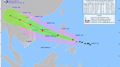
According to the latest JMA typhoon bulletin, Typhoon Yinxing is forecast to strengthen, possibly entering the East Sea to become typhoon number 7 in 2024.
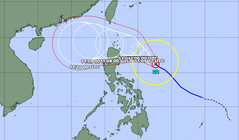
The Japan Meteorological Agency (JMA) informed that at 6:00 a.m. on November 5, the center of storm Yinxing was in the sea off the eastern coast of the Philippines, with the strongest wind near the center of the storm at level 11 (30 m/s), gusting to level 14 (45 m/s).
This meteorological agency forecasts that today, storm Yinxing will move quite quickly in a west-northwest direction, towards the sea northeast of Luzon Island (Philippines).
After passing the northern coast of Luzon Island, Typhoon Yinxing is likely to enter the East Sea around November 8.
If it enters the East Sea as forecasted above, storm Yinxing will become storm number 7 in 2024.
JMA forecasts that storm Yinxing will continue to strengthen in the coming days, with the strongest intensity reaching level 13 (40m/s), gusting to level 16 (55m/s).
The name of the typhoon Yinxing was proposed by China, meaning a type of tree.
East Sea Weather
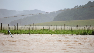
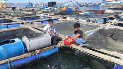
According to the National Center for Hydro-Meteorological Forecasting, currently, at Bach Long Vi station, there are strong northeast winds of level 6, gusting to level 7. The Gulf of Tonkin, the sea area from Quang Tri to Ninh Thuan , Ca Mau to Kien Giang and the Gulf of Thailand have scattered showers and thunderstorms.
Forecast for the next 24 hours:
| Forecast time | Affected sea areas | Strong winds | Wave height | ||
|---|---|---|---|---|---|
| Day and night 5/11 | Wind level (Bophorus level) | Direction | Height (meters) | Direction | |
| North East Sea area (including the waters of Hoang Sa archipelago) | Level 6-7, gust level 8-9. Rough sea. | Northeast | 3-5 | Northeast | |
| Gulf of Tonkin | Level 6, gust level 7-8. Rough sea. | Northeast | 2-3 | Northeast | |
| Quang Tri to Ninh Thuan | Level 5, sometimes level 6, gusts level 7-8. Rough sea. | North to Northeast | 2-4 | Northeast |
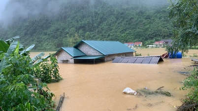
In addition, on the day and night of November 5, the Gulf of Tonkin, the Central and Southern East Sea; the sea area from Quang Tri to Ca Mau, Ca Mau to Kien Giang and the Gulf of Thailand will have scattered showers and thunderstorms. During thunderstorms, there is a possibility of tornadoes and strong gusts of wind of level 7-8.
Meteorological agency warns:
Day and night of November 6: Strong Northeast wind in the Gulf of Tonkin at level 5, sometimes level 6, gusting to level 7; rough sea; waves 1.5-2.5m high.
In the North East Sea area (including the waters of Hoang Sa archipelago), strong northeast wind level 6-7, gusting to level 8-9; rough seas; waves 3-6m high.
From Quang Tri to Ninh Thuan, strong northeast wind level 6, gusting to level 7-8; rough sea; waves 2-4m high.
From Binh Thuan to Ca Mau, strong northeast wind level 5, sometimes level 6, gusting to level 7-8; rough sea; waves 1-2m high.
All vessels operating in the above areas are at high risk of being affected by cyclones, strong winds and large waves.
Source: https://vietnamnet.vn/tin-bao-yinxing-moi-nhat-jma-du-bao-bao-vao-bien-dong-2338759.html

![[Photo] General Secretary To Lam, Secretary of the Central Military Commission attends the 12th Party Congress of the Army](https://vphoto.vietnam.vn/thumb/1200x675/vietnam/resource/IMAGE/2025/9/30/9b63aaa37ddb472ead84e3870a8ae825)
![[Photo] Panorama of the cable-stayed bridge, the final bottleneck of the Ben Luc-Long Thanh expressway](https://vphoto.vietnam.vn/thumb/1200x675/vietnam/resource/IMAGE/2025/9/30/391fdf21025541d6b2f092e49a17243f)
![[Photo] President Luong Cuong receives President of the Cuban National Assembly Esteban Lazo Hernandez](https://vphoto.vietnam.vn/thumb/1200x675/vietnam/resource/IMAGE/2025/9/30/4d38932911c24f6ea1936252bd5427fa)
![[Photo] Solemn opening of the 12th Military Party Congress for the 2025-2030 term](https://vphoto.vietnam.vn/thumb/1200x675/vietnam/resource/IMAGE/2025/9/30/2cd383b3130d41a1a4b5ace0d5eb989d)
![[Photo] The 1st Congress of Phu Tho Provincial Party Committee, term 2025-2030](https://vphoto.vietnam.vn/thumb/1200x675/vietnam/resource/IMAGE/2025/9/30/1507da06216649bba8a1ce6251816820)


Comment (0)