
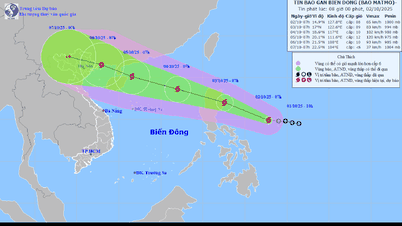
At 7am this morning, The storm center is in the sea east of the Philippines with the strongest wind near the storm center at level 8 (62-74km/h), gusting to level 10.
The most likely scenario now is that the storm will move steadily in a west-northwest direction, operating in the North East Sea, then moving towards Hainan Island and Leizhou Peninsula (China), entering the Gulf of Tonkin.
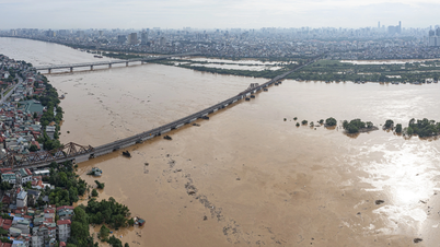
With this scenario, the storm could make landfall directly in the North of our country or the Vietnam-China border area, causing heavy rain and strong winds in the North.
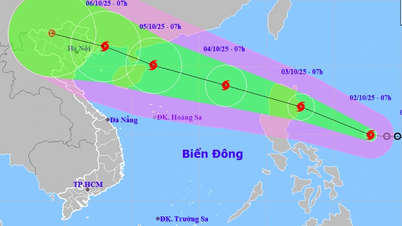
Specifically, on October 2-3, the storm moved rapidly in a west-northwest direction, traveling about 20-25km per hour and continued to strengthen. Around the night of October 3, the storm entered the East Sea. At 7:00 a.m. on October 4, the storm center was in the North East Sea with a strong intensity of level 10, gusting to level 12.

Storm No. 11 is likely to directly affect the North of our country.
It is forecasted that after entering the East Sea, the storm will continue to move west-northwest at a fairly fast speed of about 25 km/h and may strengthen further.
At 7:00 a.m. on October 5, the storm was only 70km northeast of Hainan Island (China) with the intensity of a very strong storm, level 12, gusting to level 15.
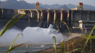
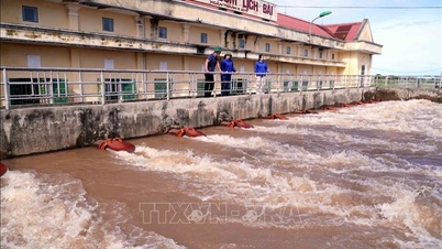
Around the night of October 5, the storm was active in the Gulf of Tonkin and on the morning of October 6, it made landfall in the Vietnam-China border area, directly affecting the North of our country. The meteorological agency said that from October 6-8, the North is likely to experience widespread heavy rain.
The East Sea is experiencing an unusually heavy storm season. Since the beginning of the year, the East Sea has recorded 10 storms, 4 tropical depressions and is about to have 11 more storms, a number much higher than the average of many years.
In the last 5 years, the number of storms up to the end of September is usually 4-6, the most is only 6. However, this year up to the end of September, the East Sea recorded 10 storms and 4 tropical depressions, in September alone there were 4 storms including Ragasa, Mitag, Tapah, Bualoi, higher than the average of many years by 4-5 storms.
According to Tien Phong Newspaper
Source: https://baotuyenquang.com.vn/xa-hoi/202510/bao-so-11-co-kha-nang-vao-mien-bac-b032616/


Comment (0)