

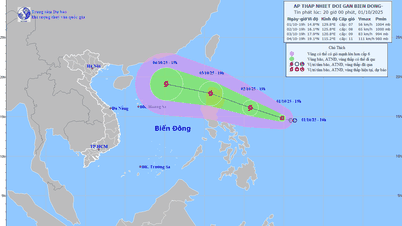
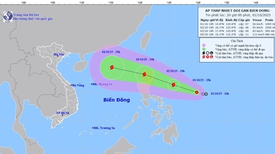
Satellite image of storm No. 5 at 3:00 p.m. on August 24 (Photo: NCHMF)
Mr. Hoang Phuc Lam, Deputy Director of the National Center for Hydro-Meteorological Forecasting, said so when informing about the developments of storm No. 5 on the afternoon of August 24.
According to Mr. Lam, at 3:00 p.m. this afternoon, the center of storm No. 5 was about 460km east-southeast of Ha Tinh and about 400km east of northern Quang Tri.
The strongest wind near the center of storm No. 5 is level 13-14 (134-166km/h), gusting to level 17 - up 2 levels compared to early this morning - and up 7 levels since yesterday morning.
"It is forecasted that this evening and tonight, the storm will move in a West-Northwest direction at a speed of about 20km/h and may strengthen.
Some intensity forecasts suggest the storm could reach level 15, but this is unlikely.
Around noon to tomorrow afternoon, the storm's eye is likely to make landfall in the provinces from Thanh Hoa to northern Quang Tri, focusing on Nghe An, Ha Tinh and the old Quang Binh " - Mr. Lam informed.
Regarding the impact of the storm, Mr. Lam said that the storm cloud circulation No. 5 is large, covering many provinces, so from this afternoon, the cloud edge northwest of the storm center will start causing rain in the Northern Delta, including the capital Hanoi .
From this afternoon, the sea area from Thanh Hoa to Hue (including Hon Ngu island, Con Co special zone) will have winds gradually increasing to level 7-9, then increasing to level 10-11, near the storm center level 12-14, gusting to level 16, waves 5-7m high, near the center 8-10m, rough seas.
From tonight, on land from Thanh Hoa to Quang Tri, winds will gradually increase to level 8-10, near the storm center level 11-13, gusting to level 14-15. Coastal areas from Quang Ninh to Ninh Binh will gradually increase to level 6-8, gusting to level 9.
Coastal areas and islands from Hai Phong - Northern Quang Tri have storm surges from 0.5-1.5m high.
"Storm No. 5 is a very strong storm, the intensity of the storm when it impacts can be equivalent to Storm No. 3 Yagi in 2024 and stronger than Storm No. 10 (Doksuri) in 2017.
When the storm approaches the shore, its intensity is likely to reach level 13-14, reaching level 16, coastal mainland areas will have strong winds of level 12-13, possibly even level 14, gusting to level 16" - Mr. Lam emphasized.

Mr. Hoang Phuc Lam, Deputy Director of the National Center for Hydro-Meteorological Forecasting, information on the afternoon of August 24 (Photo: C.TUỆ)
Also due to the storm's influence, from this afternoon until the end of August 26, in the midlands and deltas of the North, Lao Cai area and from Thanh Hoa to Hue, there will be widespread heavy rain with common rainfall of 100-150mm, locally over 250mm.
In particular, the area from Thanh Hoa to Northern Quang Tri has heavy to very heavy rain with common rainfall of 200-400mm, locally over 700mm.
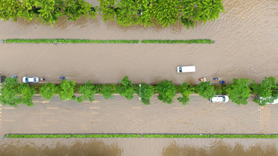
Mr. Lam emphasized that especially heavy rain from Thanh Hoa to Quang Tri has the potential to cause widespread flooding.
It is forecasted that during this storm, in Thanh Hoa, the Buoi River will rise to alert level 2, the upstream of the Ma River will rise to alert level 1 - alert 2, and the downstream of the Ma River will rise above alert level 1.
- Nghe An: the upstream of Ca River is at alert level 2 - alert level 3 and above alert level 3, the downstream of Ca River is at alert level 2 - alert level 3.
- Ha Tinh: Ngan Sau and Ngan Pho rivers rose to alert level 2 - alert level 3 and above alert level 3, La river rose to alert level 2 - alert level 3.
- Quang Tri: Gianh River, Kien Giang River, Thach Han River reached alert level 2 - alert level 3 and above alert level 3.
- Hue City: Bo River and Huong River reached alert level 1 - alert level 2.
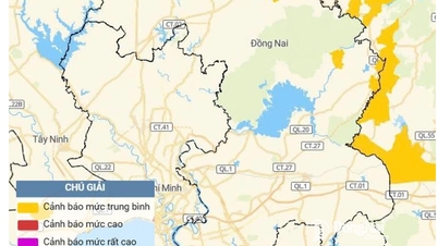
Warning of the risk of flash floods and landslides in the provinces of the midlands and deltas of the North, the Central region, focusing on Thanh Hoa - Hue./.
According to Tuoi Tre Newspaper
Source: https://tuoitre.vn/bao-so-5-manh-len-dau-cap-14-giat-cap-17-khi-do-bo-gio-co-the-tuong-duong-yagi-20250824154122096.htm
Source: https://baolongan.vn/bao-so-5-manh-len-dau-cap-14-giat-cap-17-khi-do-bo-gio-co-the-tuong-duong-yagi-a201283.html
![[Photo] Keep your warehouse safe in all situations](https://vphoto.vietnam.vn/thumb/1200x675/vietnam/resource/IMAGE/2025/10/1/3eb4eceafe68497989865e7faa4e4d0e)


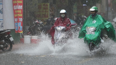
![[Photo] Hanoi morning of October 1: Prolonged flooding, people wade to work](https://vphoto.vietnam.vn/thumb/1200x675/vietnam/resource/IMAGE/2025/10/1/189be28938e3493fa26b2938efa2059e)
![[Photo] President of the Cuban National Assembly visits President Ho Chi Minh's Mausoleum](https://vphoto.vietnam.vn/thumb/1200x675/vietnam/resource/IMAGE/2025/10/1/39f1142310fc4dae9e3de4fcc9ac2ed0)


Comment (0)