
According to the latest storm news, while storm No. 8 (Toraji) is forecast to gradually weaken in the East Sea, two storms, Usagi and Man-yi, are active one after another.
According to the National Center for Hydro-Meteorological Forecasting, at 7:00 a.m. on November 13, the center of storm No. 8 was at about 20.3 degrees North latitude; 116.4 degrees East longitude, in the northeastern sea area of the North East Sea.
The strongest wind near the storm center is level 8-9 (62-88km/h), gusting to level 11. Moving in the West Northwest direction, speed 10-15km/h.
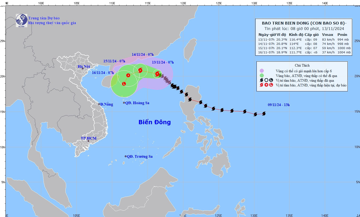
Forecast of storm No. 8 in the next 24 - 72 hours:
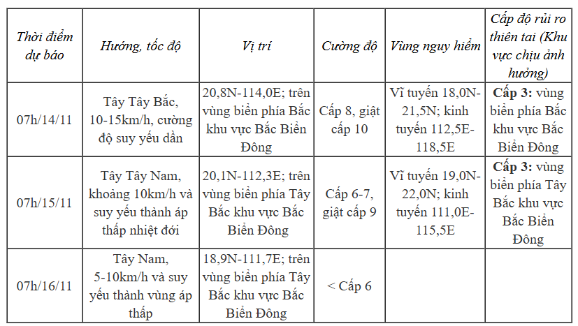
The meteorological agency forecasts that the storm will cause strong winds and large waves at sea: The northern sea area of the North East Sea will have strong winds of level 6-7, near the eye of the storm will have winds of level 8-9, gusts of level 11, waves 3-5m high, near the eye of the storm 5-7m; very rough seas.
Vessels operating in the above mentioned dangerous areas are susceptible to the impact of storms, whirlwinds, strong winds and large waves.
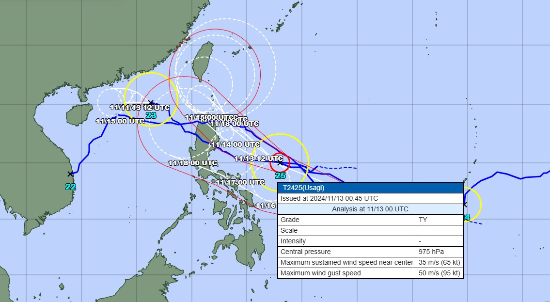
In addition, according to the latest storm bulletin from the Japan Meteorological Agency (JMA), two storms, Usagi and Man-yi, are expected to impact the Philippines and possibly enter the East Sea.

Source: https://vietnamnet.vn/bao-so-8-suy-yeu-hai-bao-usagi-va-man-yi-noi-duoi-nhau-gay-tinh-hinh-phuc-tap-2341435.html

![[Photo] Binh Trieu 1 Bridge has been completed, raised by 1.1m, and will open to traffic at the end of November.](https://vphoto.vietnam.vn/thumb/1200x675/vietnam/resource/IMAGE/2025/10/2/a6549e2a3b5848a1ba76a1ded6141fae)


Comment (0)