
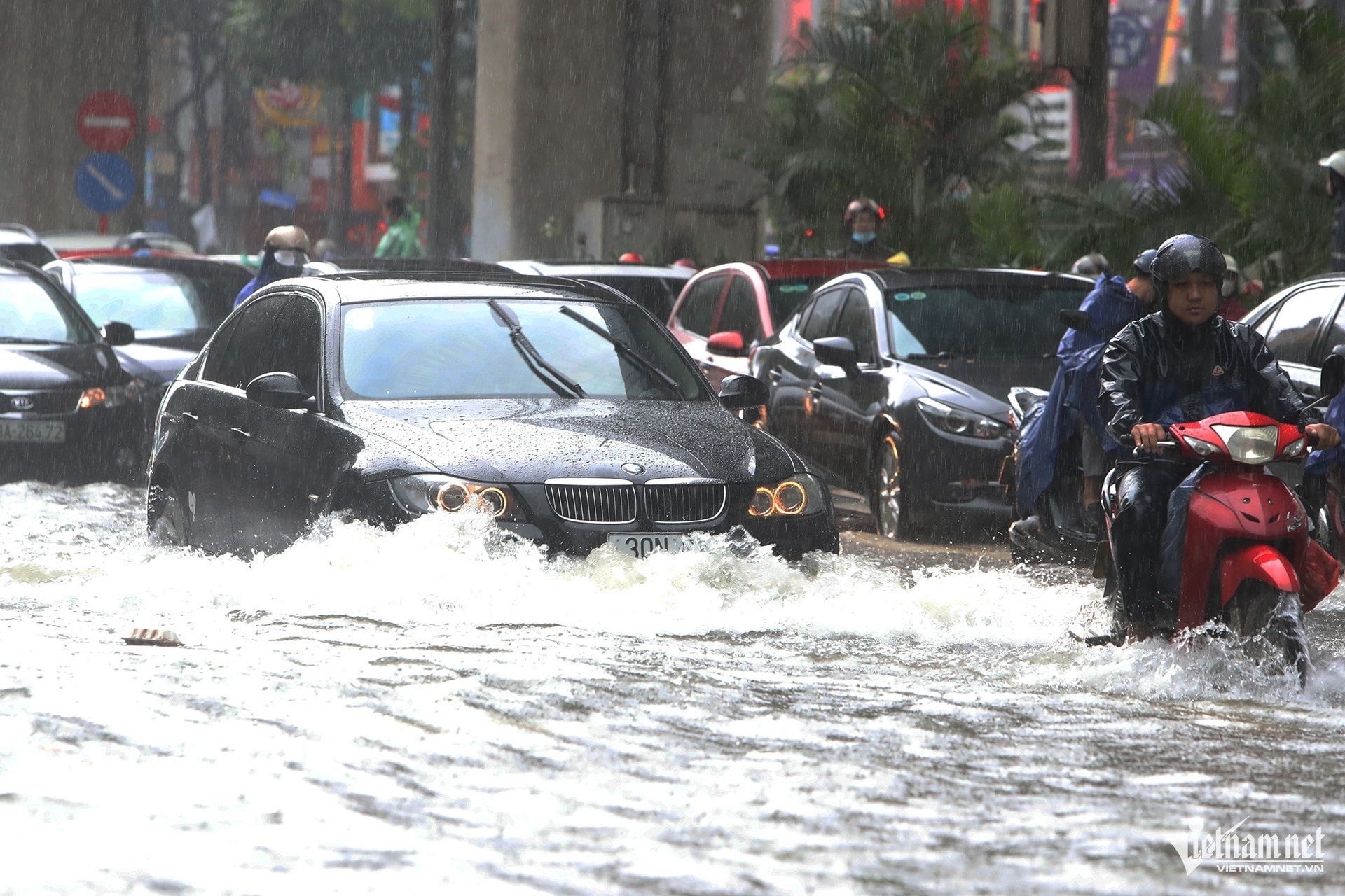
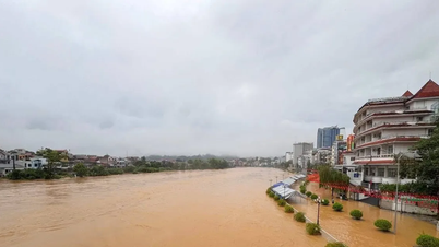
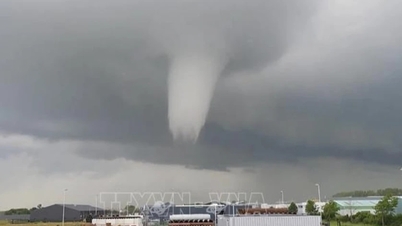
According to the National Center for Hydro-Meteorological Forecasting, due to the influence of the post-storm circulation No. 7 Tapah (which has dissipated), many places in the North have heavy rain, with a high risk of flash floods and landslides.
Specifically, from the evening of September 9 to the night of September 10, the mountainous and midland areas of the North will have moderate rain, heavy rain and scattered thunderstorms, with common rainfall of 50-100mm, locally over 200mm. Risk of heavy rain >100mm/3 hours.
In addition, in the late afternoon and evening of September 9, the Central Highlands and the South will have scattered showers and thunderstorms, with rainfall of 10-30mm, locally over 60mm.
In the evening and night of September 9, other places in the North will have showers and thunderstorms, with rainfall of 15-30mm, locally over 70mm.
Thanh Hoa and Nghe An have scattered showers and thunderstorms, rainfall 10-30mm, locally over 70mm. Risk of heavy rain >60mm/3h.
The meteorological agency said that from September 11, heavy rain in the mountainous and midland areas of the North will gradually decrease.
In addition, the Northern Hydrometeorological Station forecasts that due to the influence of the tropical convergence zone, combined with high-altitude wind convergence, from the evening of September 9 to September 10, Hanoi will have showers and thunderstorms, with some places experiencing heavy rain with whirlwinds, lightning and strong gusts of wind; the weather will be cool, with the highest temperature commonly ranging from 29 to 31 degrees Celsius; lasting until September 12.
The meteorological agency warned that the above areas during thunderstorms are likely to experience tornadoes, lightning, hail and strong gusts of wind. Localized heavy rains are likely to cause flash floods on small rivers and streams, landslides on steep slopes and flooding in low-lying areas.
PV (synthesis)Source: https://baohaiphong.vn/ngay-mai-mien-bac-mua-lon-xoi-xa-o-vung-nui-va-trung-du-520375.html
![[Photo] Solemn opening of the 12th Military Party Congress for the 2025-2030 term](https://vphoto.vietnam.vn/thumb/1200x675/vietnam/resource/IMAGE/2025/9/30/2cd383b3130d41a1a4b5ace0d5eb989d)
![[Photo] Panorama of the cable-stayed bridge, the final bottleneck of the Ben Luc-Long Thanh expressway](https://vphoto.vietnam.vn/thumb/1200x675/vietnam/resource/IMAGE/2025/9/30/391fdf21025541d6b2f092e49a17243f)
![[Photo] President Luong Cuong receives President of the Cuban National Assembly Esteban Lazo Hernandez](https://vphoto.vietnam.vn/thumb/1200x675/vietnam/resource/IMAGE/2025/9/30/4d38932911c24f6ea1936252bd5427fa)

![[Photo] The 1st Congress of Phu Tho Provincial Party Committee, term 2025-2030](https://vphoto.vietnam.vn/thumb/1200x675/vietnam/resource/IMAGE/2025/9/30/1507da06216649bba8a1ce6251816820)
![[Photo] General Secretary To Lam, Secretary of the Central Military Commission attends the 12th Party Congress of the Army](https://vphoto.vietnam.vn/thumb/1200x675/vietnam/resource/IMAGE/2025/9/30/9b63aaa37ddb472ead84e3870a8ae825)


Comment (0)