
Speed up project progress
Nui Thanh district is prioritizing the effective use of resources, focusing on resolving site clearance problems, speeding up the implementation of key projects such as Quang Trung road, Tam Giang bridge, Tam Tien bridge and access roads...
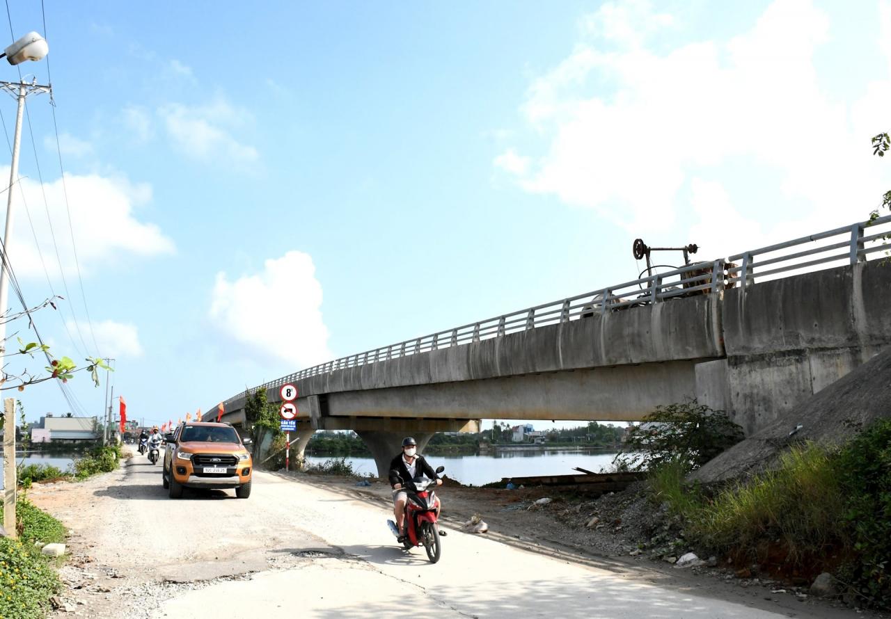
Mr. Nguyen Quang Thanh - Director of Nui Thanh District Project Management Board said that the Tam Giang Bridge project was approved by the People's Committee of Nui Thanh District with a total investment of more than 151 billion VND, the bridge length is 210.5m including 4 pillars, 2 abutments, 5 spans and the approach roads at both ends of the bridge are 469.5m long.
The project was invested with the goal of completing the infrastructure, meeting the requirements of socio -economic development. The project started in April 2017 with the form of both construction and site clearance. Due to many difficulties in site clearance, the construction implementation process was interrupted.
Up to now, the bridge project has been basically completed, only the bridge surface and lighting installation remain. The 100m long approach road towards Nui Thanh town has completed the weak soil treatment and is being unloaded to construct the roadbed.
The 369m long approach road section towards Tam Giang commune has been treated for weak soil, is being unloaded and is implementing the construction of the approach roadbed. Through many efforts, the Tam Giang bridge project has completed site clearance and handed over the clean site to the construction contractor from November 2024.
"The contractor has mobilized machinery and equipment, speeding up construction, and is expected to complete, hand over, and put into use this year," said Mr. Thanh.
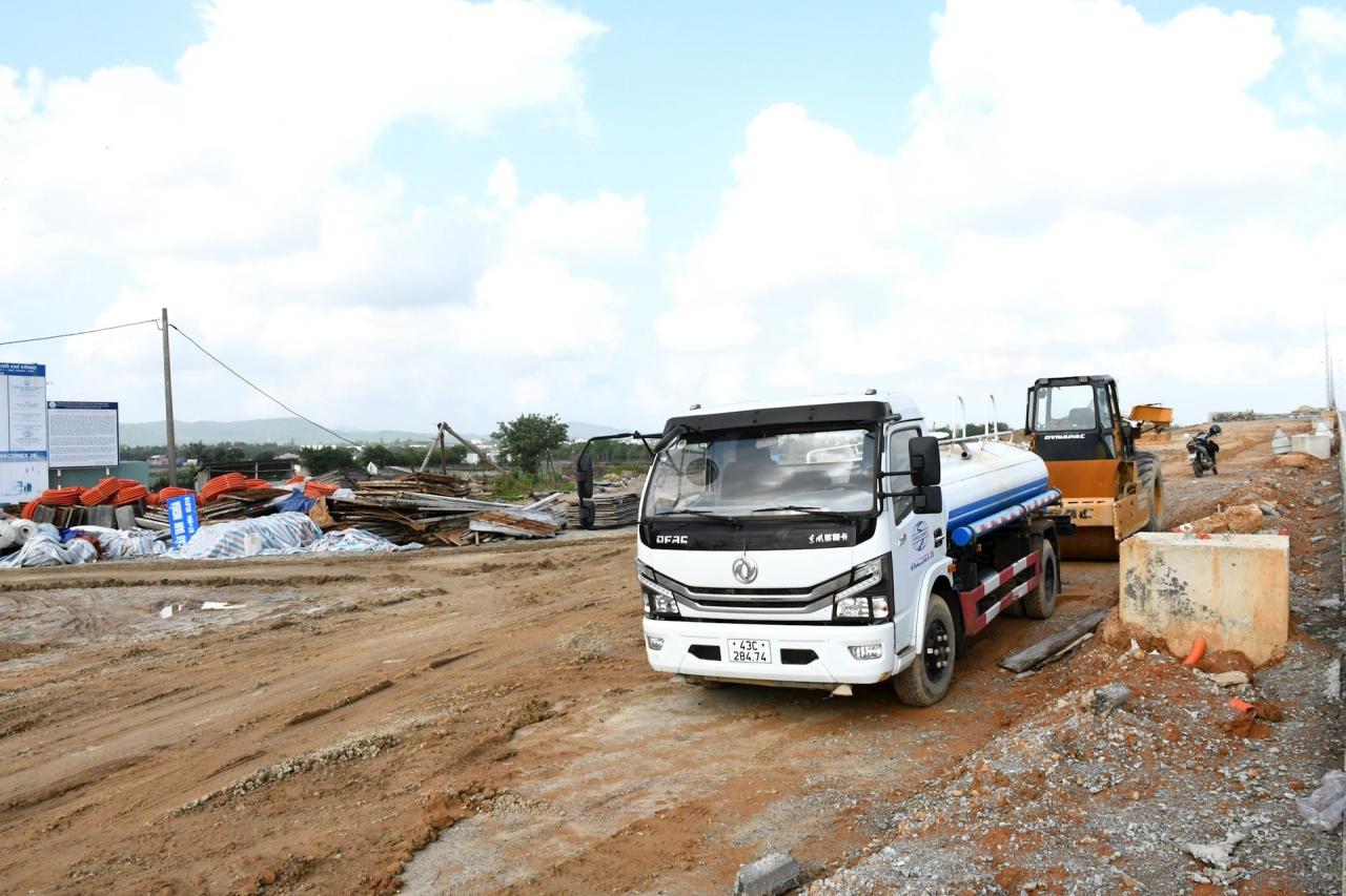
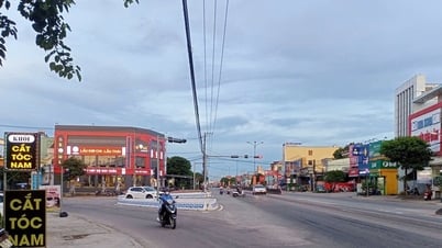
Quang Trung Road project is located in the center of Nui Thanh town with a length of 743.48m, starting point is Tam Giang bridge, ending point is intersection with National Highway 1.
The project was approved by the People's Committee of Nui Thanh district for construction drawings and estimates on July 21, 2016 with an estimated value of more than 68.7 billion VND. Up to now, the contractor is constructing but is stuck with site clearance. According to Mr. Nguyen Quang Thanh, the project site clearance is expected to be completed in the second quarter of 2025 and construction will be accelerated to be completed in 2025.
The Tam Tien Bridge and approach road project was approved by the Provincial People's Committee on May 30, 2019 with a total investment of VND 220 billion and a total length of 4.18km.
The project started in December 2020, while site clearance encountered many difficulties, so the construction process lasted for many years. According to the Nui Thanh District Project Management Board, the project site clearance is expected to be completed in the first quarter of 2025, and the project construction will be completed in 2025.
Deploying breakthrough tasks
According to Mr. Nguyen Tri An - Secretary of Nui Thanh District Party Committee, implementing Conclusion No. 29, dated May 4, 2021 of the Provincial Party Committee on implementing breakthrough tasks, Nui Thanh district focuses on building a synchronous infrastructure system and urban development. Infrastructure is strongly invested by the locality from the central, provincial, and district budgets...
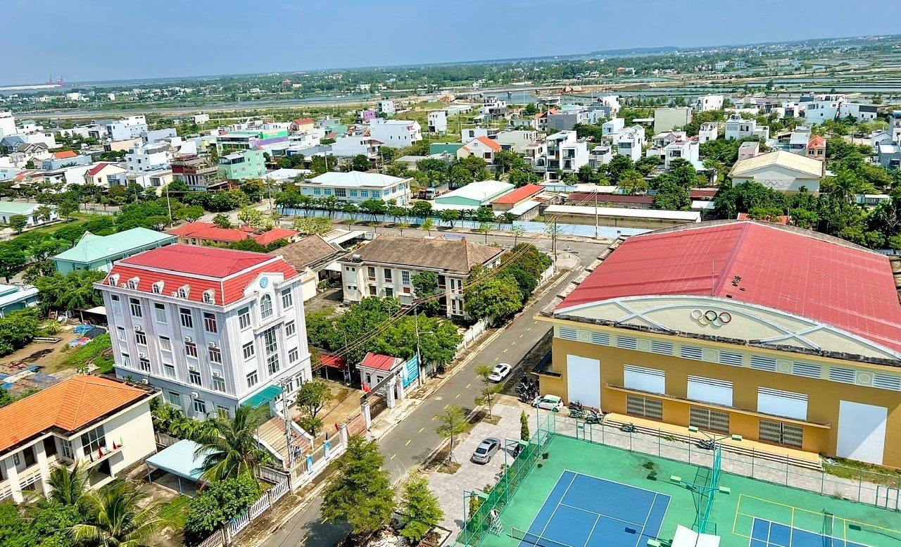
The Nui Thanh traffic system is quite synchronously developed, including expressways, national highway 1, Vo Chi Cong street, Ky Ha port, Chu Lai - Truong Hai port, Chu Lai airport, DT, DH, DX routes...
Traffic connects Nui Thanh with the whole country, the whole province, the region to all residential areas, creating favorable conditions for urban development. Industrial zones, industrial clusters, power grid systems, telecommunications, water supply, residential areas, and urban areas are formed quite synchronously. Thanks to that, trade, services, and industry develop diversely and strongly to meet the production and people's life requirements.
Nui Thanh urban area is identified as the regional center of the southern Quang Nam region as well as the Central Key Economic Zone. The provincial regional planning identifies the role of Nui Thanh urban area as being in the driving force cluster No. 3, promoting the economic development of the Southern Quang Nam corridor; acting as the commercial, service and financial center of the Chu Lai Open Economic Zone and oriented to develop according to the standards of a type II urban area.
Mr. Nguyen Tri An said: "The principle of infrastructure investment associated with urban development of Nui Thanh is to ensure harmonious, balanced development and social equity for all classes of people; ensure stable economic growth and increased people's income."
Mr. Le Van Sinh - Chairman of Nui Thanh District People's Committee said that the development of Nui Thanh urban area must ensure modernity, sustainability, and be associated with green urban areas and ecological urban areas.
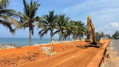
To link infrastructure investment with urban development, Nui Thanh prioritizes completing Vo Chi Cong route connected to Chu Lai airport to ensure inter-regional connectivity between Da Nang - Quang Nam - Quang Ngai coastal areas and the coastal belt road.
The district builds cross-roads connecting the expressway, National Highway 1 with Vo Chi Cong Street, bridges across Truong Giang River to Highway 613B and the traffic system connecting functional areas. Completes Highway 617 connecting Nui Thanh - Bac Tra My; upgrades Chu Lai seaport to a national seaport according to the plan.
The locality proposed to invest in a new Cua Lo route for 50,000-ton ships; build new Tam Hoa and Tam Giang ports to serve port and logistics services. Dredging rivers to ensure flood drainage, prevent natural disasters, improve the environment; form riverside tourist routes and riverside urban areas.
Source: https://baoquangnam.vn/nui-thanh-ket-noi-ha-tang-voi-phat-trien-do-thi-3148796.html

![[Photo] General Secretary To Lam receives US Ambassador to Vietnam Marc Knapper](https://vphoto.vietnam.vn/thumb/1200x675/vietnam/resource/IMAGE/2025/9/29/c8fd0761aa184da7814aee57d87c49b3)
![[Photo] General Secretary To Lam, Secretary of the Central Military Commission attends the 12th Party Congress of the Army](https://vphoto.vietnam.vn/thumb/1200x675/vietnam/resource/IMAGE/2025/9/30/9b63aaa37ddb472ead84e3870a8ae825)
![[Photo] Solemn opening of the 12th Military Party Congress for the 2025-2030 term](https://vphoto.vietnam.vn/thumb/1200x675/vietnam/resource/IMAGE/2025/9/30/2cd383b3130d41a1a4b5ace0d5eb989d)
![[Photo] The 1st Congress of Phu Tho Provincial Party Committee, term 2025-2030](https://vphoto.vietnam.vn/thumb/1200x675/vietnam/resource/IMAGE/2025/9/30/1507da06216649bba8a1ce6251816820)


![[Photo] General Secretary To Lam attends the ceremony to celebrate the 80th anniversary of the post and telecommunications sector and the 66th anniversary of the science and technology sector.](https://vphoto.vietnam.vn/thumb/1200x675/vietnam/resource/IMAGE/2025/9/29/8e86b39b8fe44121a2b14a031f4cef46)


Comment (0)