
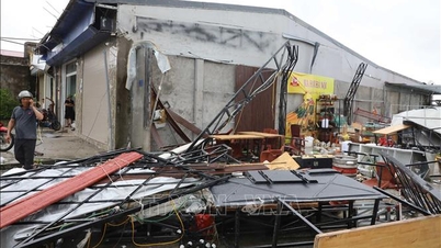
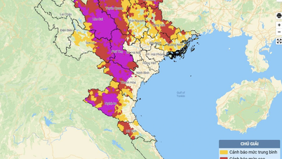
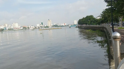
Mr. Nguyen Van Huong, Head of Weather Forecasting Department of the Weather Forecast Center, National Center for Hydro-Meteorological Forecasting (Department of Hydrometeorology, Ministry of Agriculture and Environment ) said that the circulation of tropical low pressure clouds and storm clouds covers most of the northern, central and southern areas of the East Sea as well as the central sea area from Quang Tri to Quang Ngai. The above areas are all affected by the circulation of tropical low pressure, then storm No. 1.
Due to the influence of the tropical depression, on the day and night of June 10, the southern part of the northern East Sea (including the waters of the Hoang Sa archipelago), the central and southern East Sea (including the waters of the Truong Sa archipelago), the waters from Binh Dinh to Ca Mau, Ca Mau to Kien Giang and the Gulf of Thailand will have showers and thunderstorms.
During thunderstorms there is a possibility of tornadoes, strong gusts of wind level 6-7 and waves over 2m high.
During the day and night of June 11, the sea area from Khanh Hoa to Ca Mau will have strong southwest winds of level 6, gusting to level 7-8, rough seas, waves 2-4m high; the northern East Sea area (including the Hoang Sa archipelago) and the northern central East Sea area will have strong winds of level 6-7, the area near the storm's center will have winds of level 8-9, gusting to level 11, very rough seas, waves 3-5m high; the southern central and southern East Sea area (including the Truong Sa archipelago) will have strong southwest winds of level 6, sometimes level 7, gusting to level 8-9, rough seas, waves 3-5m high.
Source: https://nhandan.vn/trong-24-gio-toi-ap-thap-nhiet-doi-co-kha-nang-manh-len-thanh-bao-so-1-post885789.html
![[Photo] General Secretary To Lam attends the ceremony to celebrate the 80th anniversary of the post and telecommunications sector and the 66th anniversary of the science and technology sector.](https://vphoto.vietnam.vn/thumb/1200x675/vietnam/resource/IMAGE/2025/9/29/8e86b39b8fe44121a2b14a031f4cef46)
![[Photo] Many streets in Hanoi were flooded due to the effects of storm Bualoi](https://vphoto.vietnam.vn/thumb/1200x675/vietnam/resource/IMAGE/2025/9/29/18b658aa0fa2495c927ade4bbe0096df)


![[Photo] General Secretary To Lam receives US Ambassador to Vietnam Marc Knapper](https://vphoto.vietnam.vn/thumb/1200x675/vietnam/resource/IMAGE/2025/9/29/c8fd0761aa184da7814aee57d87c49b3)
![[Photo] General Secretary To Lam, Secretary of the Central Military Commission attends the 12th Party Congress of the Army](https://vphoto.vietnam.vn/thumb/1200x675/vietnam/resource/IMAGE/2025/9/30/9b63aaa37ddb472ead84e3870a8ae825)


![[Photo] National Assembly Chairman Tran Thanh Man chairs the 8th Conference of full-time National Assembly deputies](https://vphoto.vietnam.vn/thumb/1200x675/vietnam/resource/IMAGE/2025/9/29/2c21459bc38d44ffaacd679ab9a0477c)


Comment (0)