
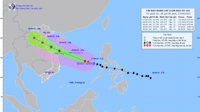
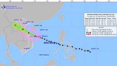
The National Center for Hydro-Meteorological Forecasting said that this morning (September 26), storm BUALOI is active in the central Philippines with winds of level 11, gusts of level 14. In the coming days, the storm will move quickly in the West-Northwest direction, enter the East Sea and tend to strengthen, causing strong winds and large waves in many sea areas.
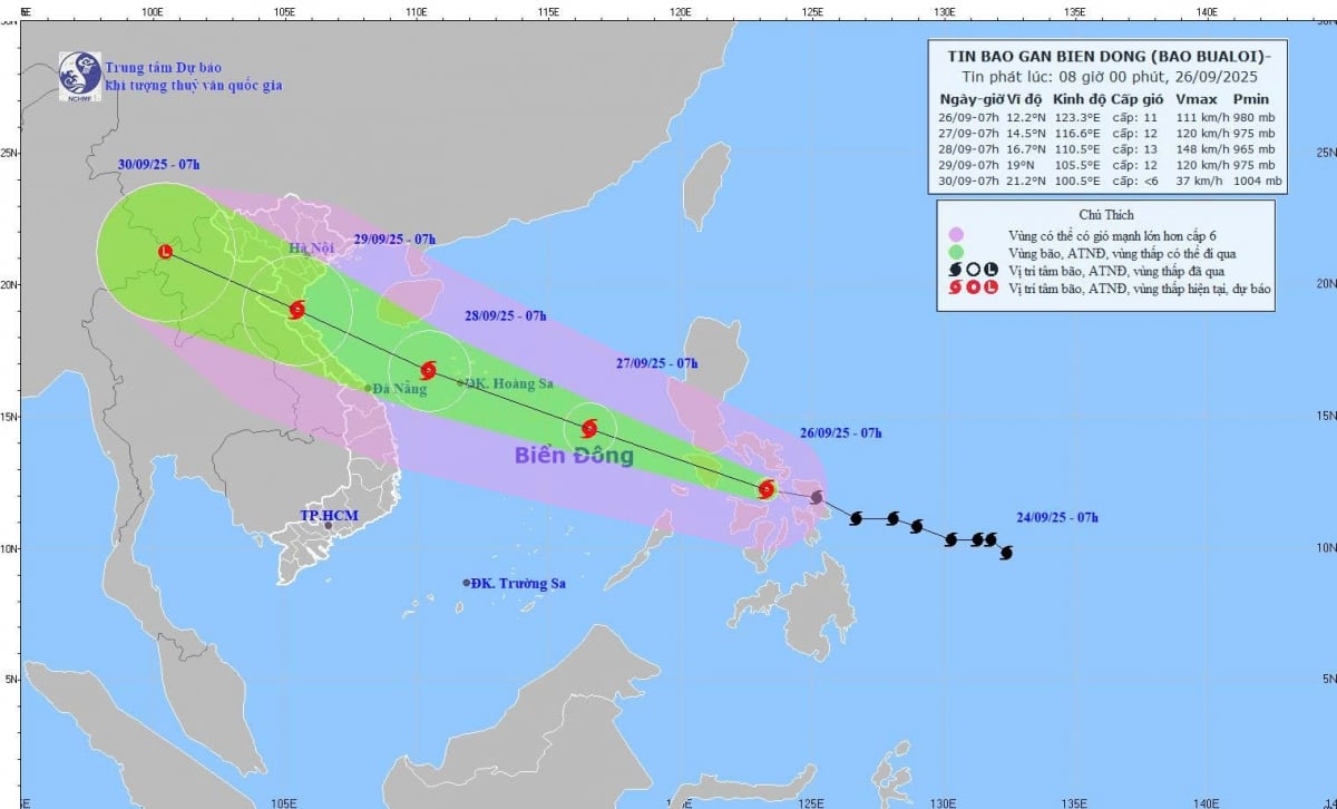 |
| This morning, the center of the storm was at about 12.2°N-123.3°E, in the central Philippines. The strongest wind reached level 11 (103-117 km/h), gusting to level 14, moving west-northwest at a speed of about 30 km/h. |
It is forecasted that by 7am tomorrow morning (September 27), the storm will enter the East Sea, intensifying to level 11-12, gusting to level 15. The danger zone extends from 11.5-17.0°N, east of longitude 114.0°E. Natural disaster risk is warned at level 3 in the Northeast and Central East Sea.
In the next 24-72 hours, the storm will continue to move west-northwest at a speed of 25-30 km/h, and will strengthen. By September 28, the storm center will be at about 16.7°N-110.5°E, with winds increasing to level 13, gusting to level 16, posing a danger to the North and Central East Sea, the Hoang Sa archipelago and the sea area from Quang Tri to Quang Ngai .
On September 29, the storm approached the shore at a position of about 19.0°N - 105.5°E, with strong winds of level 12, gusts of level 15. The affected area expanded to the Northwest of the East Sea, the South of the Gulf of Tonkin and the coast from Quang Tri to Quang Ngai.
In the next 72-96 hours, the storm is forecast to continue moving rapidly in the West-Northwest direction at a speed of about 25 km/h but its intensity will gradually weaken.
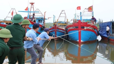
From the afternoon of September 26, the northeastern and central East Sea areas will have winds of level 6-7, then increasing to level 8-9. Areas near the storm center will have strong winds of level 10-12, gusts of level 15, waves 5-7 m high, and rough seas. Ships in the danger zone may be affected by thunderstorms, whirlwinds, strong winds, and large waves.
According to PV/VOV.VN
Source: https://baovinhlong.com.vn/thoi-su/202509/bao-bualoi-vao-bien-dong-nguy-co-gio-giat-cap-16-1b91ccd/


![[Photo] Soldiers guard the fire and protect the forest](https://vphoto.vietnam.vn/thumb/1200x675/vietnam/resource/IMAGE/2025/9/27/7cab6a2afcf543558a98f4d87e9aaf95)


![[Photo] Prime Minister Pham Minh Chinh attends the 1st Hai Phong City Party Congress](https://vphoto.vietnam.vn/thumb/1200x675/vietnam/resource/IMAGE/2025/9/27/676f179ddf8c4b4c84b4cfc8f28a9550)


Comment (0)