
 |
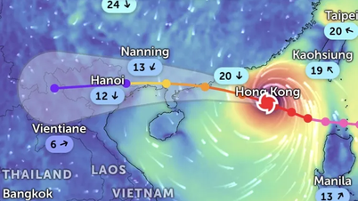
| Location of storm Bualoi this morning |
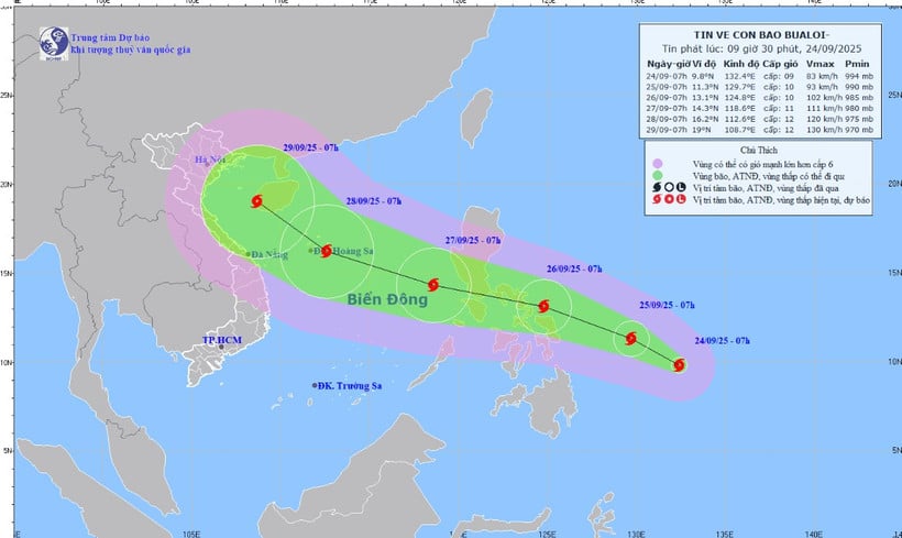
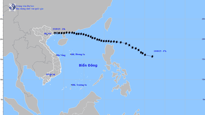
At 7:00 a.m. on September 24, the storm center was at about 9.8 degrees north latitude and 132.4 degrees east longitude. The strongest wind near the center was level 9 (75-88 km/h), gusting to level 11. Moving in a West Northwest direction at a speed of about 15 km/h.
It is forecasted that around the night of September 26, the storm will enter the East Sea and become storm number 10 in 2025.
Forecast (next 24-72 hours) at 7:00 a.m. on September 25, the storm is located at 11.3 degrees north latitude, 129.7 degrees east longitude. Intensity level 9-10, gust level 12. At 7:00 a.m. on September 26, the storm is located at 13.1 degrees north latitude, 124.8 degrees east longitude. Intensity level 10, gust level 12.
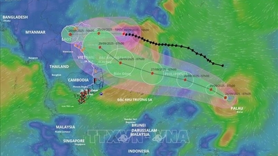
At 7:00 a.m. on September 27, the storm was located at 14.3 degrees north latitude and 118.6 degrees east longitude, moving into the East Sea. Intensity level 11, gust level 14.
Danger zone: North of latitude 12 degrees north, longitude 17 degrees east, east of longitude 117 degrees east.
Disaster risk level: Level 3 - eastern sea area of the North and Central East Sea.
Warning: In the next 72-120 hours, the storm will continue to move rapidly in the West-Northwest direction, at a speed of 20-25 km/hour, and may strengthen.
Storm impact warning, from the evening and night of September 26, the northeastern sea area and the middle of the East Sea will have winds gradually increasing to level 6-7, then increasing to level 8-9. The area near the storm center will have winds of level 10-11, gusting to level 14, waves 5-7m high, and rough seas.
Danger to vessels operating in the North and Central East Sea areas.
Government Newspaper
Source: https://baodongnai.com.vn/kinh-te/202509/bao-so-10-bualoi-giat-cap-11-du-kien-di-vao-bien-dong-ngay-26-9-3990d39/
![[Photo] Soldiers guard the fire and protect the forest](https://vphoto.vietnam.vn/thumb/1200x675/vietnam/resource/IMAGE/2025/9/27/7cab6a2afcf543558a98f4d87e9aaf95)


![[Photo] Prime Minister Pham Minh Chinh attends the 1st Hai Phong City Party Congress](https://vphoto.vietnam.vn/thumb/1200x675/vietnam/resource/IMAGE/2025/9/27/676f179ddf8c4b4c84b4cfc8f28a9550)


Comment (0)