
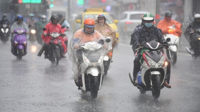
Strong cold air is coming right before Lunar New Year 2025, so from the afternoon and night of January 26 (ie 27th of Tet), the North will turn very cold, the mountainous areas will be extremely cold, with the possibility of frost and frost. The lowest temperature in Hanoi is 9 degrees.
The National Center for Hydro-Meteorological Forecasting said this afternoon (January 23) that currently in the North there is a strong cold air mass moving south.
Around the night of January 25 and the morning of January 26, this cold air mass will affect the Northeast region, then affect the North Central region, the Northwest region, the Central Central region and some places in the South Central region. Northeast wind inland will strengthen to level 3, coastal areas level 3-4, some places will have gusts of level 6.
Due to the influence of strong cold air, in the North and North Central regions, from the afternoon and night of January 26 (ie 27th of Tet), the weather will be very cold, mountainous areas will be extremely cold, high mountainous areas will have the possibility of frost and frost; in the Central Central region, from the night of January 26, the weather will turn cold.

The meteorological agency noted that the lowest temperature during this cold air mass in the North and North Central regions is generally 9-12 degrees Celsius, in the mountainous areas of the North 6-8 degrees Celsius, in the high mountainous areas below 3 degrees Celsius; in the area from Quang Binh to Hue 14-17 degrees Celsius; from Da Nang to Quang Ngai 16-19 degrees Celsius.
Particularly, Hanoi weather from the evening and night of January 26th will turn cold. The lowest temperature in this cold air mass is commonly 9-12 degrees.
Also due to the influence of the cold air strengthening from the night of January 25-26, the Northern and North Central regions will have scattered rain, showers and thunderstorms in some places; from January 26-28, the Central Central region will have rain, showers, locally heavy rain and thunderstorms. During thunderstorms, there is a possibility of tornadoes, lightning and strong gusts of wind.
"The cold air mass is pouring in strongly, causing temperatures in the Northern and North Central regions to drop sharply, so mountainous areas are likely to experience severe cold, and high mountainous areas are likely to experience frost and frost.
In addition, the weather at sea from early morning on January 26, in the Gulf of Tonkin, the Northeast wind was strong at level 6, then increased to level 7, gusting to level 9, rough seas, waves 2-4m high. From the afternoon of January 26, in the North East Sea area (including the sea area of Hoang Sa archipelago), the Northeast wind gradually increased to level 6-7, gusting to level 8-9, rough seas, waves 3-5.5m high. From the night of January 26, in the sea area from Quang Tri to Ca Mau , the Central and South East Sea area (including the sea area of Truong Sa archipelago), the Northeast wind gradually increased to level 6, sometimes level 7, gusting to level 8-9, rough seas, waves 3-5m high.
The meteorological agency noted that impacts such as thunderstorms accompanied by tornadoes, lightning and strong gusts of wind could affect agricultural production, cause trees to fall, damage houses, traffic works and infrastructure.
Localized heavy rains are likely to cause flooding in low-lying areas; flash floods in small rivers and streams, and landslides on steep slopes.
Strong winds and large waves at sea are likely to affect boat operations and other activities.
Severe cold, frost, ice and frost can affect crops and livestock.


Source: https://vietnamnet.vn/dot-khong-khi-lanh-manh-tran-ve-truoc-tet-nguyen-dan-ha-noi-ret-nhat-chi-9-do-2366046.html

![[Photo] Soldiers guard the fire and protect the forest](https://vphoto.vietnam.vn/thumb/1200x675/vietnam/resource/IMAGE/2025/9/27/7cab6a2afcf543558a98f4d87e9aaf95)


![[Photo] Prime Minister Pham Minh Chinh attends the 1st Hai Phong City Party Congress](https://vphoto.vietnam.vn/thumb/1200x675/vietnam/resource/IMAGE/2025/9/27/676f179ddf8c4b4c84b4cfc8f28a9550)


Comment (0)