
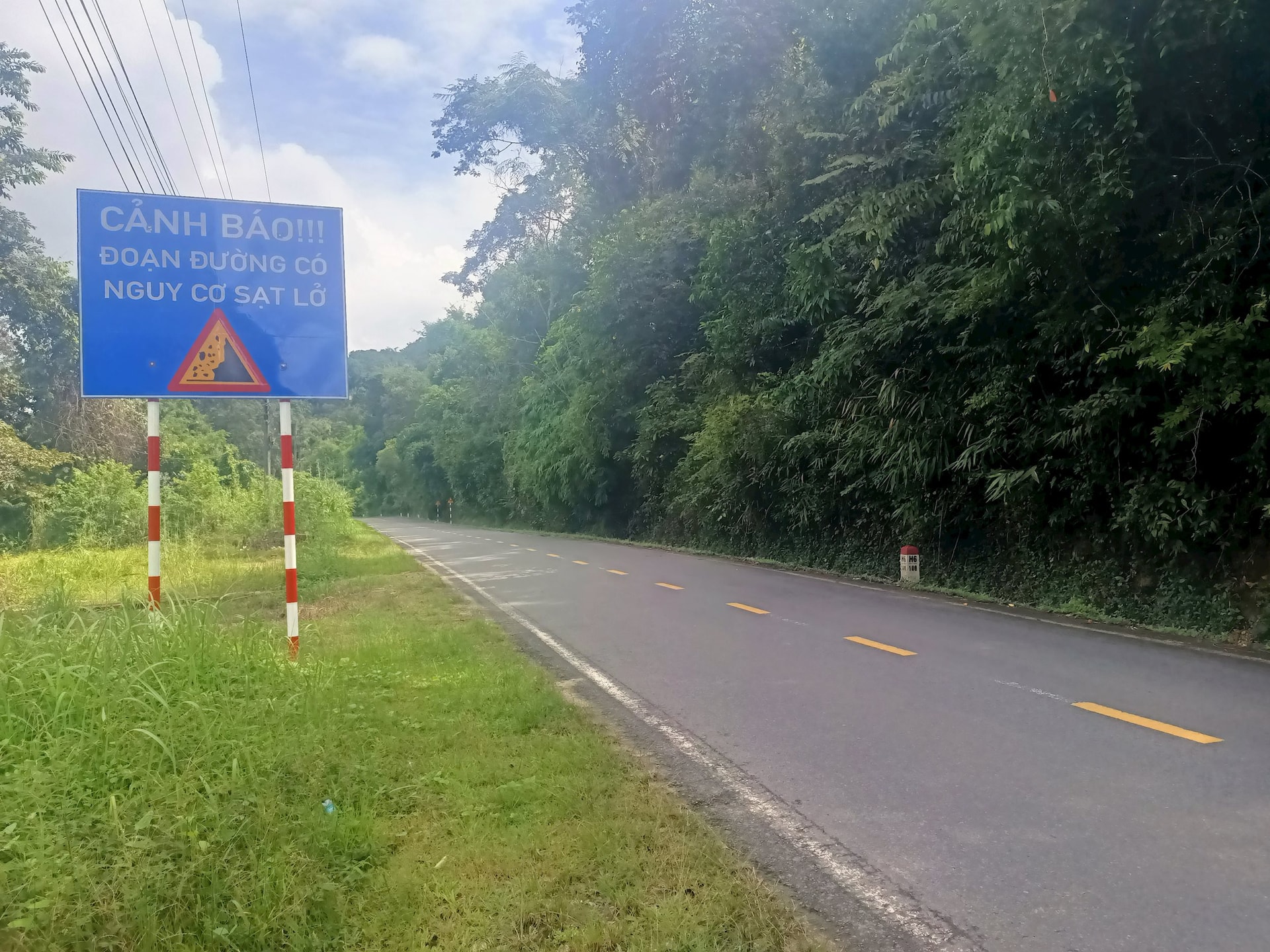
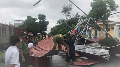
However, currently, on Highway 55 there are many points that are very prone to landslides, which can endanger traffic safety for pedestrians and vehicles. From Son My commune to La Gi - Tanh Linh, the traffic volume is quite high, but many areas go through forests, mountain passes, are narrow, and do not have phone signal, so when a vehicle has an accident, people have a hard time contacting relatives or the authorities to handle the incident.
Several years ago, the section from Tanh Linh to La Da had several landslides that disrupted traffic. Recently, in July, a tree fell onto the road through Tanh Linh, fortunately no one was injured.
Mr. Phan Duy Thanh, who lives in Dong Kho commune, has a macadamia garden in La Day village (La Da commune), so he and his family often travel on this road to take care of the garden. He said: "The road is narrow with only 2 lanes, many sharp turns at the mountain passes, one side is a cliff, the other side is a ravine, driving must observe the road which is already difficult, but when it rains, the phenomenon of rocks and soil on the mountain flowing down with the rainwater is heart-stopping... Every time it rains, I walk and look up the hill to see if the ground is moving. But driving like that will not focus on observing the road, very easily causing accidents...".
Ms. Nguyen Thi Phuong - who often collects freshwater fish from Ham Thuan - Da Mi lake to sell at Dong Kho market, Huy Khiem, Tanh Linh confided: "Almost every year there are a few landslides on this road. When walking on the road, my eyes have to constantly look up the mountain for fear of unusual landslides. There was a day when I almost caused an accident so I was very worried...".
According to the reporter's observation, on Highway 55, the section from the intersection of Da Mi village, Dong Kho commune to Da Tro village, La Da commune is about 14 km long, but it is estimated that there are more than 30 points at risk of large and small landslides. These are places that have had landslides before, so they are very easy to see. There are landslides up to 3 m wide that have previously overflowed with soil and trees on the road surface, a meter thick, so the landslides are still jagged... La Da commune has nearly 25 km of Highway 55 passing through.
The terrain along the road is mainly hills and mountains. Some sections have slopes, but most of the slopes are only 1-3 meters high while the hillsides are 5-7 meters high. Therefore, when there is heavy rain, the water flows down, causing landslides and overflowing onto the road, causing serious traffic obstruction...
National Highway 55 is an important arterial route connecting the Lam Dong - Ho Chi Minh City regions, especially now, in La Gi, Tanh Linh, Dong Kho areas, people and officials often travel to the administrative center to solve work, so the traffic volume is even heavier. Therefore, people recommend that the Ministry of Construction needs to invest in upgrading and expanding National Highway 55. At the same time, it is necessary to build more slopes at points with high risk of landslides, to ensure traffic safety, helping people travel more conveniently...
Source: https://baolamdong.vn/nguy-co-sat-lo-tren-quoc-lo-55-393011.html
![[Photo] Many streets in Hanoi were flooded due to the effects of storm Bualoi](https://vphoto.vietnam.vn/thumb/1200x675/vietnam/resource/IMAGE/2025/9/29/18b658aa0fa2495c927ade4bbe0096df)
![[Photo] General Secretary To Lam, Secretary of the Central Military Commission attends the 12th Party Congress of the Army](https://vphoto.vietnam.vn/thumb/1200x675/vietnam/resource/IMAGE/2025/9/30/9b63aaa37ddb472ead84e3870a8ae825)
![[Photo] General Secretary To Lam attends the ceremony to celebrate the 80th anniversary of the post and telecommunications sector and the 66th anniversary of the science and technology sector.](https://vphoto.vietnam.vn/thumb/1200x675/vietnam/resource/IMAGE/2025/9/29/8e86b39b8fe44121a2b14a031f4cef46)


![[Photo] General Secretary To Lam receives US Ambassador to Vietnam Marc Knapper](https://vphoto.vietnam.vn/thumb/1200x675/vietnam/resource/IMAGE/2025/9/29/c8fd0761aa184da7814aee57d87c49b3)


![[Photo] National Assembly Chairman Tran Thanh Man chairs the 8th Conference of full-time National Assembly deputies](https://vphoto.vietnam.vn/thumb/1200x675/vietnam/resource/IMAGE/2025/9/29/2c21459bc38d44ffaacd679ab9a0477c)


Comment (0)