
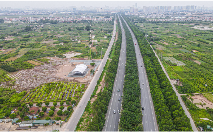
According to the Decision, the plan and location of the route from the new National Highway 3 service road through the People's Committee of Van Ha commune to the end of Dong Anh district, scale 1/500, prepared by the Hanoi Institute of Construction Planning, and appraised by the Hanoi Department of Planning and Architecture. The starting point of the route intersects with the new National Highway 3 service road, the end point is at the border between Dong Anh district, Hanoi city and Tu Son city, Bac Ninh province, with a length of about 1.84 km. The route direction is determined based on the General Construction Plan of Van Ha commune approved by the People's Committee of Dong Anh district.
Typical cross-section width B = 40m includes the following components: Roadway 2x11.25m (6 lanes), median strip 3m, sidewalks on both sides 2x7.25m. At the beginning of the route intersecting with the new National Highway 3, the road cross-section includes 03 main components: Overpass over the new National Highway 3 with width B = 19.5m (4 lanes), Northern branch B = 21.5m (3 lanes), Southern branch B = 13m (2 lanes).
Intersections are determined on the basis of the road network according to the approved planning; details will be further studied and accurately determined during the process of making detailed plans for both sides of the road or the investment project for the cross-road route approved by the competent authority.
The red line of the road is determined based on the planned road centerline, road cross-section, technical parameters, dimensions and combined with interpolation specifically determined on the drawing.
The City People's Committee assigned the Department of Planning and Architecture to check and confirm the plan drawings and route locations according to the approval decision of the City People's Committee.
Dong Anh District People's Committee organizes the public announcement of the approved route plan and location documents for relevant organizations and individuals to know and implement; strictly manages land and construction order on both sides of the route according to the approved planning, plan and location of the route; deploys the work of setting up road boundary markers at the same time as carrying out land recovery and site clearance during the implementation of the investment project.
Source: https://kinhtedothi.vn/phe-duyet-tuyen-duong-tu-duong-gom-quoc-lo-3-moi-tai-huyen-dong-anh.html
![[Photo] Panorama of the cable-stayed bridge, the final bottleneck of the Ben Luc-Long Thanh expressway](https://vphoto.vietnam.vn/thumb/1200x675/vietnam/resource/IMAGE/2025/9/30/391fdf21025541d6b2f092e49a17243f)
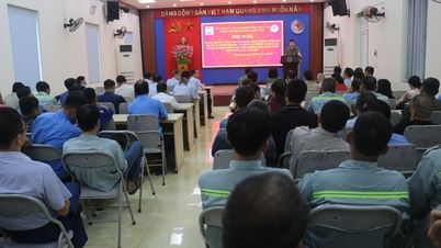
![[Photo] Solemn opening of the 12th Military Party Congress for the 2025-2030 term](https://vphoto.vietnam.vn/thumb/1200x675/vietnam/resource/IMAGE/2025/9/30/2cd383b3130d41a1a4b5ace0d5eb989d)
![[Photo] The 1st Congress of Phu Tho Provincial Party Committee, term 2025-2030](https://vphoto.vietnam.vn/thumb/1200x675/vietnam/resource/IMAGE/2025/9/30/1507da06216649bba8a1ce6251816820)
![[Photo] President Luong Cuong receives President of the Cuban National Assembly Esteban Lazo Hernandez](https://vphoto.vietnam.vn/thumb/1200x675/vietnam/resource/IMAGE/2025/9/30/4d38932911c24f6ea1936252bd5427fa)
![[Photo] General Secretary To Lam, Secretary of the Central Military Commission attends the 12th Party Congress of the Army](https://vphoto.vietnam.vn/thumb/1200x675/vietnam/resource/IMAGE/2025/9/30/9b63aaa37ddb472ead84e3870a8ae825)


Comment (0)