
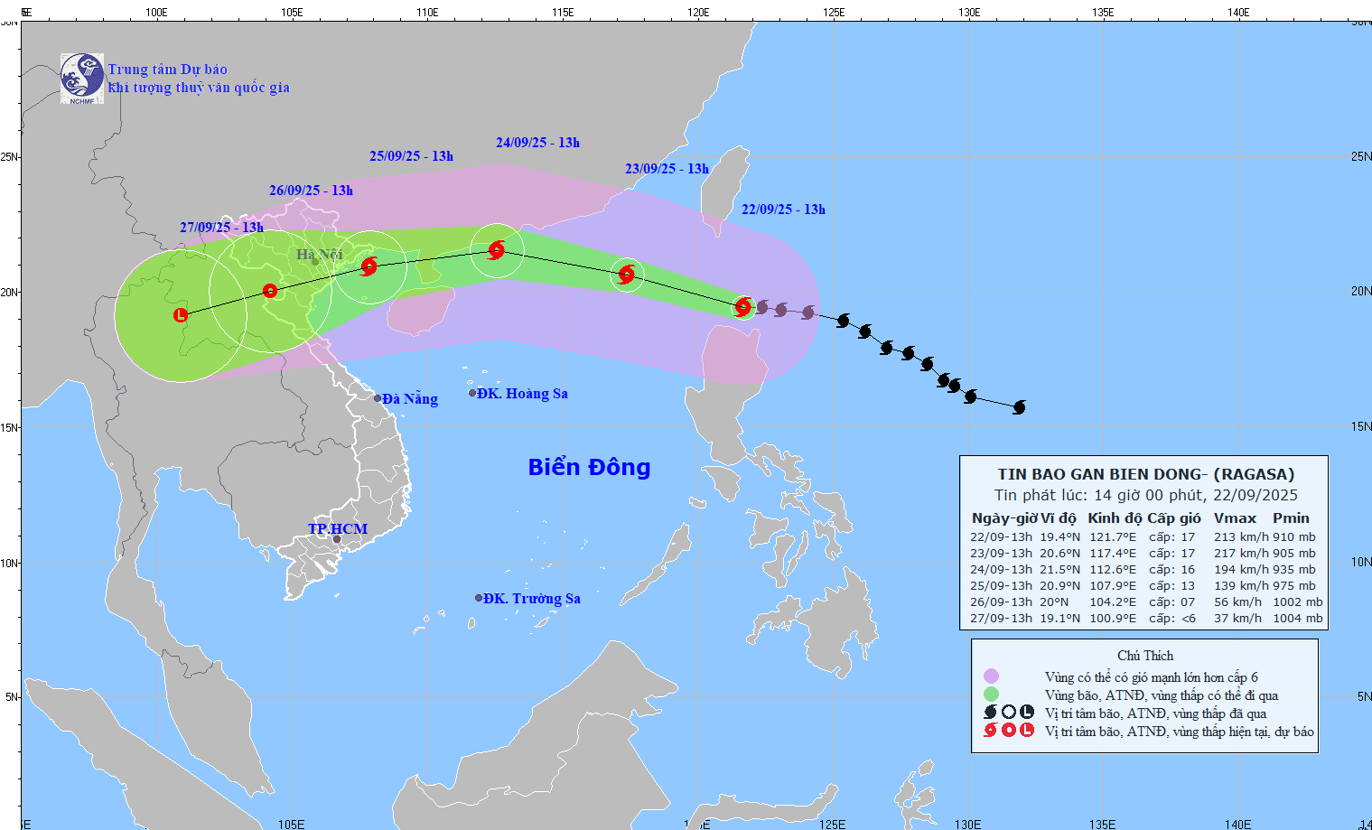
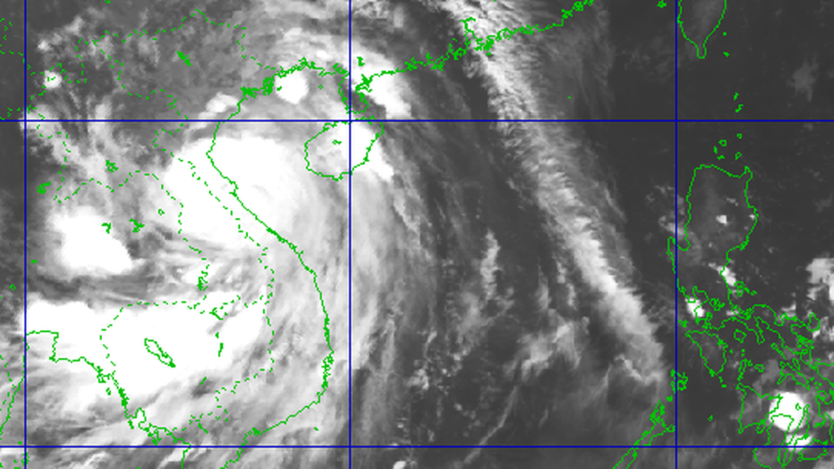
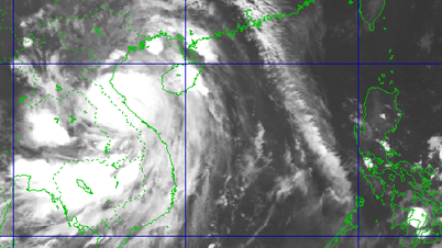
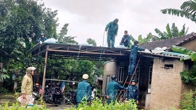
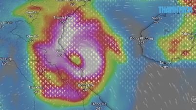
According to the National Center for Hydro-Meteorological Forecasting, at 1 p.m. on September 22, the center of super typhoon RAGASA was at about 19.4°N - 121.7°E, about 140 km north of Luzon Island (Philippines). The strongest wind near the center of the super typhoon was level 17 (202 - 221 km/h), gusting above level 17. Moving in the West Northwest direction, speed about 20 - 25 km/h.
Forecast until 13:00 on September 23, the storm will move in the West Northwest direction, speed 20 - 25 km/h and enter the East Sea, the storm position is at 20.6N-117.4E, in the sea area northeast of the North East Sea area, storm intensity is level 17, gusts above level 17, the dangerous area is north of latitude 18.0N; east of longitude 115.0E, natural disaster risk level 4, the affected area is the sea area northeast of the North East Sea area.
At 1:00 p.m. on September 24, the storm moved in the West-Northwest direction, at a speed of 20-25 km/h, located at 21.5N-112.6E; in the northern sea area of the North East Sea, about 230 km east of Leizhou Peninsula (China), the storm intensity was level 15-16, gusting over level 17, the dangerous area was north of latitude 18.5N; east of longitude 110.0E, natural disaster risk level 4, the affected area was the northern sea area of the North East Sea.
Forecast at 1:00 p.m. on September 25, the storm will move in the West Southwest direction, at a speed of about 20 km/h and gradually weaken, the storm will be located at 20.9N-107.9E; on the sea area from Quang Ninh to Ninh Binh , the storm intensity will be level 12-13, gusting to level 16, the dangerous area is north of latitude 18.0N; west of longitude 114.00E, natural disaster risk level 4, the affected area is the sea area northwest of the North East Sea; the Gulf of Tonkin area.
From the next 72 to 120 hours, the storm will move in the West Southwest direction, at a speed of about 20 km/hour, and its intensity will continue to weaken.
Due to the influence of the storm, the northern sea area of the North East Sea gradually increased to level 8 - 9, then increased to level 10 - 14, the area near the center of the super storm passed level 15 - 17, gusts above level 17, waves over 10 m high, rough seas.
From September 24, the wind in the Gulf of Tonkin will gradually increase to level 6 - 7, then increase to level 8 - 10, the area near the storm center will be level 11 - 13, gusting over level 16, waves 5 - 7 m high; the sea will be very rough. Ships in the danger zone are likely to be affected by storms, whirlwinds, very strong winds, and very large waves.
Source: https://baotintuc.vn/xa-hoi/sieu-bao-ragasa-giat-cap-17-ap-sat-bien-dong-20250922153638596.htm
![[Photo] High-ranking delegation of the Russian State Duma visits President Ho Chi Minh's Mausoleum](https://vphoto.vietnam.vn/thumb/1200x675/vietnam/resource/IMAGE/2025/9/28/c6dfd505d79b460a93752e48882e8f7e)

![[Photo] Joy on the new Phong Chau bridge](https://vphoto.vietnam.vn/thumb/1200x675/vietnam/resource/IMAGE/2025/9/28/b00322b29c8043fbb8b6844fdd6c78ea)
![[Photo] The 4th meeting of the Inter-Parliamentary Cooperation Committee between the National Assembly of Vietnam and the State Duma of Russia](https://vphoto.vietnam.vn/thumb/1200x675/vietnam/resource/IMAGE/2025/9/28/9f9e84a38675449aa9c08b391e153183)


Comment (0)