
According to a hydrometeorological expert, updated at 9:00 a.m. on September 21, 7 regional and international hydrometeorological stations including Hong Kong, Taiwan, China, Japan, the US, the Philippines, and South Korea all have the same opinion that storm Ragasa will make landfall in Vietnam on September 26.

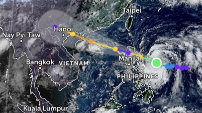
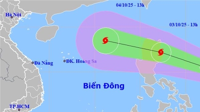
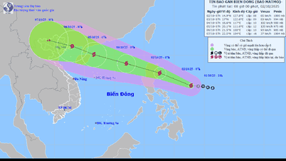
According to the National Center for Hydro-Meteorological Forecasting, at 7:00 a.m. this morning, the center of storm Ragasa was at about 17.9 degrees north latitude and 127.0 degrees east longitude, about 520 km east of Luzon Island (Philippines). The strongest wind near the center of the storm was at level 14, equivalent to wind speeds of 150 - 166 km/h, gusting to level 17.
Currently, the storm is moving west-northwest at a speed of about 15 km/hour. It is forecasted that on September 23, Ragasa storm will enter the East Sea with super typhoon intensity, with strong winds of level 16-17.
Mr. Nguyen Van Huong, Head of Weather Forecasting Department, National Center for Hydro-Meteorological Forecasting, said there are two possibilities when storm Ragasa enters the East Sea and becomes storm number 9 this year.
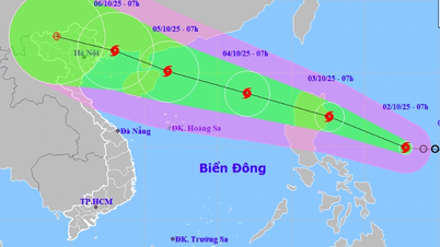
Specifically, Ragasa storm will enter the mainland coast of Guangdong province (China) and then move through Leizhou peninsula and continue to affect the northern provinces of our country. In this scenario, Ragasa storm's intensity will weaken significantly when it has friction with the mainland.
When entering the East Sea, if storm Ragasa moves mainly westward, it will directly affect Vietnam with strong winds and heavy rain.
According to Mr. Nguyen Van Huong, the National Center for Hydro-Meteorological Forecasting has recorded that there is a cold air mass in the north that is capable of changing the direction of the storm.
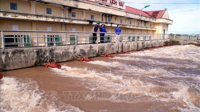
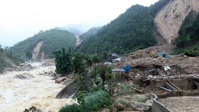
It is forecasted that from September 25 to 27, due to the influence of the circulation before storm Ragasa, the coastal areas of the North, the provinces from Thanh Hoa to Hue City will have strong winds and heavy rains occurring widely.
Storm Ragasa, level 14, entering the East Sea, can 'sink large tonnage ships'
The National Center for Hydro-Meteorological Forecasting warns that due to the impact of storm Ragasa, from September 22, the sea area east of the northern East Sea will gradually increase in wind to level 8 - 9, then increase to level 10 - 14. In the area near the storm's center, the wind will be strong at level 15 - 17, gusting above level 17. Waves will be over 10 meters high, and the sea will be rough.
The National Center for Hydro-Meteorological Forecasting has issued a level 4 disaster risk warning (very high risk) in the northern East Sea, with very strong storm winds that can sink large ships and boats. Accordingly, ships and boats operating in the northern East Sea are likely to be affected by strong winds, storms, and large waves from storm Ragasa.
Source: https://baolaocai.vn/7-dai-khi-tuong-quoc-te-du-bao-bao-ragasa-di-vao-viet-nam-post882589.html


Comment (0)