
The National Center for Hydro-Meteorological Forecasting said that tonight and tomorrow morning, storm Manyi is expected to move into the East Sea and become the 9th storm to affect Vietnam this year.
1. Update the latest storm news
This evening (November 17), storm Manyi made landfall on the eastern side of Luzon Island (Philippines), and the storm's intensity has decreased by 2 levels.
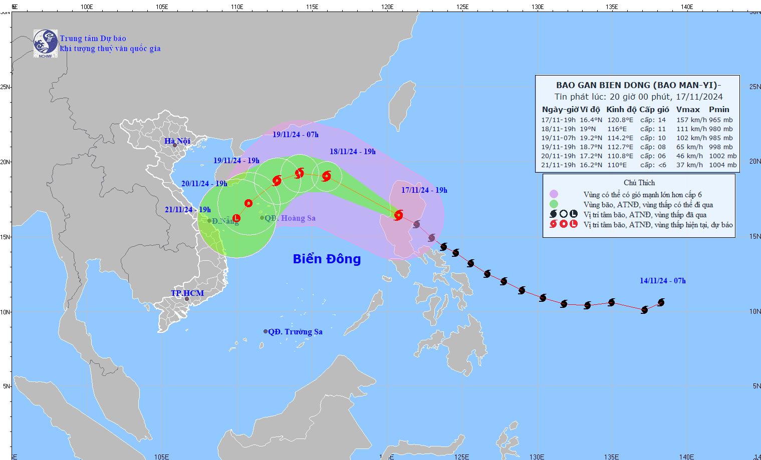
Updated location and path of storm Manyi. Photo: NCHMF
At 7 p.m., the center of storm Manyi was at about 16.4 degrees North latitude; 120.8 degrees East longitude, on the mainland of Luzon Island (Philippines). The strongest wind near the center of the storm was level 14 (150-166 km/h), gusting to level 17. Moving northwest at a speed of about 25 km/h.
Storm progress (next 24 to 72 hours):
| Forecast time | Direction, speed | Location | Intensity | Danger zone | Disaster Risk Level (Affected Area) |
| 19:00/18/11 | Northwest 20-25km/h, entering the East Sea and gradually weakening | 19.0N-116.0E; in the North East Sea area; about 470km northeast of Hoang Sa archipelago | Level 11, level 14 | Latitude 14.5N-21.0N; East of longitude 114.0E | Level 3: East of the North East Sea area |
| 19:00/19/11 | West, then West Southwest approximately 15km/h, continuing to weaken | 18.7N-112.7E; west of the North East Sea area; about 220km north of Hoang Sa archipelago | Level 8, level 10 | Latitude 17.0N-21.0N; East longitude 111.0E-118.0E | Level 3: North East Sea area |
| 19:00/20/11 | Southwest, about 10km/h and gradually weakened into a tropical depression | 17.2N-110.8E; in the sea northwest of Hoang Sa archipelago | Level 6, level 8 jerk | Latitude 15.5N-20.5N; longitude 109.5E-114.5E | Level 3: West of the North East Sea area (including the waters of the Hoang Sa archipelago) |
From the next 72 to 96 hours, the tropical depression moves in the Southwest direction, traveling 5-10km per hour, gradually weakening into a low pressure area.
Regarding the impact of storm Manyi: The eastern sea area of the North East Sea has strong winds of level 8-10, the area near the storm's eye has winds of level 11-13, gusts of level 15, waves 3.0-5.0m high, the area near the storm's eye has waves of 5.0-7.0m; the sea is very rough.
Vessels operating in the above mentioned dangerous areas are susceptible to the impact of storms, whirlwinds, strong winds and large waves.
2. Tonight (November 17), the North welcomes cold air
Currently, the cold air mass is moving south.

Latest cold air developments: Cold air has approached, what is the temperature in the northern provinces?
Around the night of November 17, this cold air mass will affect some places in the Northeast region of the North; then affect other places in the Northeast and North Central regions, some places in the Northwest and North Central regions. Northeast wind inland level 3, coastal areas level 4.
When moving into the East Sea, storm Manyi will encounter a cold air mass moving down from mainland China, along with cold sea surface temperatures and dry northeast winds, so it will gradually weaken and most likely dissipate before affecting mainland Vietnam.
On land, it is forecasted that around tonight, November 17, the cold air mass from mainland China will move down to the North, with the Northeast wind inland strengthening to level 3, and coastal areas level 4.
From November 18, in the Northeast and Thanh Hoa, the weather will turn cold at night and early morning. From November 20, in the North and North Central regions, the weather will be cold at night and early morning. The lowest temperature during this cold air mass in the North and North Central regions will generally be from 18-20 degrees Celsius, in mountainous areas, some places will be below 15 degrees Celsius.
Detailed forecast:
At sea in the Gulf of Tonkin on the night of November 17, the wind changed to the Northeast direction, from November 18 gradually increasing to level 6, gusting to level 7-8; rough sea; waves from 2.0-3.5m high.
In the North East Sea area, the Northeast wind (including the sea area of Hoang Sa archipelago) is strong at level 6-7, gusting at level 8-9; rough seas; waves are 2.0-4.0m high.
Due to the influence of disturbances in the upper East wind zone combined with cold air, from early morning on November 18-19 in the North and Central Central regions there will be rain, showers and thunderstorms in some places, locally heavy rain in some places. During thunderstorms there is a possibility of tornadoes, lightning and strong gusts of wind.
Thunderstorms accompanied by tornadoes, lightning and strong gusts of wind can affect agricultural production, cause trees to fall, damage houses, traffic works and infrastructure.
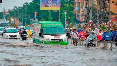
Localized heavy rains are likely to cause flooding in low-lying areas; flash floods in small rivers and streams, and landslides on steep slopes.
Strong winds and large waves at sea are likely to affect boat operations and other activities.
Source: https://danviet.vn/dien-bien-khong-khi-lanh-moi-nhat-khong-khi-lanh-da-tien-sat-nhiet-do-cac-tinh-mien-bac-the-nao-20241117203118842.htm


Comment (0)