
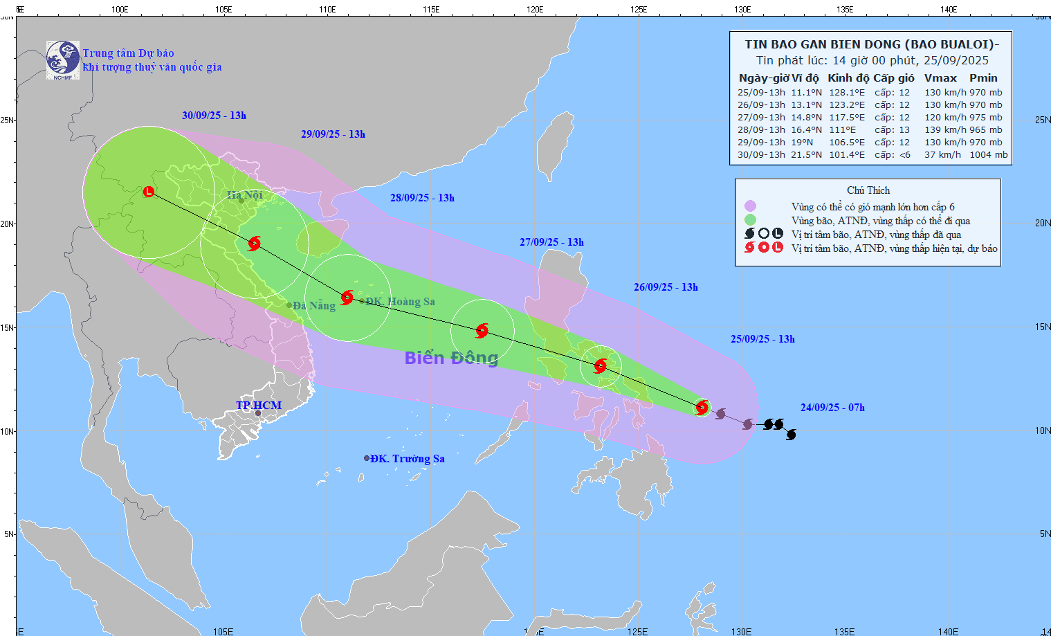
According to the National Center for Hydro-Meteorological Forecasting, at 1:00 p.m. on September 25, the storm center was at about 11.1°N - 128.1°E, in the sea east of the Philippines, with the strongest wind at level 12 (118 - 133 km/h), gusting to level 15, the storm moving West Northwest at a speed of 15 - 20 km/h.
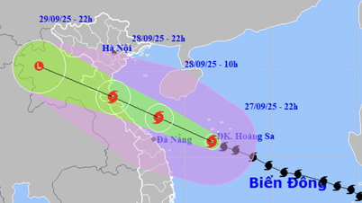
It is forecasted that around the night of September 26, storm Bualoi will enter the eastern sea area of the central East Sea, becoming storm number 10 in 2025.
Forecast, by 13:00 on September 26, the storm's position will be at 13.1°N - 123.2°E; storm intensity will be level 12, gusting to level 15, the storm will move in the West Northwest direction, 20 km/hour.
At 1 p.m. on September 27, the storm was located at 14.8°N - 117.5°E, entering the East Sea; Storm intensity level 12, gust level 15. Dangerous area is latitude 12.0 - 17.5°N; east of longitude 115.0°E; Natural disaster risk level 3, affected area is east of the North and central East Sea.
Forecast, at 13:00 on September 28, the storm is located at 16.4°N - 111.0°E; Storm intensity is level 12 - 13, gust level 16, the storm is moving in the West Northwest direction, speed 25 km/h, with the possibility of strengthening. The dangerous area is latitude 12.5 - 19.5°N; East of longitude 108.0°E; Natural disaster risk level 3, affected areas are the North and Central East Sea (including Hoang Sa special zone)
Warning: In the next 72 - 120 hours, the storm will move rapidly to the Northwest at a speed of 25 km/hour, and its intensity may increase.
Due to the storm's influence, from the evening of September 26, the sea area east of the North and the middle of the East Sea will have winds of level 6 - 7, then increase to level 8 - 9. The area near the storm's center will have strong winds of level 10 - 12, gusts of level 15, waves 5 - 7m high, and rough seas. Ships operating in the danger zone may be affected by thunderstorms, whirlwinds, strong winds, and large waves.
Along with that, meteorological experts said that this afternoon (September 25), the tropical depression (weakened from storm No. 9) has weakened into a low pressure area in the Quang Ninh area.
At 1 p.m., the center of the low pressure area was at about 21.5°N - 107.8°E. Strongest wind: below level 6 (below 39 km/h).
Forecast in the next 12 hours, the low pressure area will move mainly to the West, continue to weaken and gradually dissipate.
Source: https://baotintuc.vn/xa-hoi/khoang-dem-269-bao-bualoi-se-di-vao-bien-dong-20250925145251026.htm


![[Photo] Soldiers guard the fire and protect the forest](https://vphoto.vietnam.vn/thumb/1200x675/vietnam/resource/IMAGE/2025/9/27/7cab6a2afcf543558a98f4d87e9aaf95)


![[Photo] Prime Minister Pham Minh Chinh attends the 1st Hai Phong City Party Congress](https://vphoto.vietnam.vn/thumb/1200x675/vietnam/resource/IMAGE/2025/9/27/676f179ddf8c4b4c84b4cfc8f28a9550)


Comment (0)