
In the next 12-24 hours, floods on Thai Binh River are likely to peak above alert level 2 and then decrease; floods on Lo River, Cau River, Thuong River continue to decrease and stay below alert level 3; Ca River continue to decrease and stay above alert level 2.
Warning: In the next 24 hours, flood in the lower reaches of the Red River at Hanoi station will continue to rise and be above alert level 1; flood on the Luc Nam River (Bac Ninh) at Luc Nam station, and the Ma River (Thanh Hoa) at Giang station will continue to fall and be above alert level 1.
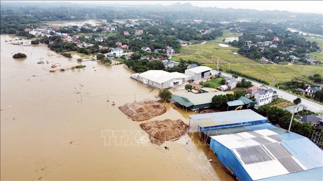
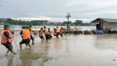
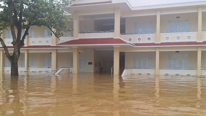
Flooding occurs in low-lying areas along rivers, urban areas in the Northern region, from Thanh Hoa to Nghe An ; flash floods and landslides on steep slopes in the mountainous areas of the Northern region, from Thanh Hoa to Nghe An (Real-time warning information on areas at risk of flash floods and landslides is provided online on the website of the Department of Hydrometeorology at: https://luquetsatlo.nchmf.gov.vn and in separate bulletins warning of flash floods and landslides).
Flood disaster risk warning level: Level 3
River floods inundate low-lying areas along the river, affecting activities such as waterway transport, aquaculture, agricultural production, people's lives and socio-economic activities.
"The forecast and warning information is calculated based on the expected discharge levels of upstream reservoirs. The hydrometeorological agency will update the bulletins when there are changes in the discharge flow of the reservoirs," noted Hoang Van Dai, Deputy Director of the National Center for Hydrometeorological Forecasting.
Source: https://baotintuc.vn/van-de-quan-tam/canh-bao-lu-khan-tren-song-lo-20251001223714565.htm


![[Photo] Binh Trieu 1 Bridge has been completed, raised by 1.1m, and will open to traffic at the end of November.](https://vphoto.vietnam.vn/thumb/1200x675/vietnam/resource/IMAGE/2025/10/2/a6549e2a3b5848a1ba76a1ded6141fae)


Comment (0)