
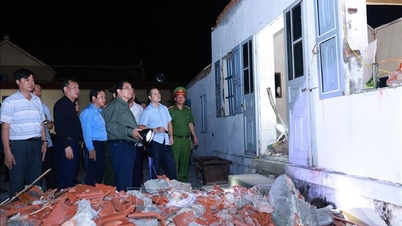
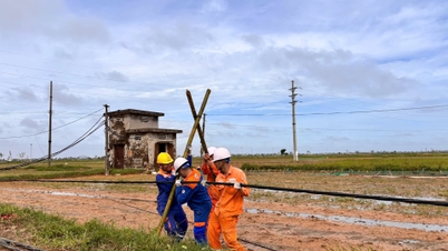
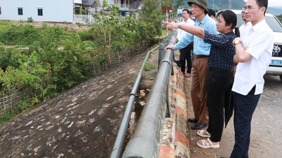
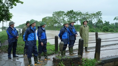
.jpg)
At 1:00 p.m. on September 27, the center of storm No. 10 was at about 15 degrees north latitude, 114 degrees east longitude, about 270km east-southeast of Hoang Sa special zone with the strongest wind at level 11-12 (about 103-133km/hour), gusting to level 15.
The storm is moving west-northwest at 30-35km/h and is likely to strengthen.
At 1:00 p.m. on September 28, the center of the storm was at about 17.2 degrees north latitude, 108.3 degrees east longitude, on the sea from Quang Tri to Da Nang , about 180km east of Quang Tri with the strongest wind at level 12 - 13, gusting to level 16 and still likely to strengthen.
The storm moved rapidly in a west-northwest direction at a speed of about 30km/h and made landfall.
At 1:00 a.m. on September 29, the center of the storm was at about 18.3 degrees north latitude, 105.8 degrees east longitude, on the mainland from Nghe An to Quang Tri with the strongest wind at level 10 - 11, gusting to level 14.

Due to the influence of storm No. 10, from the evening of September 27, the sea area of Da Nang city gradually increased to level 6-7, gusting to level 8-9, waves 3-5m high, and rough seas. From the early morning of September 28, the wind increased to level 8-9, the area near the storm center passed level 10-13, gusting to level 16, waves 5-7m high, rough seas.
On the mainland coastal area of Da Nang city on September 28, there will be strong winds of level 5, level 6, gusting to level 7-8.
From the afternoon of September 27 to the end of September 28, localities in Da Nang city will have moderate rain, heavy rain, and some places will have very heavy rain and thunderstorms. The total rainfall for the entire period is commonly 100 - 250mm, some places over 350mm. During thunderstorms, be on guard against tornadoes, lightning and strong gusts of wind.
The area near the storm's eye on land from Thanh Hoa to northern Quang Tri will have strong winds of level 10 - 12, gusting to level 14.
According to the forecast of the National Center for Hydro-Meteorological Forecasting, due to the influence of storm No. 10, from the evening of September 27, the sea area from Thanh Hoa to Quang Ngai (including Hon Ngu island, Con Co special zone and Ly Son) will have winds gradually increasing to level 6-7, gusting to level 8-9, waves 3-5m high, and rough seas. From the early morning of September 28, the wind will increase to level 8-9, the area near the storm's center will be level 10-13, gusting to level 16, waves 5-7m high, and rough seas.
Coastal areas and islands from Ninh Binh to Ha Tinh have storm surges of 0.5 - 1.5m high, especially from the south of Thanh Hoa to the north of Ha Tinh where they are 1 - 1.5m high; the risk of flooding of dykes, coastal roads, and river mouths due to storm surges and waves is very high on the evening and night of September 28.
From the afternoon of September 28, on the mainland from Thanh Hoa to northern Quang Tri, winds gradually increased to level 6-7, then increased to level 8-9, near the storm center, level 10-12, gusting to level 14; coastal areas from Quang Ninh to Ninh Binh, from southern Quang Tri to Hue, winds gradually increased to level 6-7, gusting to level 8-9.
From the evening of September 27 to September 30, in the North and the area from Thanh Hoa to Quang Ngai, there is a possibility of widespread heavy rain with total rainfall ranging from 100 - 300mm, locally over 450mm; in the Northern Delta, southern Phu Tho and from Thanh Hoa to northern Quang Tri, there will be total rainfall ranging from 200 - 400mm, locally over 600mm.
Source: https://baodanang.vn/da-nang-tiep-tuc-mua-lon-du-bao-gio-giat-cap-7-8-tren-dat-lien-3303824.html

![[Photo] General Secretary To Lam, Secretary of the Central Military Commission attends the 12th Party Congress of the Army](https://vphoto.vietnam.vn/thumb/1200x675/vietnam/resource/IMAGE/2025/9/30/9b63aaa37ddb472ead84e3870a8ae825)
![[Photo] Solemn opening of the 12th Military Party Congress for the 2025-2030 term](https://vphoto.vietnam.vn/thumb/1200x675/vietnam/resource/IMAGE/2025/9/30/2cd383b3130d41a1a4b5ace0d5eb989d)
![[Photo] The 1st Congress of Phu Tho Provincial Party Committee, term 2025-2030](https://vphoto.vietnam.vn/thumb/1200x675/vietnam/resource/IMAGE/2025/9/30/1507da06216649bba8a1ce6251816820)
![[Photo] President Luong Cuong receives President of the Cuban National Assembly Esteban Lazo Hernandez](https://vphoto.vietnam.vn/thumb/1200x675/vietnam/resource/IMAGE/2025/9/30/4d38932911c24f6ea1936252bd5427fa)
![[Photo] Panorama of the cable-stayed bridge, the final bottleneck of the Ben Luc-Long Thanh expressway](https://vphoto.vietnam.vn/thumb/1200x675/vietnam/resource/IMAGE/2025/9/30/391fdf21025541d6b2f092e49a17243f)


Comment (0)