
According to the forecast of the National Center for Hydro-Meteorological Forecasting, due to the influence of the tropical convergence zone connecting with the tropical depression in the sea east of Luzon Island (Philippines), the sea from the south of Quang Tri to Ca Mau will have scattered showers and thunderstorms, with the possibility of tornadoes and strong gusts of wind of level 6-7; on land from Hue city to Lam Dong, there will be scattered showers and thunderstorms.
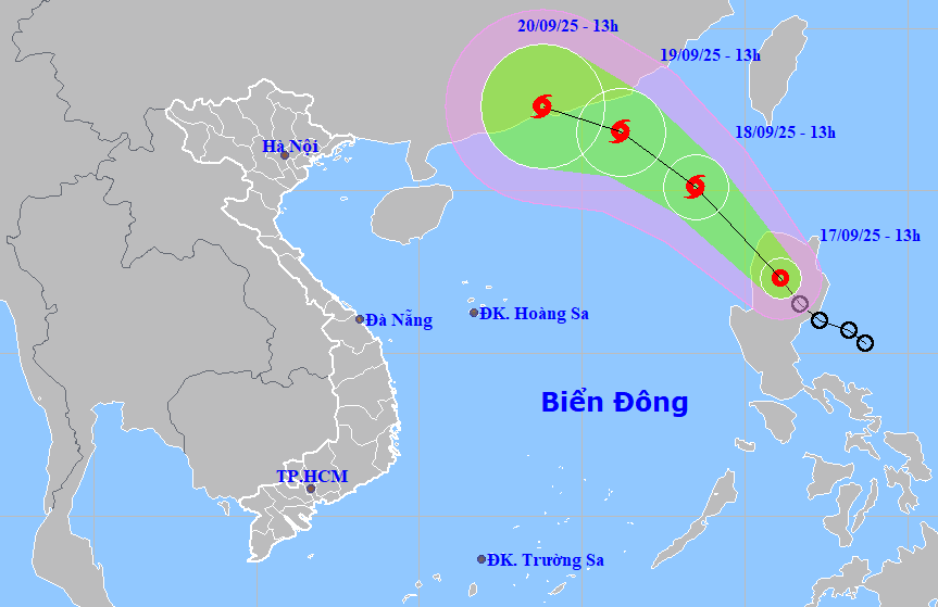
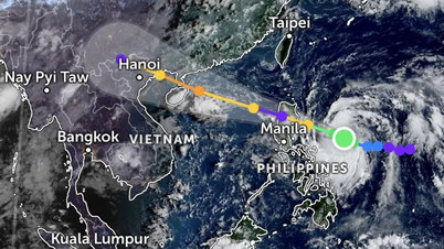
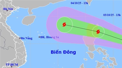
At 1:00 p.m. on September 17, the center of the tropical depression was at about 17.3 degrees north latitude, 121.3 degrees east longitude, in the northwest area of Luzon Island (Philippines) with the strongest wind at level 7, gusting to level 9 and moving northwest at a speed of about 15km/hour.
It is forecasted that in the next 24 hours, the tropical depression will continue to move northwest at a speed of 15-20km/hour, into the East Sea and is likely to strengthen into a storm.
At 1:00 p.m. on September 18, the center of the storm was at about 20.1 degrees north latitude, 118.5 degrees east longitude, in the northeastern area of the North East Sea with the strongest wind at level 8, gusting to level 10.
The storm continues to move northwest at a speed of 15 km/h and is likely to strengthen. At 1:00 p.m. on September 19, the center of the storm was located in the northeastern area of the North East Sea, about 250 km east-southeast of Hong Kong (China), with the strongest winds at level 8-9, gusting to level 11.
Due to the influence of the tropical convergence zone connecting with the tropical depression in the sea east of Luzon Island (Philippines), during the day and night of September 17, the northern, central and southern areas of the East Sea (including the Hoang Sa and Truong Sa special zones), the Gulf of Tonkin, the sea area from South Quang Tri to Ca Mau, Ca Mau to An Giang and the Gulf of Thailand will have scattered showers and thunderstorms; especially the northeastern area of the North East Sea will have storms from the evening and night.
During thunderstorms there is a possibility of tornadoes, strong gusts of wind level 6-7 and waves over 2m high.
In the evening and night of September 17, the area from Hue city to Lam Dong and the South will have scattered showers and thunderstorms, rainfall of 10-30mm, locally heavy rain over 70mm; warning of the risk of rain with intensity greater than 70mm in 3 hours.
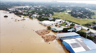
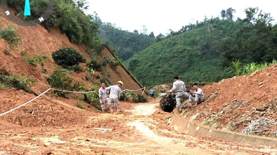
During thunderstorms there is a possibility of tornadoes, lightning, hail and strong gusts of wind; risk of flash floods on small rivers and streams, landslides on steep slopes, and flooding in low-lying areas.
From September 18 to 26, the area from Da Nang city to Lam Dong, in the afternoon and evening there will be scattered showers and thunderstorms, locally heavy rain.
To proactively respond to the tropical depression that is likely to strengthen into a storm and the natural disaster situation during the 2025 rainy and stormy season, the Da Nang City Civil Defense Command has issued a document requesting the City Military Command, the City Border Guard Command, the Department of Agriculture and Environment, and the People's Committees of coastal communes and wards to promptly notify owners of vehicles and boats operating at sea of natural disaster information for proactive prevention.
The City Border Guard Command proactively manages ships going out to sea...
Management boards and investors of projects under construction are ready to deploy plans to prevent heavy rain for projects, implement measures to prevent flooding, and clear water flows for residential areas due to unfinished projects.
The Department of Construction shall preside over and coordinate with relevant units to direct the implementation of plans to prevent flooding, clear drainage ditches; promptly complete bracing and trimming street trees to limit falling during the 2025 storm season.
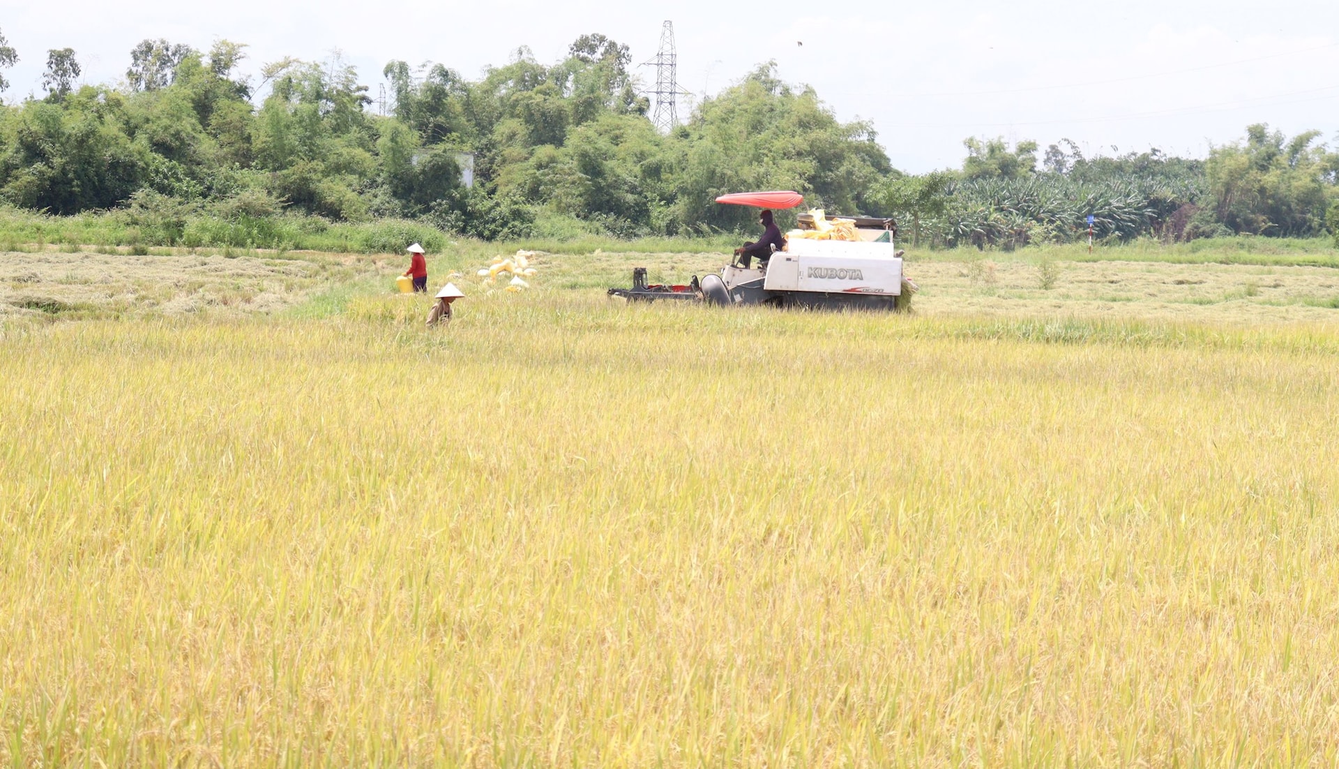
The Department of Agriculture and Environment guides localities and units to ensure safety in agricultural and fishery production activities.
The Department of Culture, Sports and Tourism and localities inform units, headquarters, tourism infrastructure and tourists about natural disasters; request tourist areas, outdoor entertainment areas... to ensure safety for tourists, infrastructure... when natural disasters occur.
People's Committees of communes and wards shall review, proactively organize inspections, and provide guidance on ensuring the safety of agricultural and fishery production activities; deploy shock forces to inspect and review residential areas along rivers, streams, low-lying areas at risk of flooding, flash floods, and landslides to proactively clear the flow; organize the relocation and evacuation of people to safe places.
At the same time, organize forces to guard, control, support, and guide to ensure safe traffic for people and vehicles, especially at culverts, spillways, deep flooded areas, fast-flowing water, on rivers, on streams, areas where landslides have occurred or are at risk of landslides; resolutely not allow people and vehicles to pass if safety is not ensured; arrange forces, materials, and means to overcome incidents, ensuring smooth traffic on main traffic routes when heavy rain occurs.
Localities and units managing irrigation and hydropower reservoirs continue to monitor forecasts, warnings, and changes in water levels of reservoirs; organize reservoir operations and regulation to ensure compliance with approved procedures; maintain safety checks on dams and reservoirs; coordinate with localities to regularly inspect and prevent people and vehicles from traveling in reservoirs and spillways; promptly notify downstream localities when water levels exceed spillways to warn people and proactively prevent them.
Armed forces units, departments, branches, localities and relevant units closely monitor the developments of low pressure areas and daily weather reports, warnings of thunderstorms, tornadoes, lightning, etc. to proactively handle possible situations.
Source: https://baodanang.vn/chu-dong-ung-pho-mua-dong-gio-giat-manh-va-thien-tai-thoi-gian-den-3303051.html
![[Photo] Binh Trieu 1 Bridge has been completed, raised by 1.1m, and will open to traffic at the end of November.](https://vphoto.vietnam.vn/thumb/1200x675/vietnam/resource/IMAGE/2025/10/2/a6549e2a3b5848a1ba76a1ded6141fae)


Comment (0)