
During the day and night of September 19, the weather in Ho Chi Minh City and the provinces and cities in the South had complicated developments. The reason was that the area was affected by the tropical convergence zone with an axis passing through the Central Central region connecting with storm No. 8, at the same time the Southwest monsoon was operating at an average intensity.
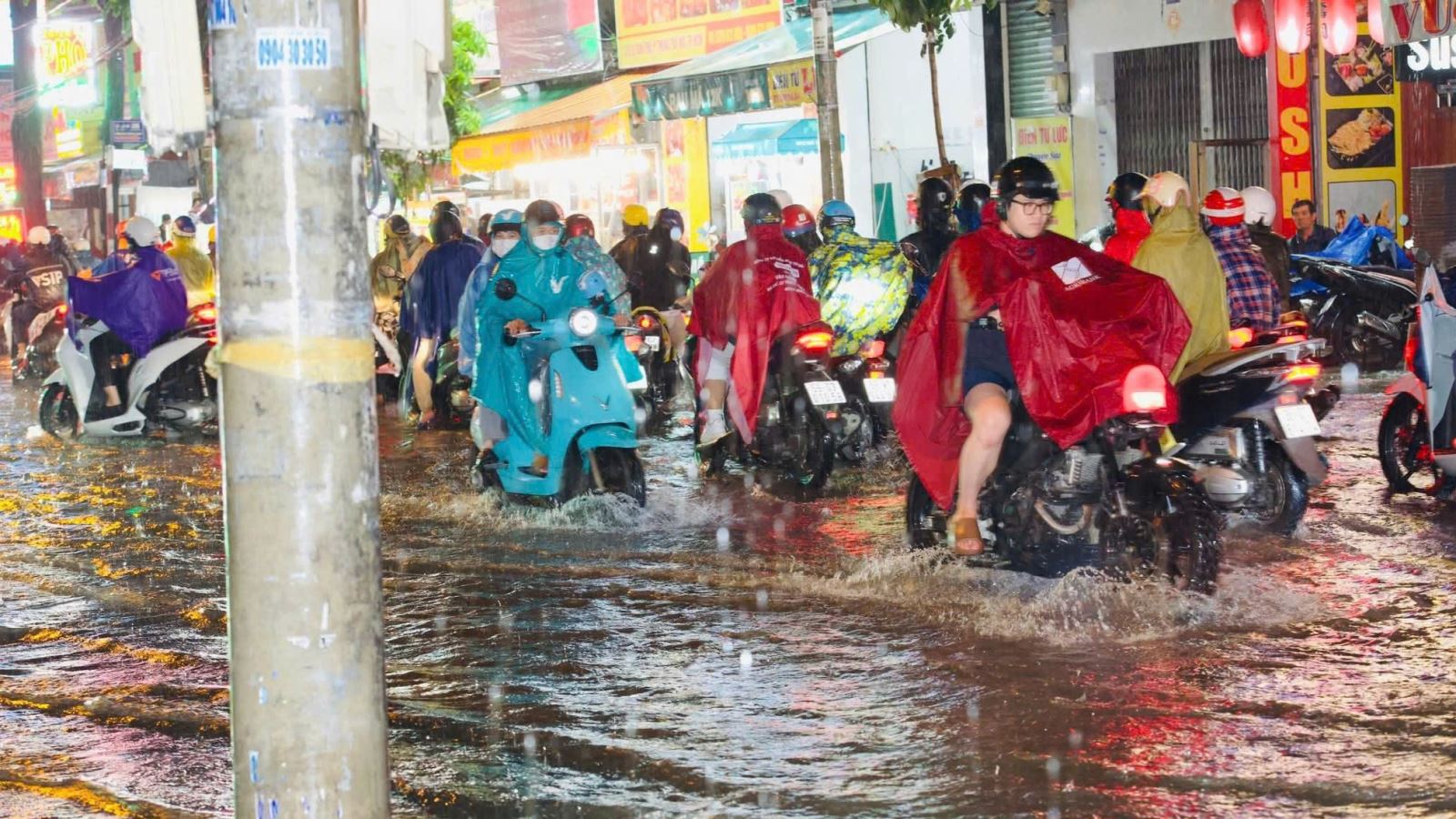
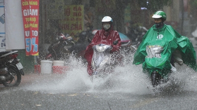
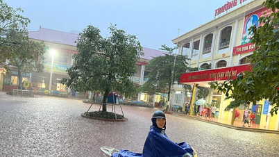
Due to the impact of the above weather patterns, the entire Southern region remains cloudy, with intermittent sunshine during the day. From noon, afternoon and evening, showers and thunderstorms appear widely, with moderate to heavy rain in many places. Particularly in Ho Chi Minh City, there have been some very heavy rains in some areas. The temperature in the city ranges from 23.5 to 30.7 degrees Celsius, with southwest winds gusting up to 10 m/s at times.
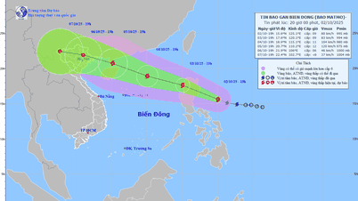
Regarding storm No. 8, experts said that this storm will no longer affect Vietnam. It is forecasted that tonight, September 19, the storm will make landfall in the southern provinces of China and gradually weaken.
However, the most worrying thing at the moment is the appearance of another storm, which could become storm number 9. Forecast models show that this storm is very strong when operating in the East Sea and its path is quite complicated. It is likely that the storm will head towards the mainland of the Northern provinces in the coming days.
However, there is still a factor that can change the intensity of the storm. According to Mr. Le Dinh Quyet, Head of the Forecast Department, Southern Hydrometeorological Station, one of the scenarios is that the storm will move close to the coastal area of southern China for a long distance. If this scenario occurs, the friction with the mainland terrain will significantly reduce the intensity of the storm before it can affect our country.
In the next 2-3 days, when storm No. 8 dissipates, rain in the South will tend to decrease in both area and volume. However, people need to be especially careful during thunderstorms, beware of tornadoes, lightning and strong gusts of wind as well as heavy rain causing flooding in low-lying urban areas, regularly update official weather forecasts to proactively have plans to prevent the complicated developments of the upcoming strong storm.
Source: https://baotintuc.vn/van-de-quan-tam/canh-bao-mua-dong-manh-tai-tp-ho-chi-minh-va-khu-vuc-nam-bo-20250919094851837.htm


![[Photo] Binh Trieu 1 Bridge has been completed, raised by 1.1m, and will open to traffic at the end of November.](https://vphoto.vietnam.vn/thumb/1200x675/vietnam/resource/IMAGE/2025/10/2/a6549e2a3b5848a1ba76a1ded6141fae)


Comment (0)