
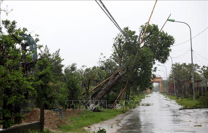
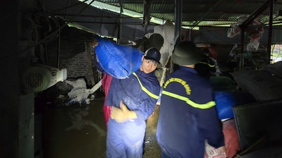
Accordingly, the impact of storm No. 10 and its circulation caused widespread damage to the national highway and expressway system managed by Road Management Area II from Nghe An to Hue . Heavy rain, strong winds and flash floods caused thousands of cubic meters of landslides, tens of thousands of trees to fall, hundreds of signs and traffic infrastructure works to be severely damaged, causing traffic jams at many points.
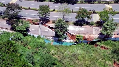
Statistics as of the morning of September 30 show that major damage has been recorded on national highways, Ho Chi Minh Road and expressways. In Nghe An, there have been many landslides on negative and positive slopes with a volume of about 280 cubic meters of earth and rock. Some embankments have collapsed and sunk up to 30-40 meters, with cracks as wide as a meter, at risk of further collapse.
Ha Tinh recorded a landslide with a volume of up to 1,500 m3, with rocks and soil covering part of the road surface and drainage ditch.
Quang Tri was heavily affected with 28 landslides, totaling more than 1,360 m3, along with hundreds of cubic meters of rock and soil filling ditches and culverts.
Hue also recorded 7 landslides with about 250 cubic meters of rock and soil, along with nearly 1,000 cubic meters of rock and soil overflowing onto the road at many locations. On the Cam Lo - La Son highway, small landslides also appeared at 4 locations, potentially dangerous when heavy rain continues.
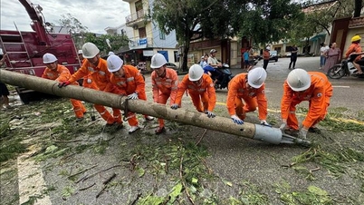
In addition, the damage to trees was also very large. National Highway 1 through Nghe An alone had more than 400 fallen trees, plus 50 large trees on the Vinh bypass. Ha Tinh recorded about 1,100 fallen trees on many sections of national highways and bypasses. Quang Tri was the most severely affected locality, with more than 2,100 fallen trees scattered along the Ho Chi Minh Highway, many large trees with diameters of 25-40cm blocking the road. In Hue, many trees were blown down by the wind, causing local congestion on both National Highway 1 and the Hue bypass. In total, the number of fallen trees reached tens of thousands of trees along the entire route.
The road surface is peeling off in many sections, resulting in potholes. Quang Tri alone has 25 locations with a total area of 20 m2 of potholes, Thua Thien Hue has an additional 100 m2 of damage on National Highway 1 and 90 m2 on the Hue bypass. On the Ho Chi Minh Highway, the section passing through Quang Tri has up to 750 m2 of damaged road surface. Many locations have peeling bridge surfaces and broken concrete, requiring urgent treatment.
The storm also caused widespread damage to the traffic safety system. Nghe An had 30 billboards fall across the road, 70 signs broken, and 20 signs damaged at the Vinh bypass. Ha Tinh recorded 50 billboards fallen, more than 150 signs damaged, and 200m of anti-glare nets tilted. Quang Tri had at least 30 sets of broken signs and 26 signs severely damaged. Hue also recorded dozens of broken and deformed signs and posts. On the highway, both Nghe An and Ha Tinh had dozens of signs and anti-glare nets tilted.
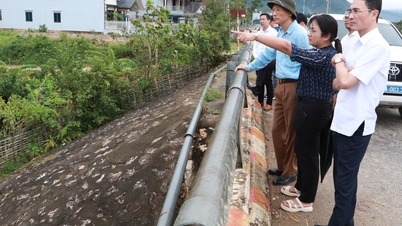
Roads in the Central region were heavily affected. As of the morning of September 30, localities and units were still working to repair the damage, but more time and resources were needed to completely handle the damage and ensure traffic safety.
In addition, many toll stations and operating buildings were also damaged. In Ha Tinh, the Rac bridge toll station had 200 square meters of roof and 60 meters of fence damaged. Pho Chau Road Management Department also had 30 square meters of roof blown off. Some toll stations such as Quan Hau, Tasco Quang Binh, Ben Thuy, and Hoang Mai still operated normally during the storm, but also recorded damage to auxiliary items.
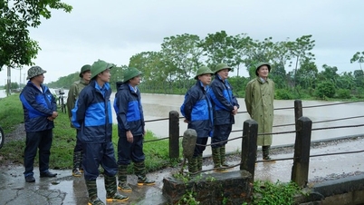
Faced with the above situation, the road management force has mobilized maximum means and manpower to clear fallen trees, rocks, and re-erect signs and barriers. Many congestion points have been temporarily resolved, and the basic routes have been reopened. However, the amount of work to be done is still very large, especially at landslides and slope collapses that are at risk of recurring when heavy rains continue.
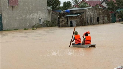
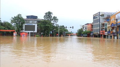
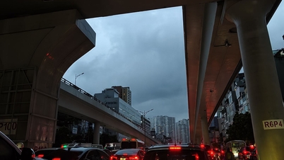
Regarding Road Management Area I, as of the morning of September 30, 2025, it was reported that National Highway 1 through Thanh Hoa had many sections flooded 12-30cm deep; the CT.01 expressway section from Cao Bo to Mai Son had a flooded underpass, vehicles were not moving; the Noi Bai - Lao Cai expressway in the IC19 area had flooded the road to National Highway 4D but traffic was still normal. In addition, many landslides occurred in Thanh Hoa, Tuyen Quang, Cao Bang, National Highway 6 and the Tam Diep - Nghi Son expressway, but they did not cause any traffic jams.
At the same time, Road Management Area III recorded scattered rain, national highways, expressways and Ho Chi Minh Road were clear, no congestion or damage occurred. Road Management Area IV said that there were places with moderate to heavy rain, light wind but no flooding, landslides or damage occurred on national highways and expressways managed by the unit.
Source: https://baotintuc.vn/xa-hoi/ha-tang-giao-thong-tu-nghe-an-den-thua-thien-hue-bi-thiet-hai-nang-20250930140659691.htm
![[Photo] Solemn opening of the 12th Military Party Congress for the 2025-2030 term](https://vphoto.vietnam.vn/thumb/1200x675/vietnam/resource/IMAGE/2025/9/30/2cd383b3130d41a1a4b5ace0d5eb989d)
![[Photo] Panorama of the cable-stayed bridge, the final bottleneck of the Ben Luc-Long Thanh expressway](https://vphoto.vietnam.vn/thumb/1200x675/vietnam/resource/IMAGE/2025/9/30/391fdf21025541d6b2f092e49a17243f)

![[Photo] General Secretary To Lam, Secretary of the Central Military Commission attends the 12th Party Congress of the Army](https://vphoto.vietnam.vn/thumb/1200x675/vietnam/resource/IMAGE/2025/9/30/9b63aaa37ddb472ead84e3870a8ae825)
![[Photo] President Luong Cuong receives President of the Cuban National Assembly Esteban Lazo Hernandez](https://vphoto.vietnam.vn/thumb/1200x675/vietnam/resource/IMAGE/2025/9/30/4d38932911c24f6ea1936252bd5427fa)
![[Photo] The 1st Congress of Phu Tho Provincial Party Committee, term 2025-2030](https://vphoto.vietnam.vn/thumb/1200x675/vietnam/resource/IMAGE/2025/9/30/1507da06216649bba8a1ce6251816820)


Comment (0)